The Dempster Highway - Canada's gateway to the Arctic
When I first came up north, I couldn’t help but stop at this sign. I posted a picture of it on the Agatsu Instagram page saying, “Not today, but soon!” Well, soon has turned into today and we’re back at the start of the Dempster Highway! Earlier this season we made it to Prudhoe Bay, the official start of the Pan-Am Highway and the furthest north you can drive in North America. But I couldn’t leave until I made it to Tuktoyaktuk, the furthest point north you can drive in my own country, Canada. Of all the trips I’ve done this summer, this one was the trip I’ve been looking forward to the most.
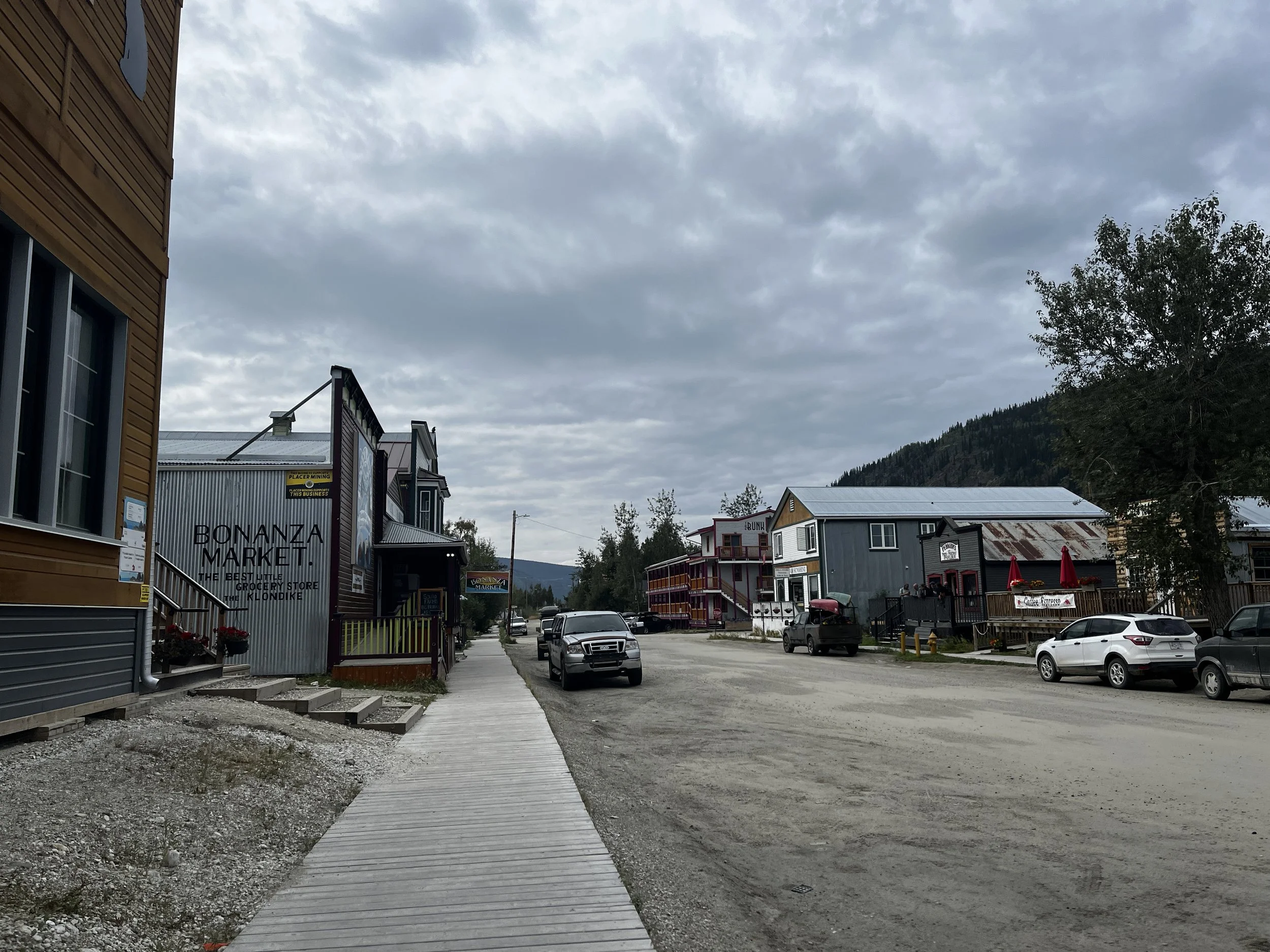
After a slow start to the morning, the jeep was packed and ready to go by 10:30. Layka and I made it to Dawson city a little before noon, the weather wasn’t too bad with only some high clouds but not chilly at all. I stopped in at the NWT Information Centre for any last-minute updates on road conditions, I advise anyone who’s going to drive the Dempster to stop here first, they are a great bunch of people who have the most up-to-date road, weather and ferry information. After getting the OK from them I picked up some last-minute supplies and it was also at this time that I realized that I had been so busy packing, I hadn’t eaten anything! So, with my tummy grumbling, time was allotted for a quick lunch at Sourdough Joe’s, a spot in Dawson City well-known for its delicious fried chicken and fish and chips, today, I chose the chicken, and it was amazing! With my belly now full we drove the last few kilometres to the start of the highway.
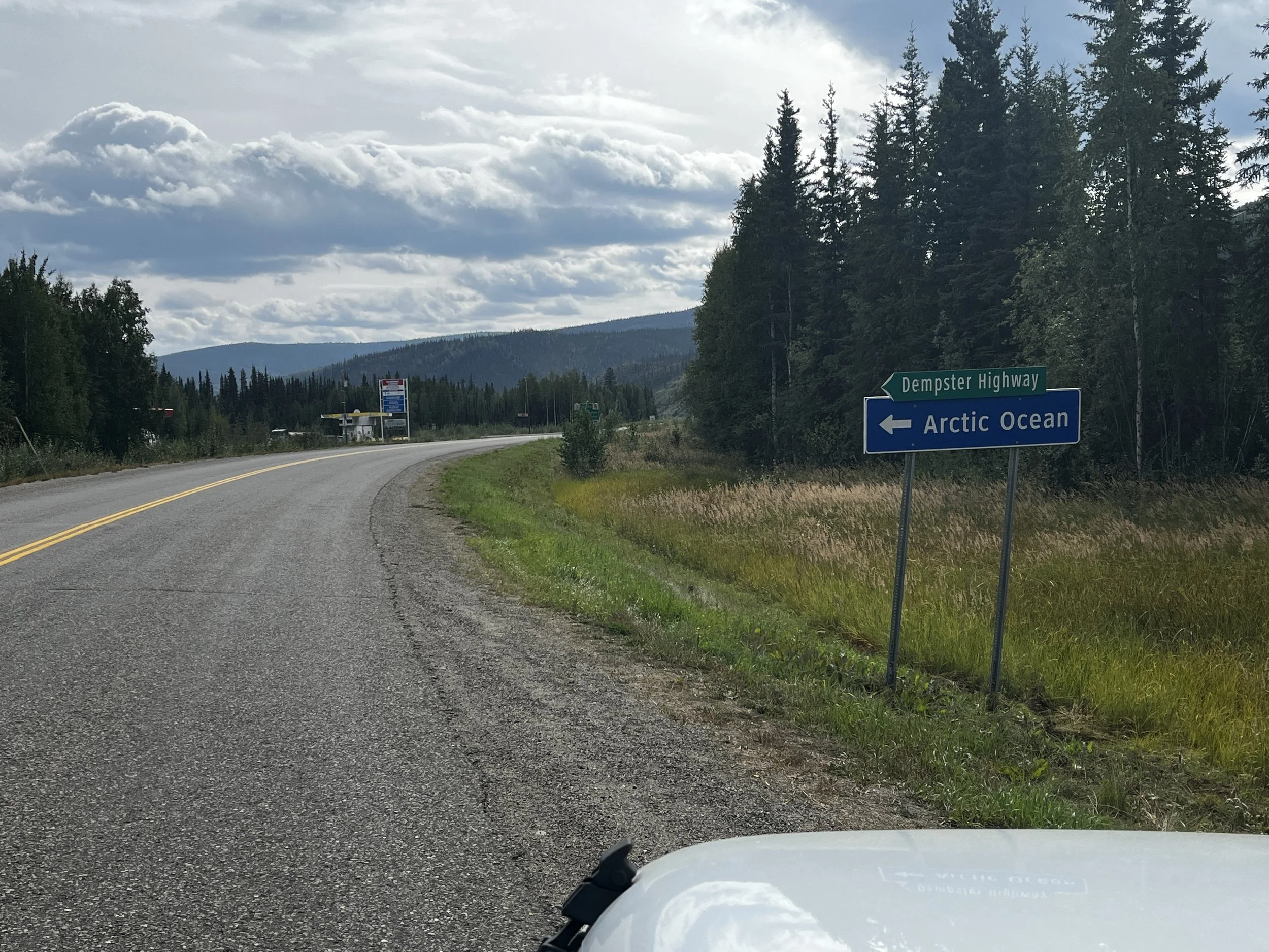

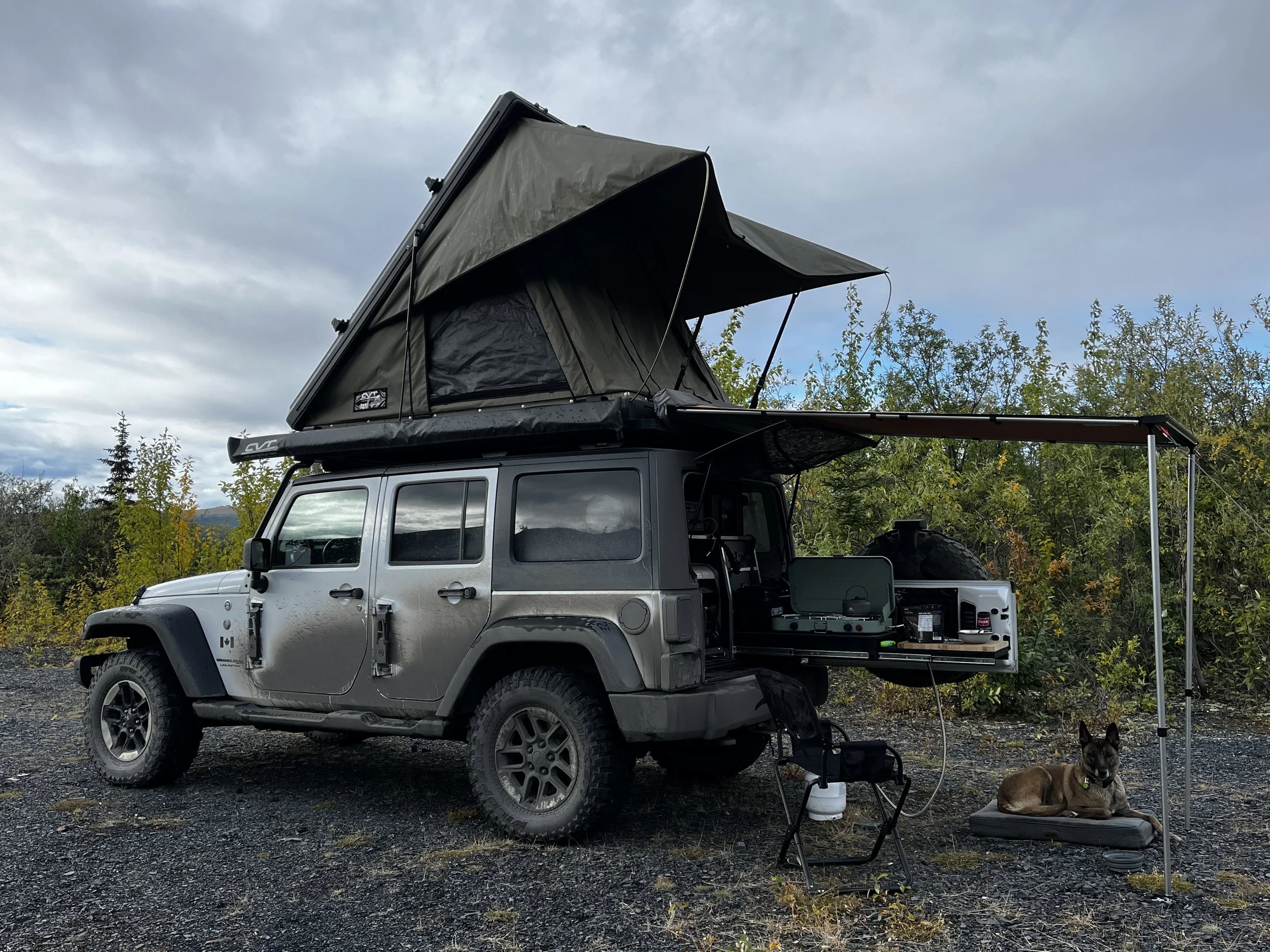
At the beginning of the Dempster, there is a self-serve gas station and, as the next fuel stop is at Eagle Plains, some 370 Kilometers to the north, along one of the most remote roads in Canada, I tried to get every last drop that I could in the tank and even added a bit of security by filling up my Rotopax as well. After fuel, I aired down to try to make the trip as smooth as possible, I went to 22 psi in the front and 25 psi in the rear. After all that and a few more pictures from the start, it was time to get off my butt and get on with the adventure.
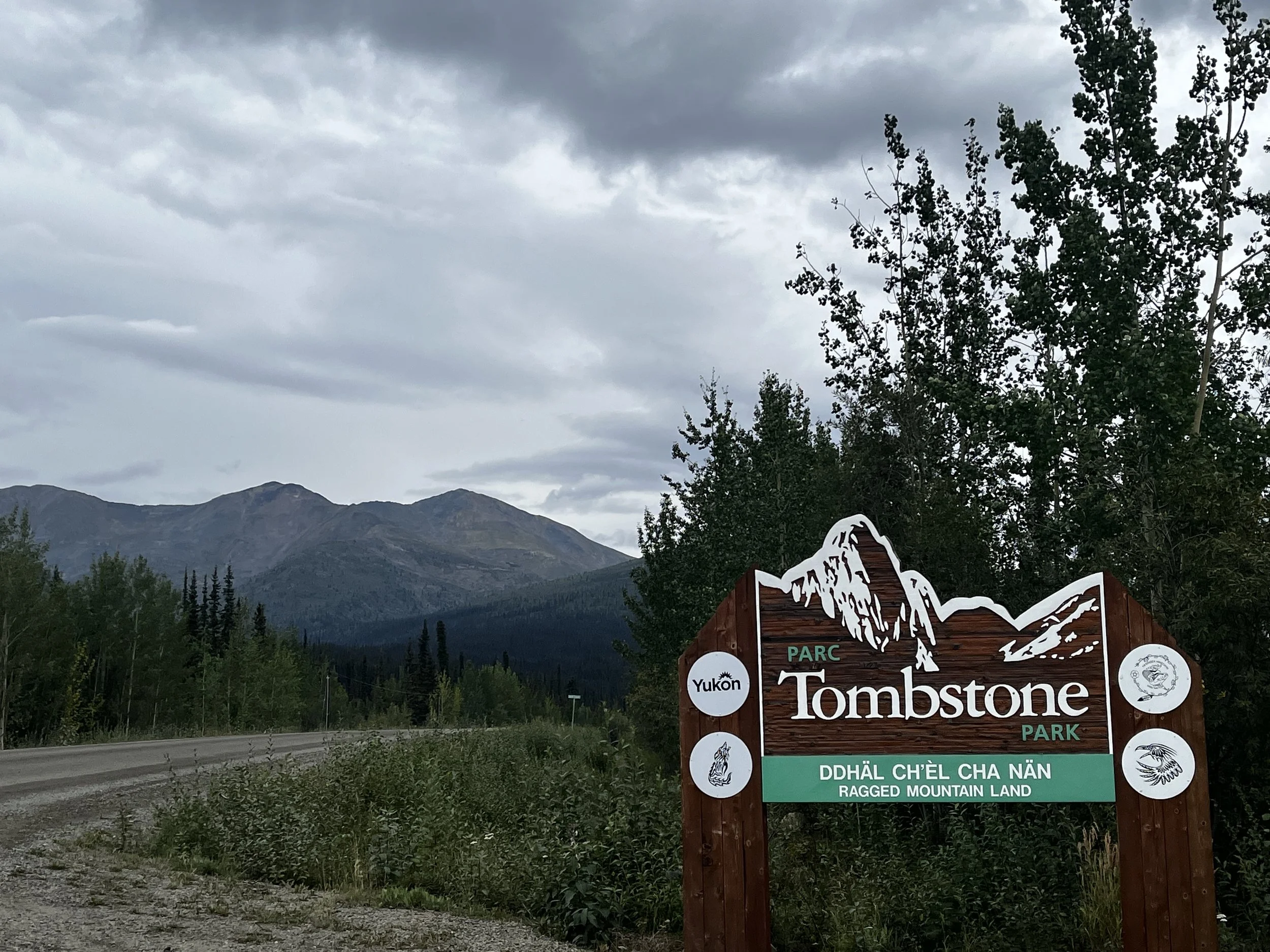

Today’s endpoint was at the Tombstone Territorial Campground, some 71 km or 44 miles up the road. The road was dirt with loose gravel, but I believe it was recently graded as it was clear any large potholes, making our arrival in Tombstone come relatively quickly. Before heading to find a campsite, we pushed a little further ahead to the Tombstone Range viewpoint, where, despite the clouds, we were treated to an absolutely epic view of the valley leading toward the majestic granite peaks of Cathedral Mountain and Mt. Frank Rae. After taking in the awe of the landscape, we headed back to the campground and found a decent spot to hunker down for the night.

We slept in a bit today, with my eyes finally opening at around 8. I tried to get to bed relatively early the night before, but a group of German tourists on a group tour were chatting and enjoying their time around the campfire until around 10 pm. Can’t blame them at all, as the Yukon and especially Tombstone is such a magical place and the trip of a lifetime. That said I still had a decent enough sleep and only woke a couple of times to the sound of raindrops hitting my tent, but by the time we were up and getting out of the tent, the rain had luckily stopped. After a quick breakfast of oatmeal and raspberries, I could see that the sky was starting to darken again, so camp was quickly packed up, and we were again on our way north.

The rain continued off and on, but at times, the clouds would give way, and the sun’s rays would peak through and give a beautiful golden glow to the landscape just to add an extra sense of awe. As we made our way toward the northern end of the park, the views just kept getting better, huge mountainous vistas enveloped a valley, while herds of horses grazing along the riverbed. Simply amazing!


We eventually made our way to Eagle Plains, which is at the approximate halfway point along the Dempster and is the only place to pick up food and fuel before reaching Fort McPherson, almost another 200 km to the north. There is also a full-service garage here that comes to the rescue of many who happen to run into misadventures along this road. We had been driving for a few solid hours, so a stop to fill up the tank and the stomach was definitely in order. By the end of our stop, both the Jeep and my belly were very happy!
About 20 km after Eagle Plains, we came to another landmark and bucket list item as we pulled up to the Arctic Circle sign. This marks the second time that Layka and I have crossed the 66 parallel, as you will remember from my previous post about the Dalton highway. The Dalton and the Dempster are also the only two roads that cross the Arctic Circle in North America. Now, with both complete, should we start expanding our adventures by crossing oceans to try to complete them all? Let me know in the comments.

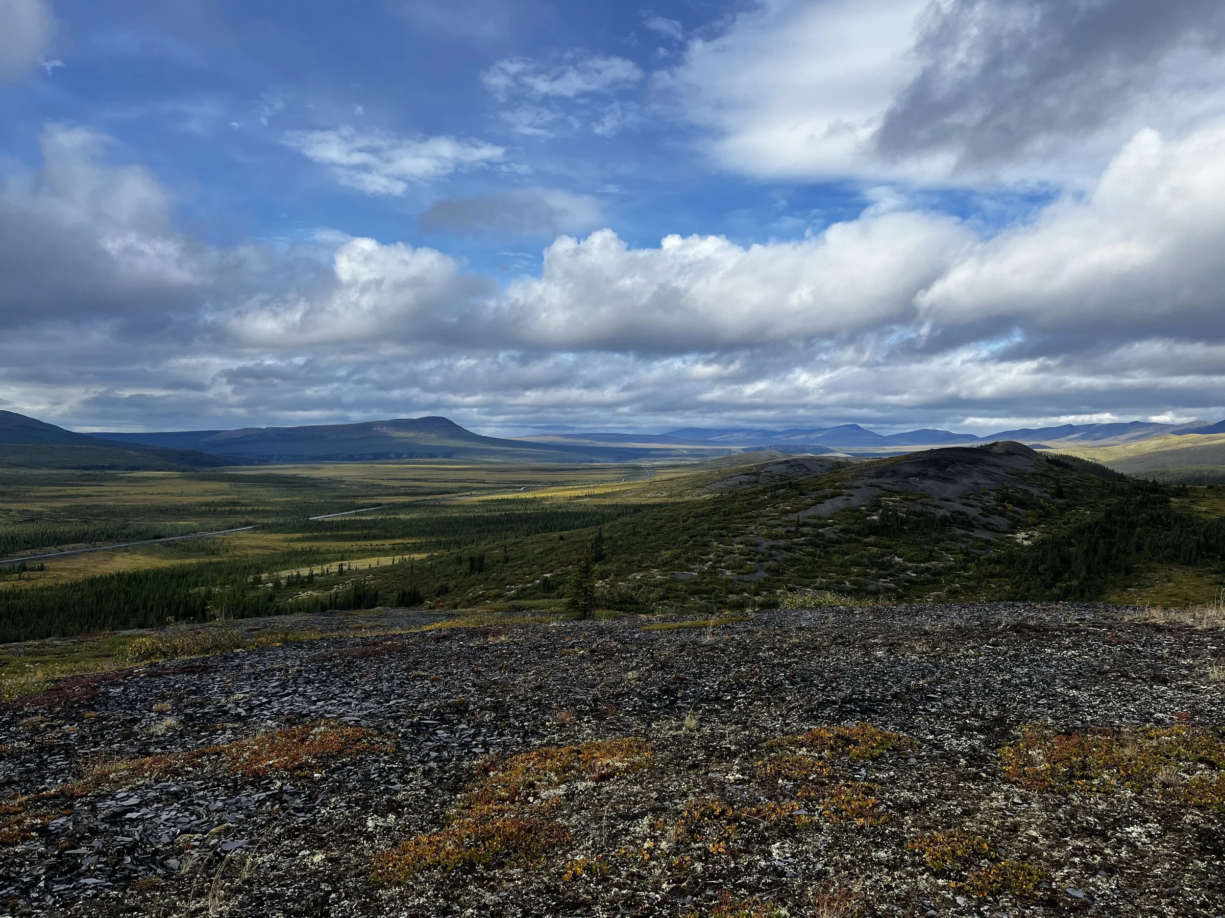
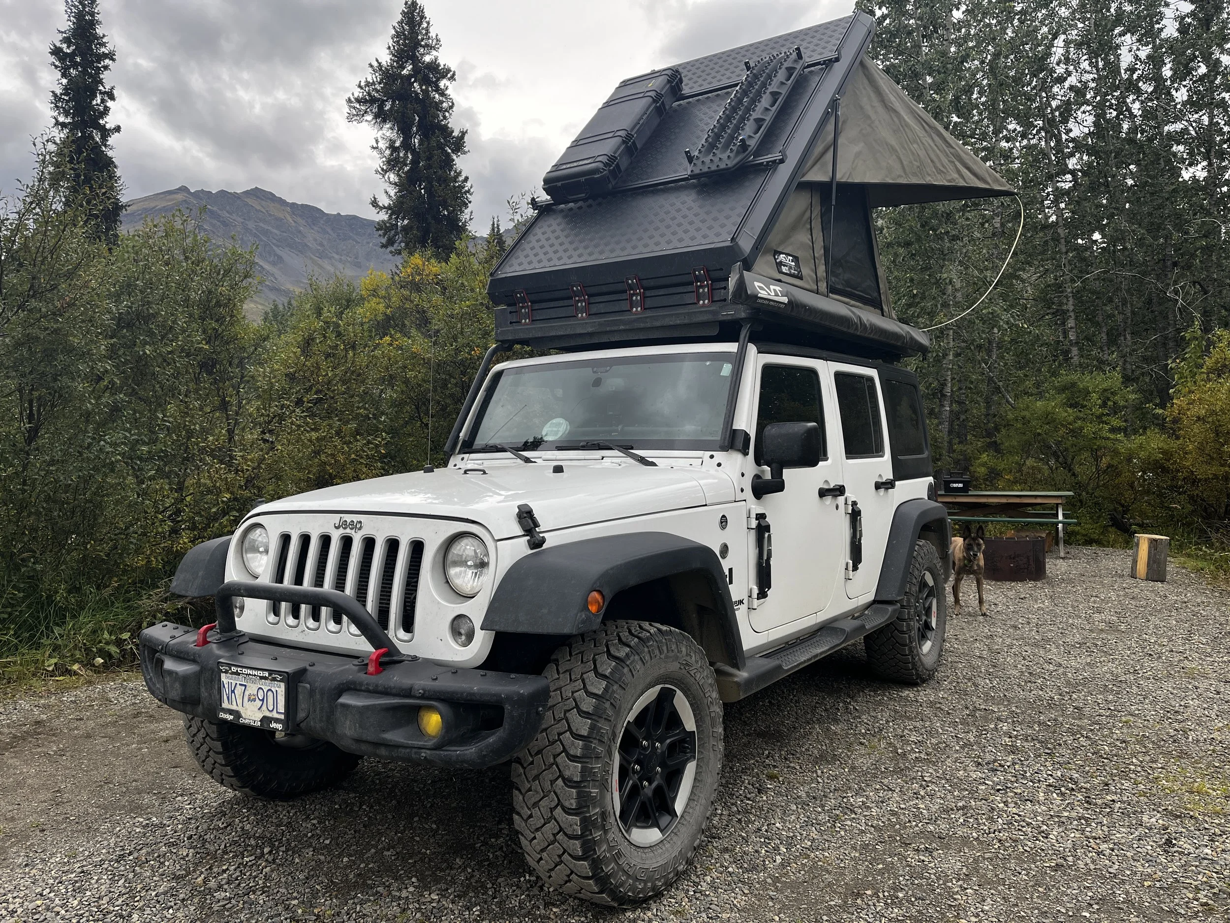
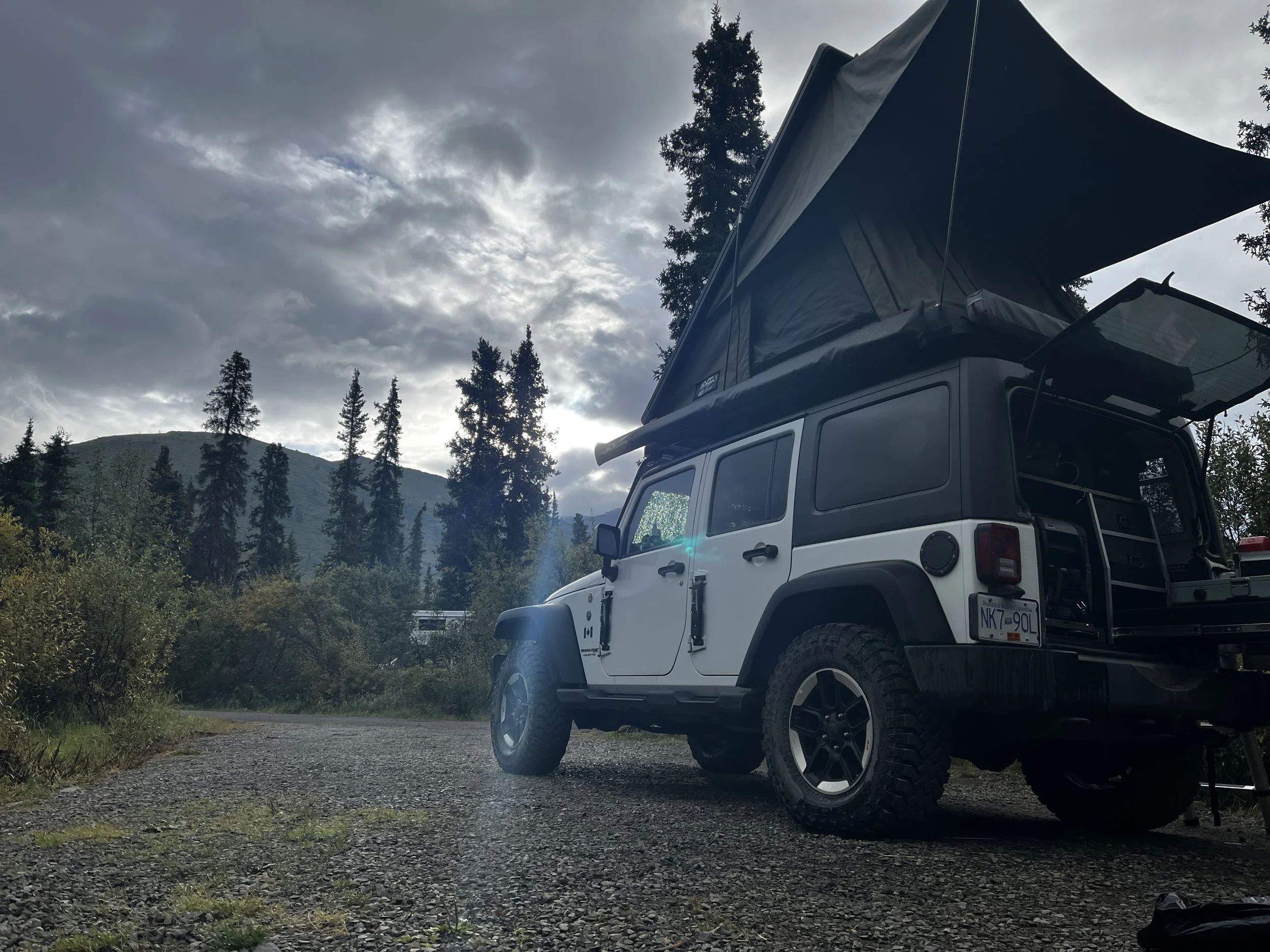
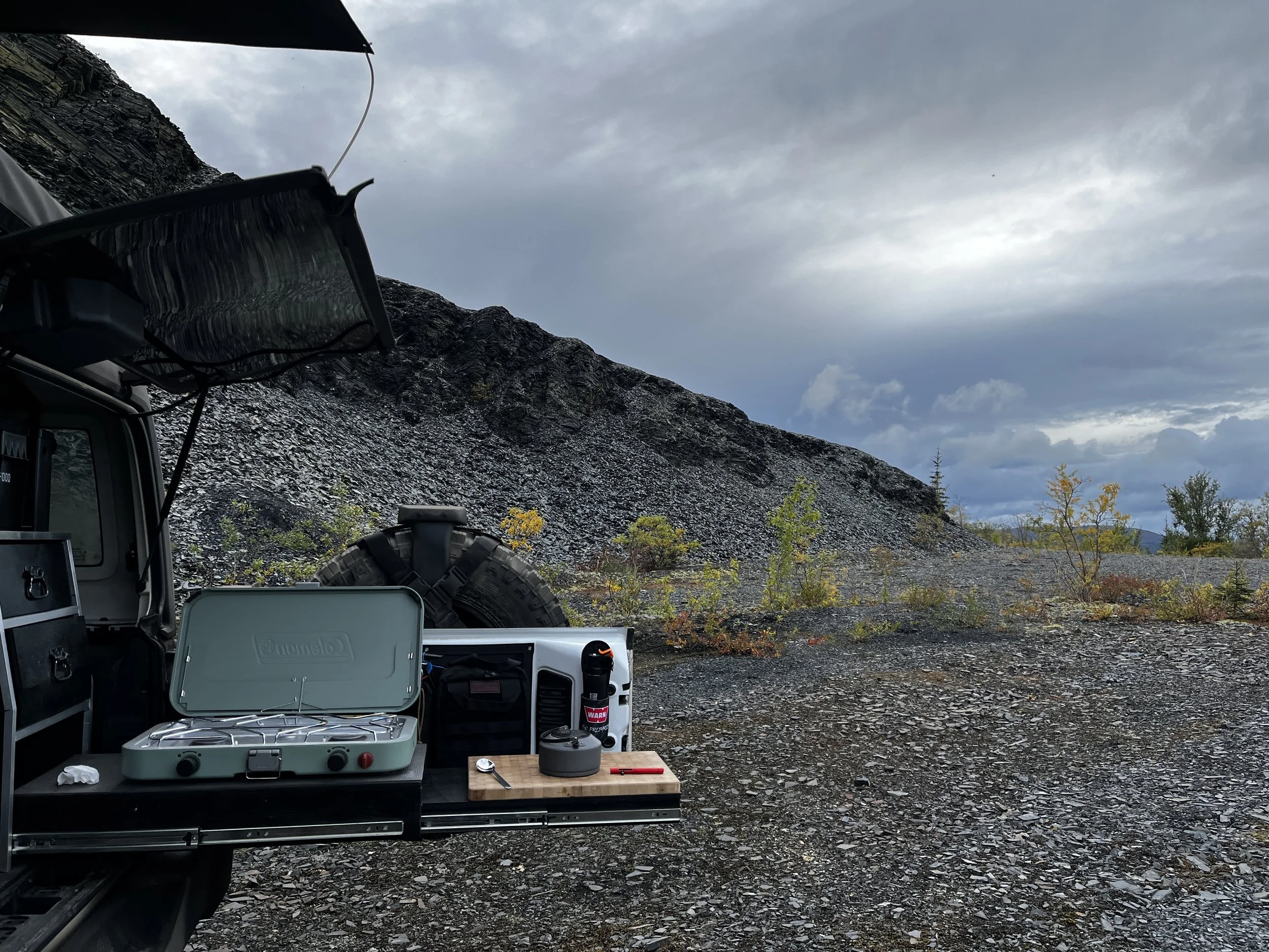
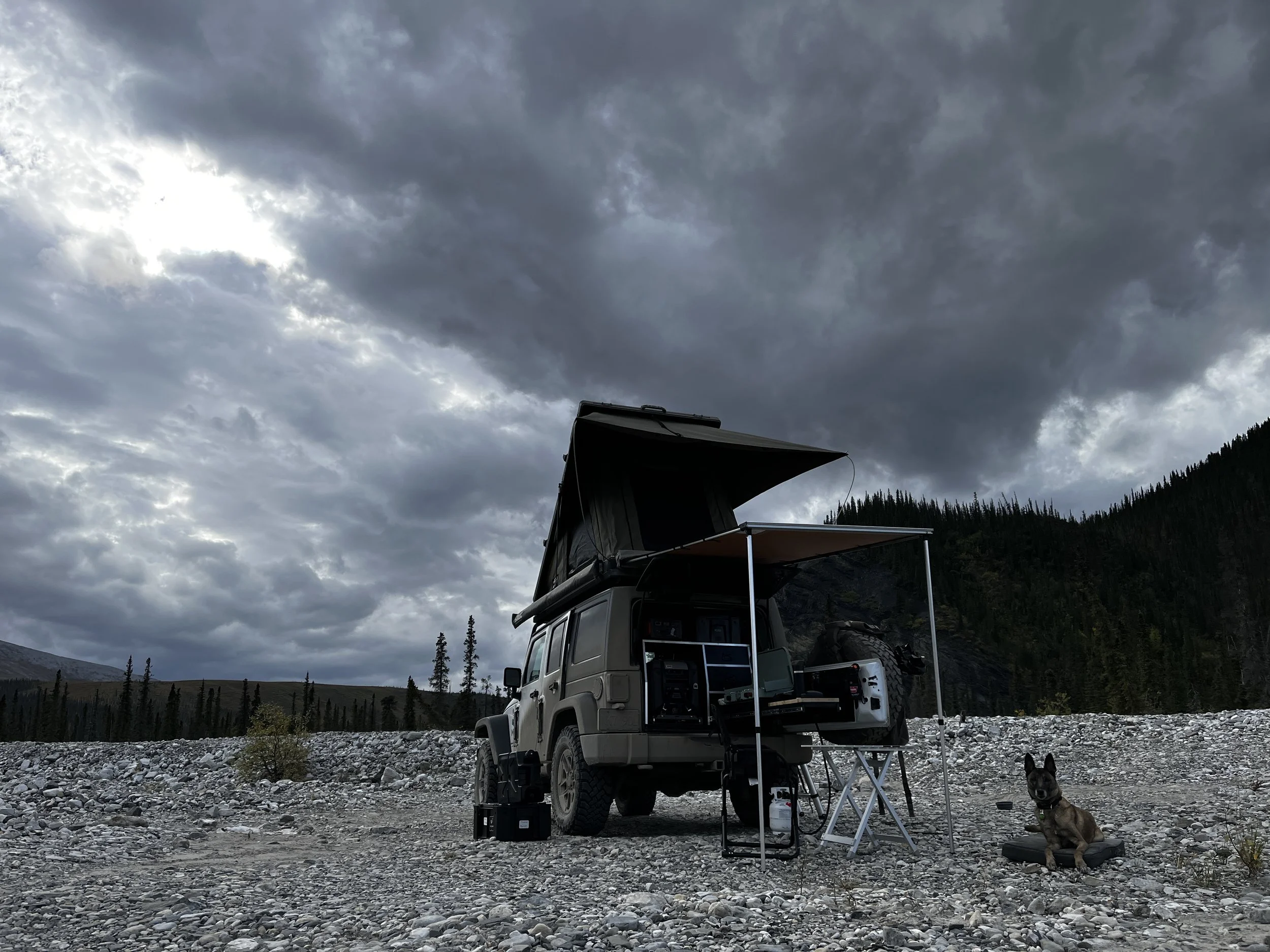
Anyway, back to the trip! After taking a few of the “proof that we were here” pictures, we carried on a little further up the road until we arrived at our camp for the night. Tonight’s site is thanks to the Epic Family Road Trip, as they stayed at this site on their trip to Tuk a few years earlier. As you travel along the Dempster, many short side roads lead to quarries used to store the gravel needed to repair the highway. Some are regularly used and some, you can tell, haven’t been used for a while. Tonight’s camp is in one such quarry. This particular quarry was well over 50 feet high, with gravel surrounding us on three sides, the perfect refuge from any strong winds that we may encounter. After camp was set up, Layka and I took a short hike to the top of the quarry, where we were greeted by one of the most epic views you could imagine. You could see the Dempster as it snaked its way up the valley, and by now, the rugged mountains of Tombstone had given way to rolling hills covered in small trees and low-lying shrubs that seemed to go off endlessly into the distance.


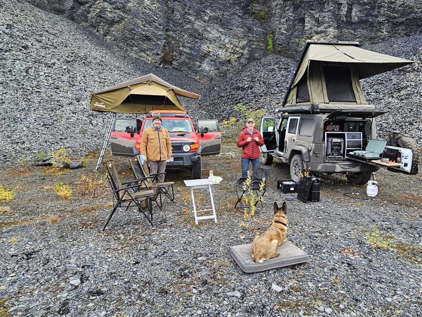
After absorbing as much as we could, we made our way back to the campsite to prepare dinner, where we were greeted by the noise of another vehicle coming up the road towards us and then came a beautiful site as a LandCruiser Troopy, (My dream car) came into view from behind some trees. After they parked the driver hopped out, and we introduced ourselves to each other. Mo from travelblog.to.go on Instagram, was from Germany and was just starting his Pan-American Highway adventure and was on his way back from Tuk. During our chat, he told me that a couple he met in Tuk would be coming up to the site as well, and before he even completed the sentence, we could hear the rumbling of a diesel engine, and shortly, another great vehicle came into view, a modified Toyota Hilux with a nice little camper on the back. Ola and Konrad are a great couple from Poland and have a cute pup, Fibi. They are on their own Pan-American journey as well, you can find them on Instagram at roadlife.stories. Apart from the epic views, meeting people on the road who are on their own personal journey is one of the most rewarding experiences you can get while doing this kind of travel! We all got along great and shared food and stories well into the night while Layka and Fibi played.

After a very restful sleep, we woke up and remembered that today is the big day! The final push to Tuk! Again, I made another quick breakfast of oatmeal and raspberries before packing up camp while Layka and Fibi played. It helps to have a dog get tired out before a long road trip! After pulling them apart, like two kids not wanting to say goodbye at the playground, we all said our goodbyes and exchanged contact info and Layka and I continued toward the top of Canada while everyone else headed south. A short time after leaving, there was a distinct change in the landscape. The low shrubs and small trees disappeared and were replaced by even lower-lying tundra. The feel of it was very reminiscent of the North Slope area of Alaska after Atigun Pass. The clouds were low, and winds were billowing. The whole scene had a very mythical feel to it as we came up to the border of the Northwest Territories, another benchmark point in my life of adventure travel.


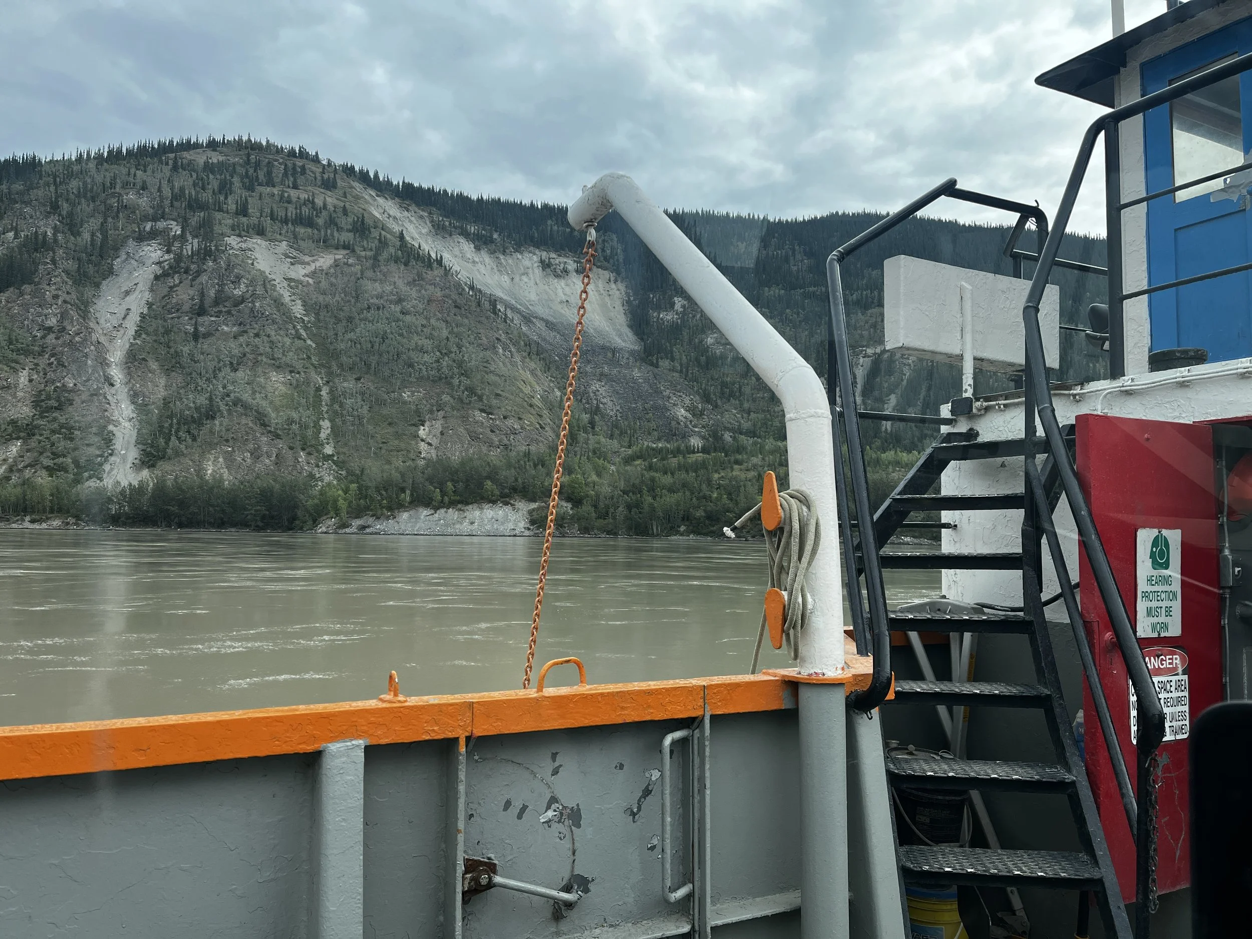
About an hour past the entrance to the NWT, we came to our first of two ferries. Ferries are always an unknown when travelling the Dempster as they could suddenly be out of service for days at a time for a variety of reasons. Lucky for us, they were fully operational today, and it was a short trip to the other side of the Peel River. We then quickly found ourselves in Fort McPherson, a small yet historic hamlet that had its beginnings as a Hudson Bay Company post with a population of under 700 people. I later found out that it was also the starting point of the ill-fated “Lost Patrol”, a mail run by the Northwest Mounted Police from the Fort to Dawson City in 1910, where all members perished. It was Corporal Dempster who was tasked with the search and located them. After that, Dempster’s adventures lead to him becoming known as the “Best trail man in the Yukon.” No wonder the road we’re now travelling on is named in his honour!
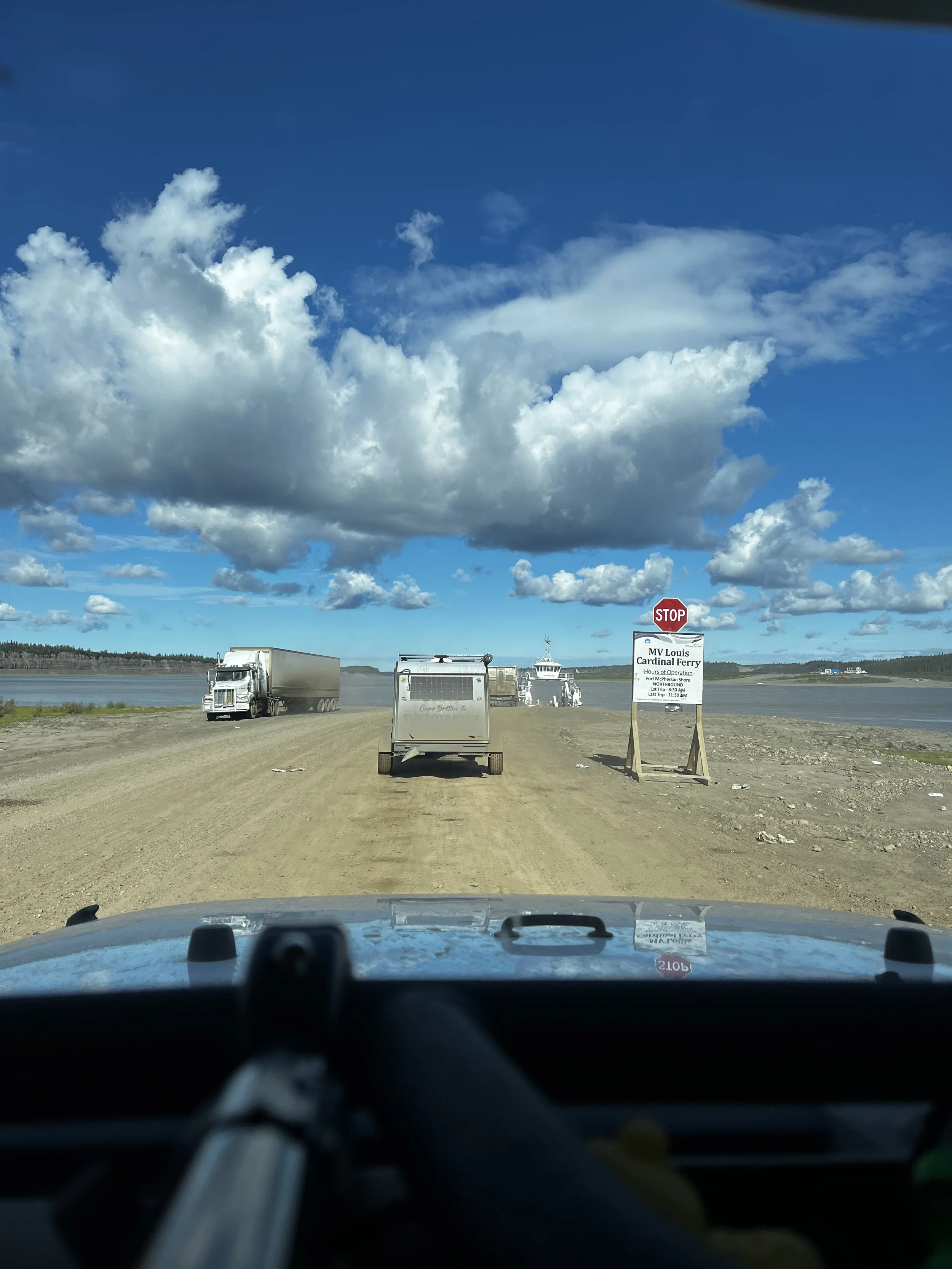
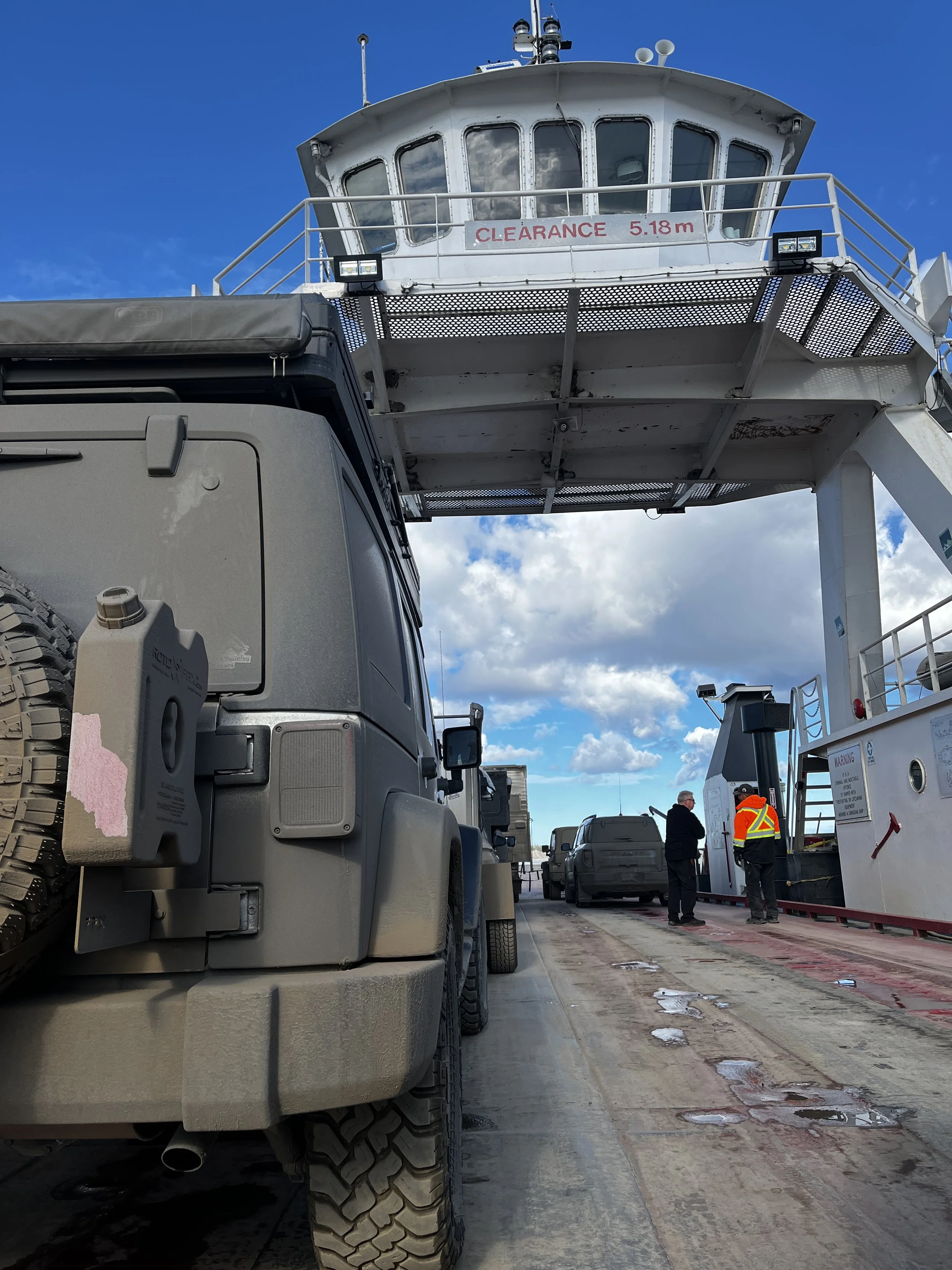
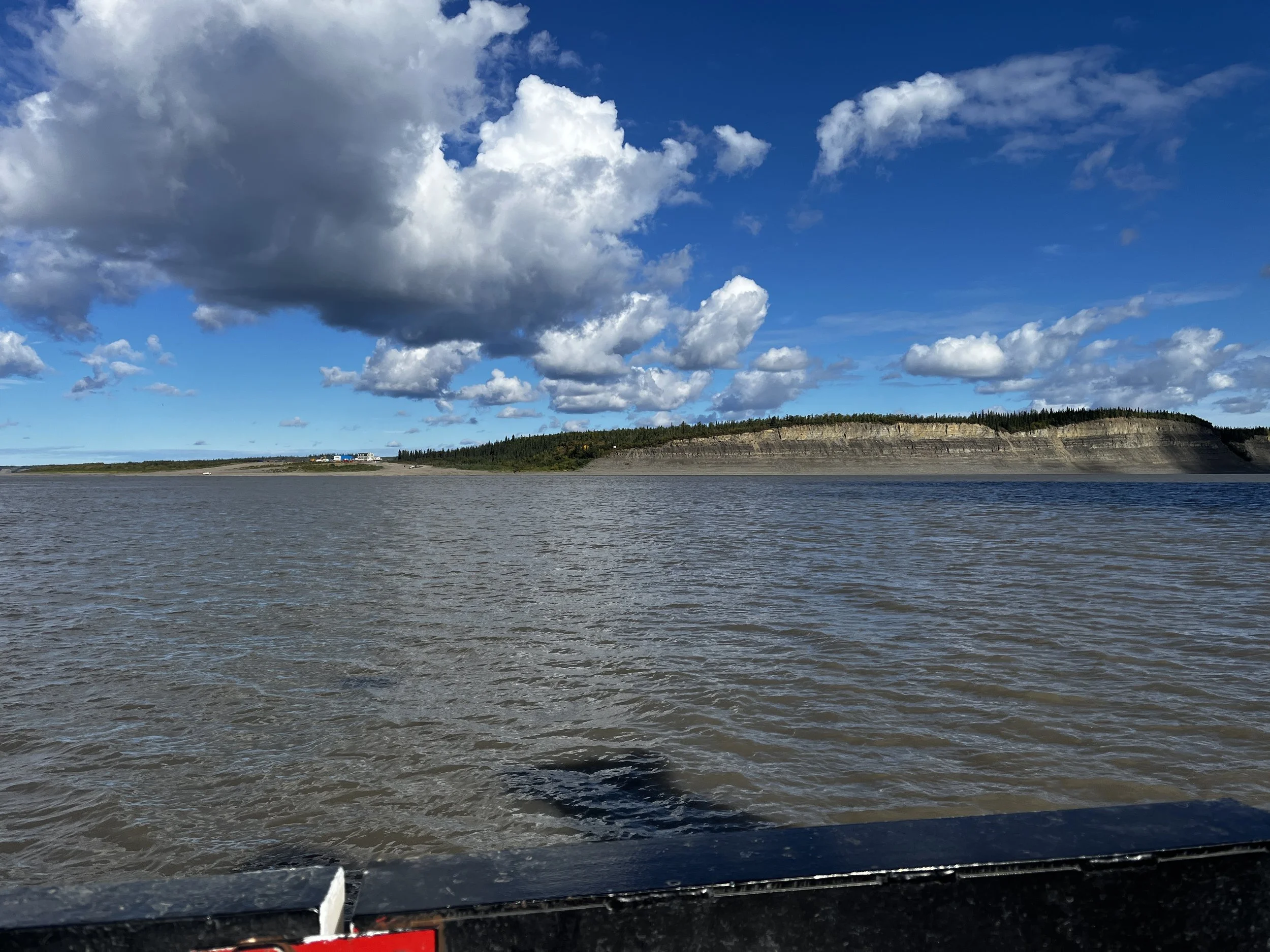
After fueling up and grabbing a few more groceries at the local market, we were back on our journey North. Having driven the Dalton Highway in June, I can wholeheartedly say that the road conditions on the Dempster are worse, with very loose gravel made of jagged rocks of shale that continuously threatened to slice tires wide open. After about 30 minutes, the cloudy skies had given way to some very welcome rays of sunshine as we reached the crossing of the Mackenzie River. Once again, to our luck, the ferry was running but this time it wasn’t just a straight shot across the river, as the ferry also provided service to the tiny Gwich’in community of Tsiigehtchic (TSEE-getch-ik), which means “mouth of the iron river” and is located at the confluence of the Arctic Red River and the Mackenzie. After a short stop here to let off a few of the 137 current residents, we were on our way across the Mackenzie to continue our quest onward to the Arctic Ocean.

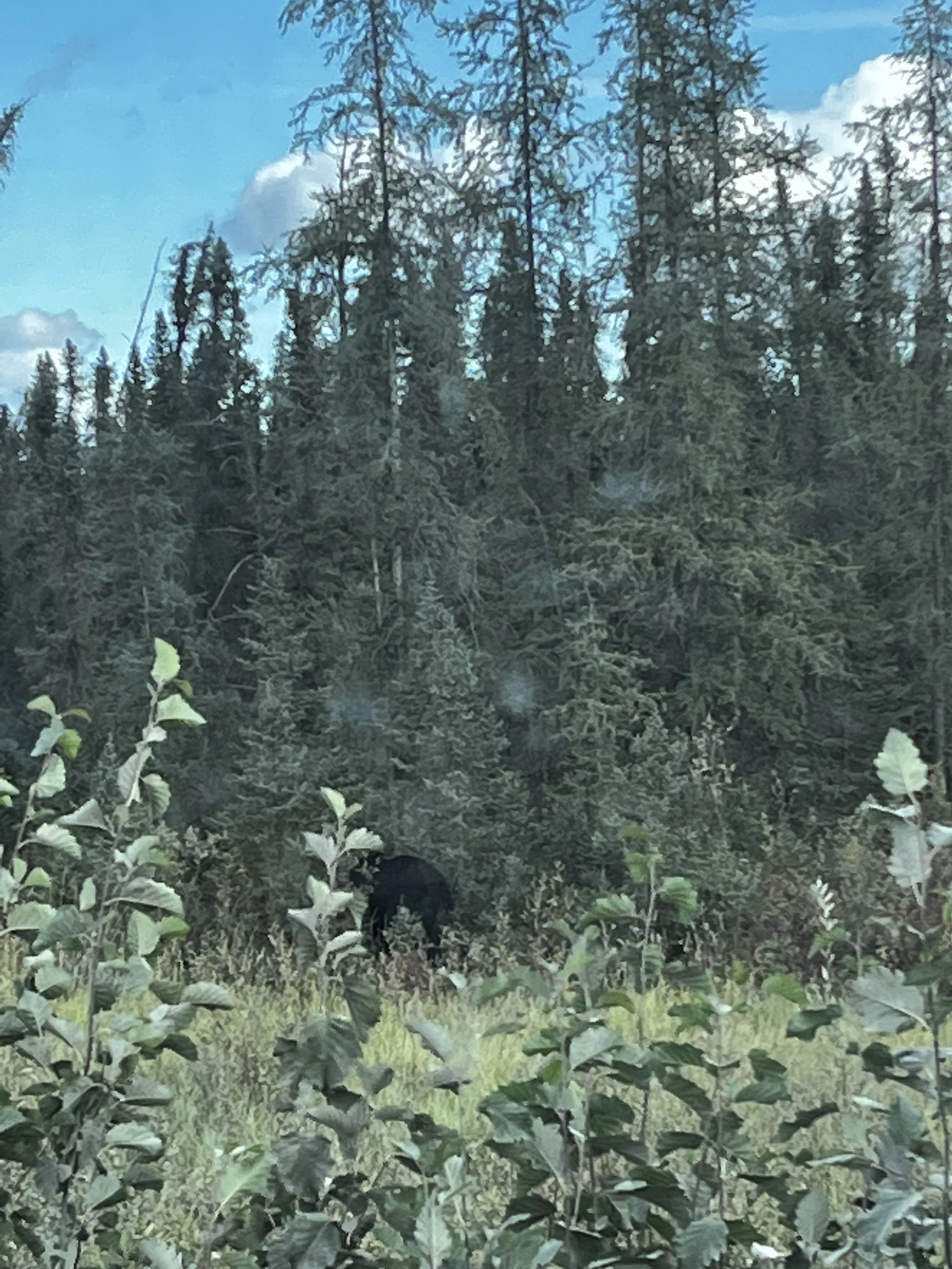
After we made it across the Mackenzie River, we made a solid push for about an hour and a half to Inuvik, only stopping for a big black bear that was walking along the road. Unfortunately, it got spooked, and it retreated to the safety of the woods before I was able to get a decent picture of him. A short time later, we reached the outskirts of Inuvik. Historically, this would have been the end of the road apart from the ice road on the Mackenzie River in winter, but in 2017, the last leg of the Dempster was opened, connecting Tukoyaktuk to Inuvik with an all-weather road. With its completion, the Arctic Ocean was open to a new age of explorers.
As I wanted to reach Tuk at a decent time and have the best chance to grab an Oceanside camp spot, we pressed on through Inuvik. One thing I will say about this part of the Dempster is that the newest doesn’t always mean the best. This section of road may only be 6 years old, but it was the worst part of the journey with very hard-packed deep washboards that threatened to shake the jeep until the only thing left was me holding the steering wheel. If I wasn’t glad that I aired down before we hit this section, then I was now!
The landscape of this area reminded me of the North Slope heading toward Deadhorse in Alaska, barren open plains of tundra, but something uniquely different was the presence of more water, lakes of various sizes dotted the landscape. Another thing unique to this part of the Dempster was that every few kilometres you would see a collection of snowmobiles randomly parked alongside the highway. I believe they may belong to local hunters who have staged them to be ready to go once the hunting season starts.

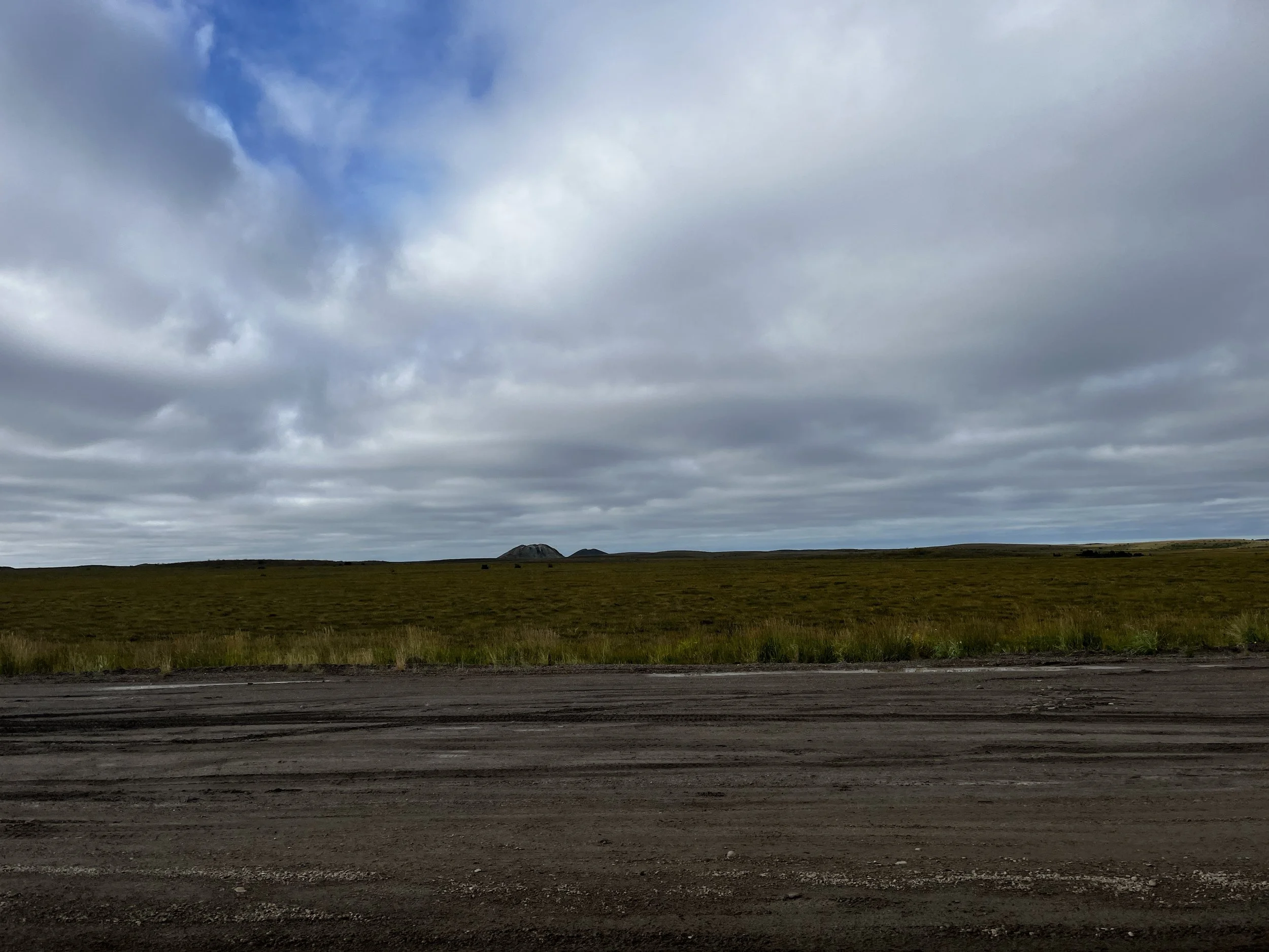
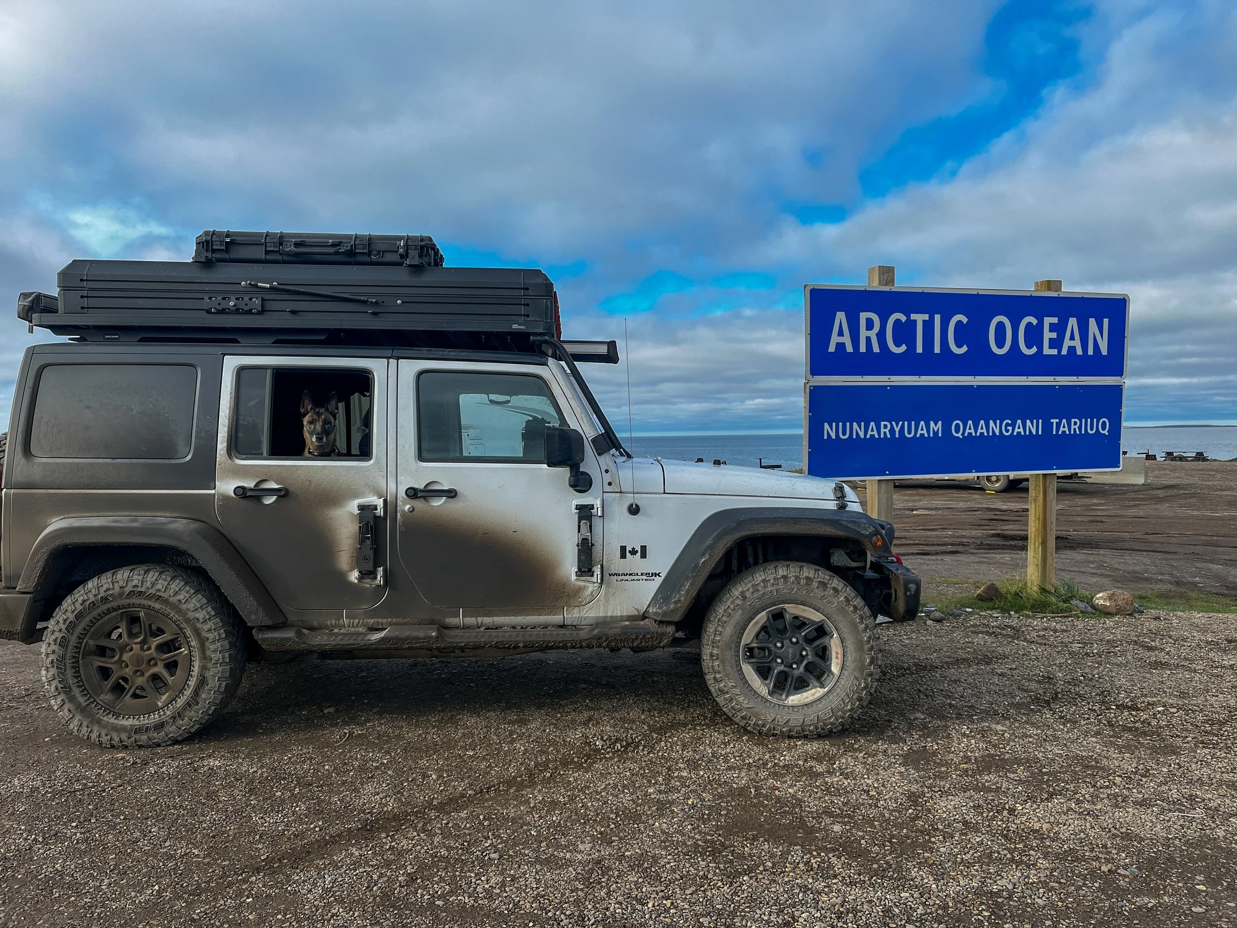
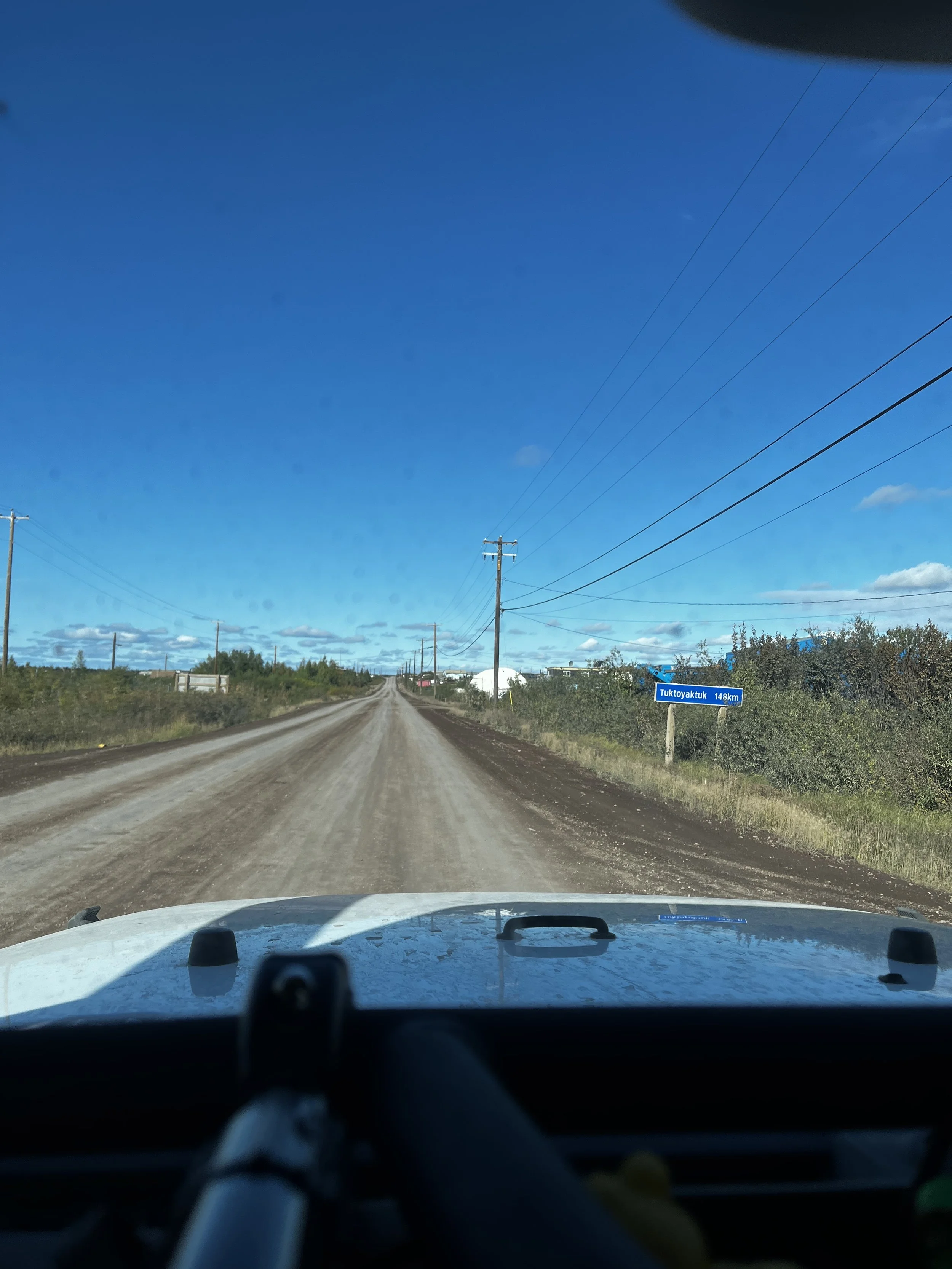
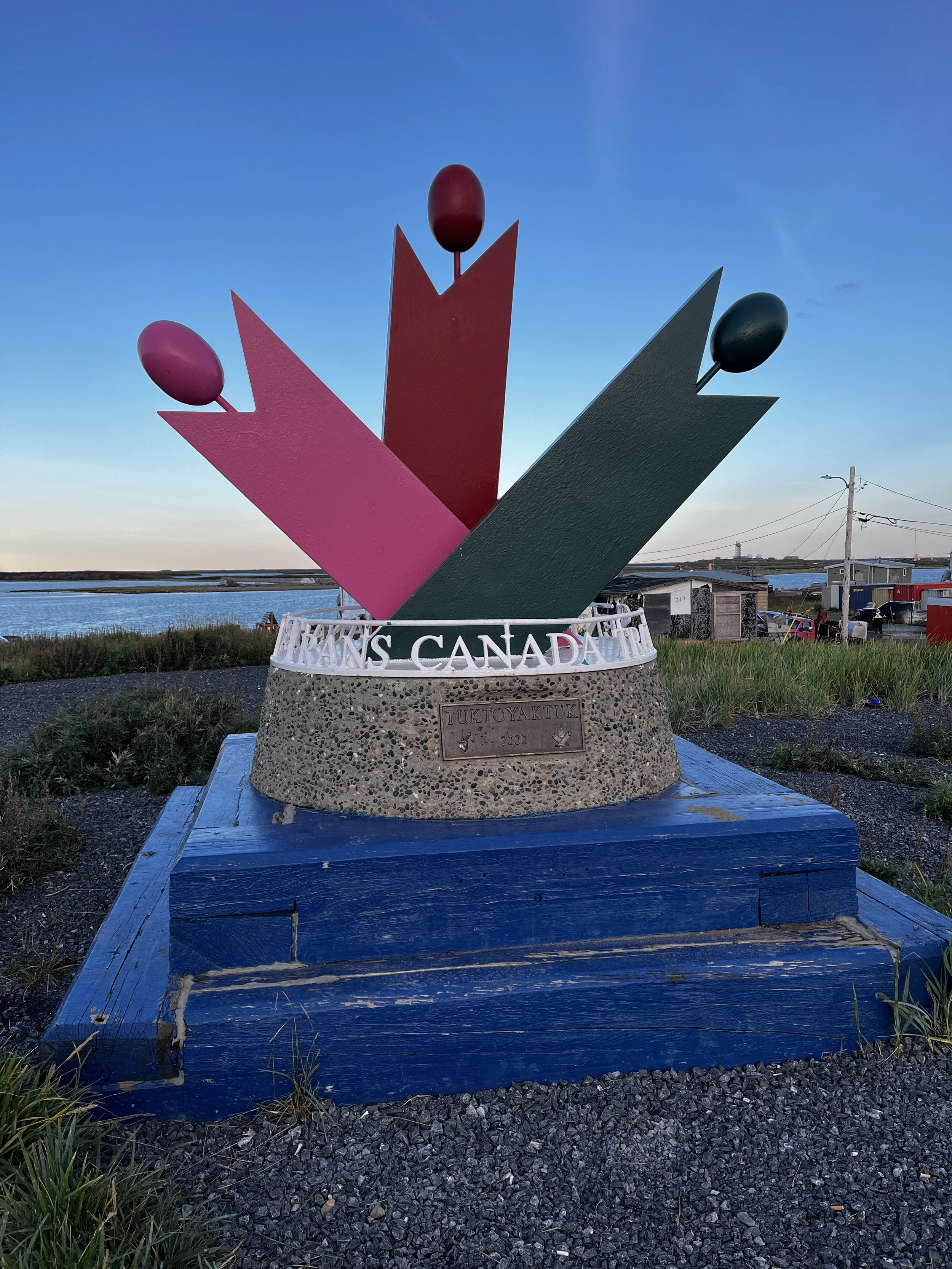
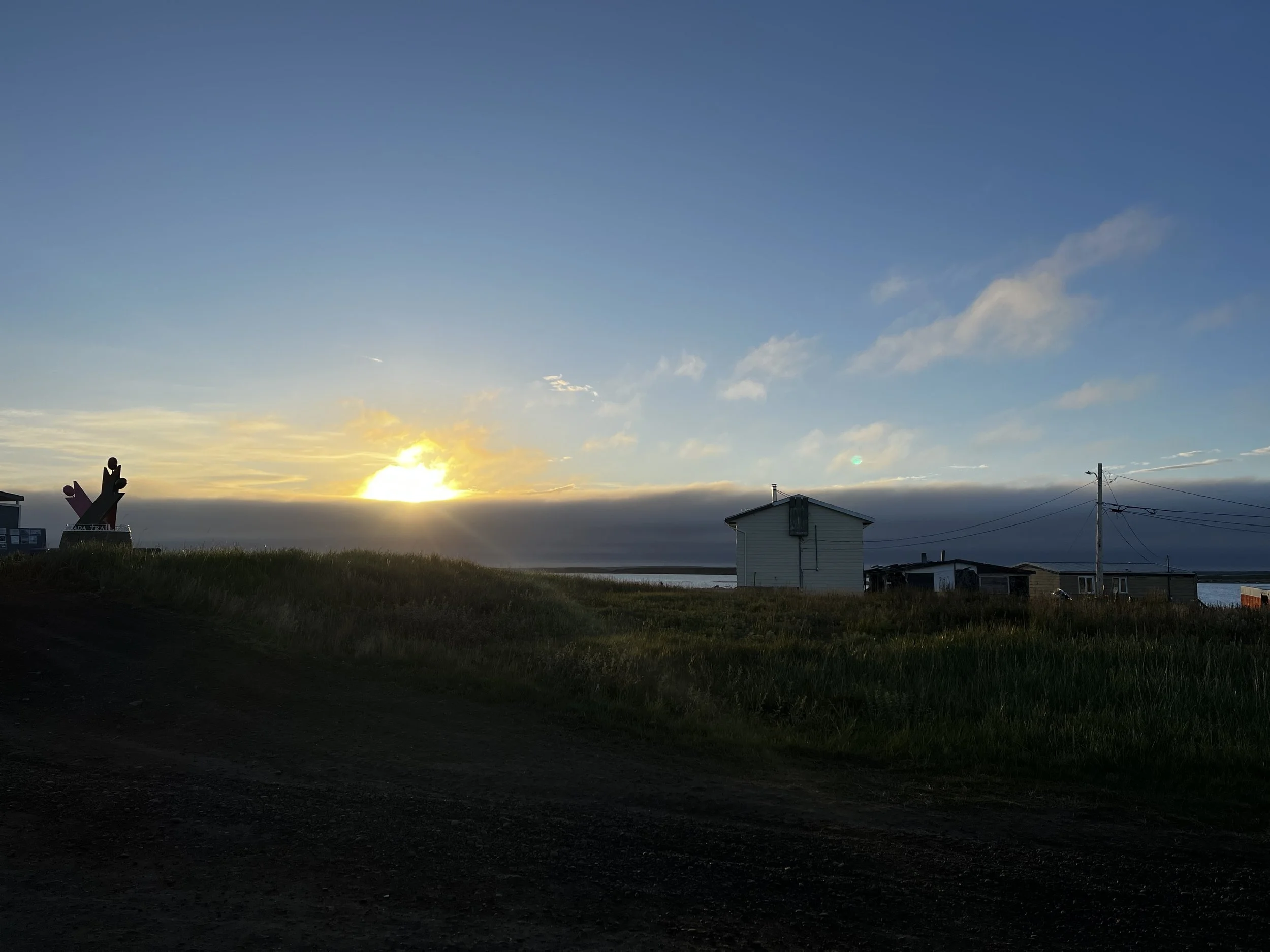
A short while later, we reached the outskirts of Tuktoyaktuk, where I laid my eyes on my first Pingo at the Pingo National Landmark Viewpoint. Pingos are small hills in the landscape that are created when the collection of water underneath originally froze and pushed the tundra up, forming an ice-cored hill that, as the only elevated position in the area, has been used as navigation aids and lookouts for hunters. After taking a few pictures, we carried on to the “End of the Road” and the northernmost point you can drive to in Canada. After taking the mandatory picture in front of the Arctic Ocean sign, we went to locate our campsite for the night.


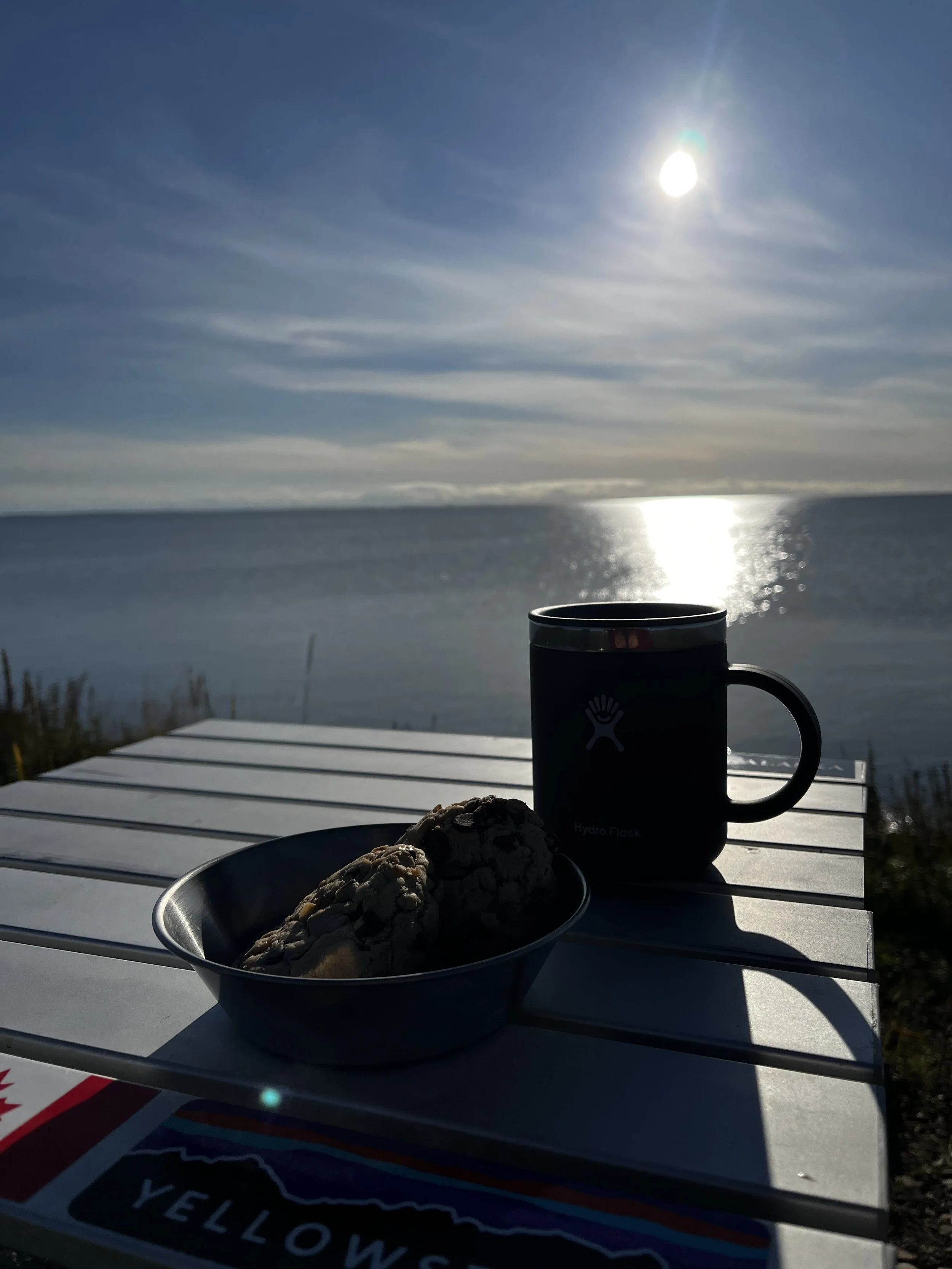
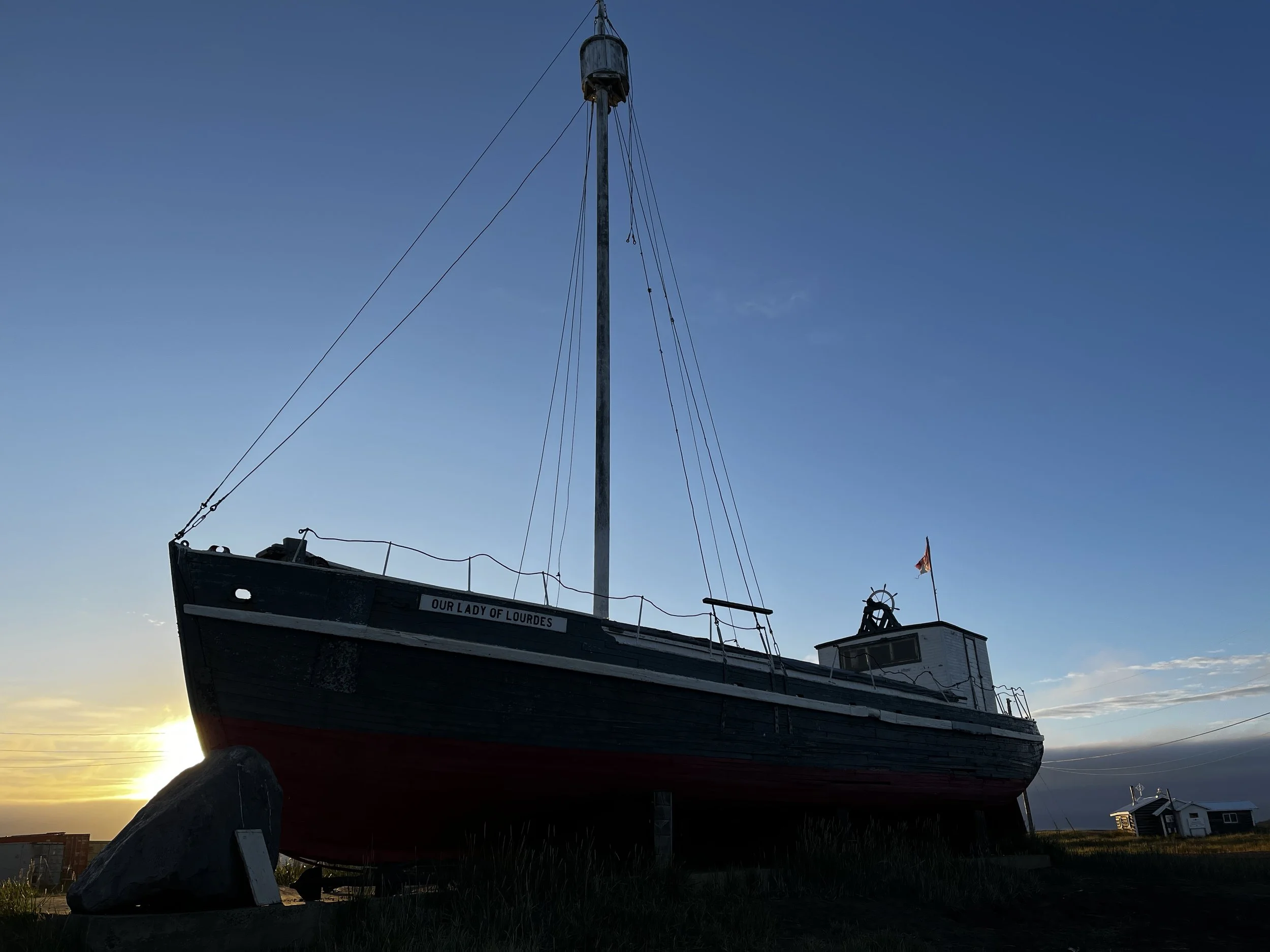
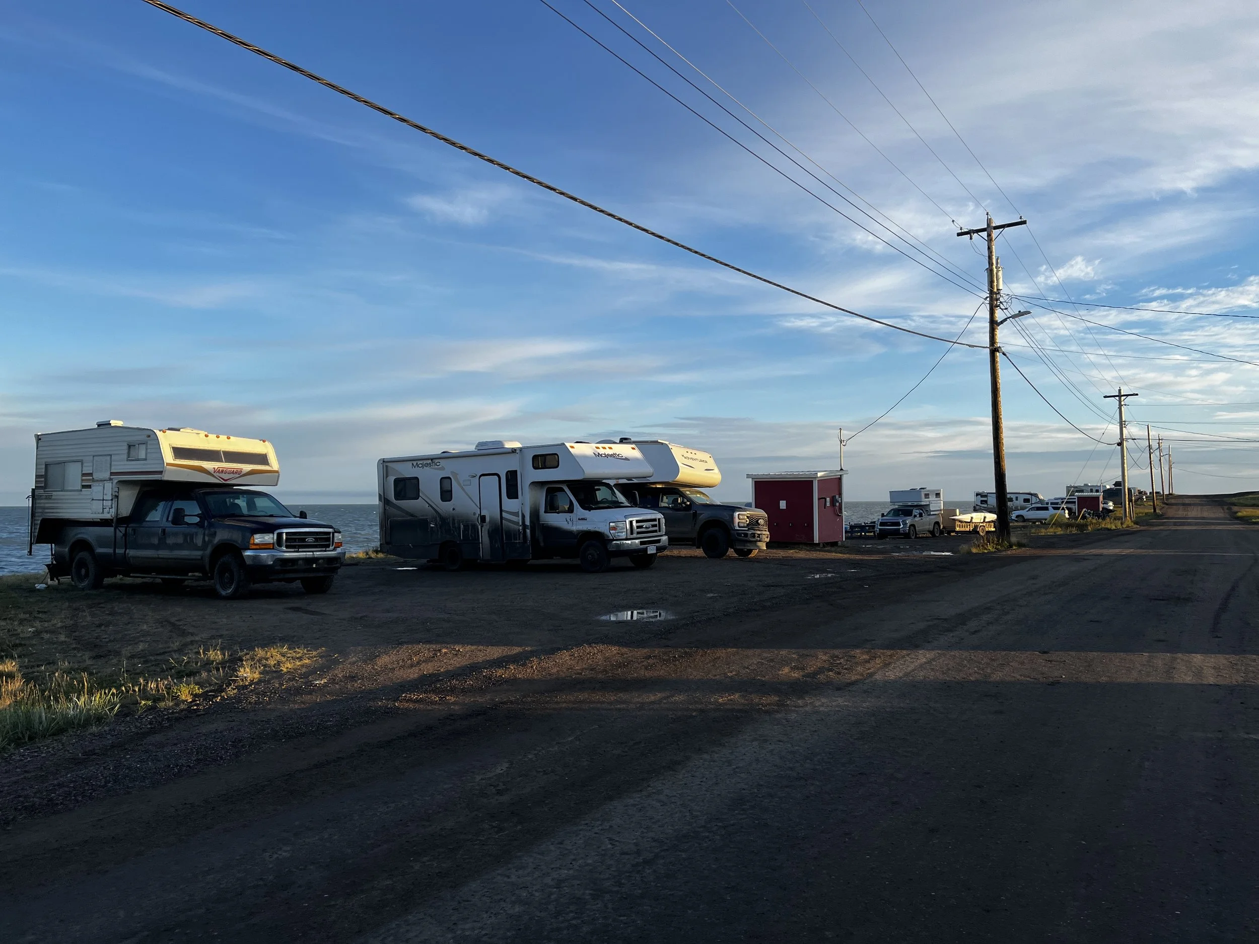
All the campsites in “Tuk” have a stunning waterfront view, a definite plus over the Dalton Highway, where you can’t even reach the ocean with your vehicle. The weather was absolutely perfect, a massive blue sky with the sun’s rays glistening off the calm waters of the Arctic Ocean. After setting up camp, supper was made, and I spent time just sitting and enjoying the view. There is a genuine feeling of community here as you have friendly kids coming up to say hi while other local artisans drive up on quads to sell their wares.
As day turned to dusk, I struck up a conversation with a couple, Doug and Diane, from the Vancouver area, who were camped beside me in their red FJ Cruiser. We chatted about our adventures to this point, and at the time of writing this, we have become good friends and have enjoyed more adventures together.

After enjoying the best sleep of the trip, I woke at around 6:30 to the sound of the tent awning being buffeted by strong winds that were coming off the water. I tried to ignore them and get a little more sleep, but as the morning progressed, so did the strength of the winds. I’m sure it would have been fine, as my Bush Company tent is pretty much bulletproof, but as prevention is the best medicine, I got up and carefully turned the Jeep, so the hard metal side was facing the wind and carried on with making coffee and breakfast. As rain was in the forecast, I packed up the tent and then went for a walk around town as it was still in the process of waking up. Unlike Prudhoe Bay, I didn’t go all out and go for a swim, but Layka and I did wade into the icy waters to make it official.

Although I would have liked to have spent a few more days here, I will have to wait for another trip. With rain on the way, we headed out back toward Inuvik, and by the time we got there, the rain had started, and the Jeep was no longer white and weighed considerably more than when we started. A quick trip to the car wash helped with that and then it was off to the Western Arctic Visitor Centre. I found out from Doug and Diane that you could get a certificate for crossing the Arctic Circle there. The actual title is “Certificate of the Arctic Circle Chapter Order of Adventurers,” and it is a very cool thing to get. The staff at the centre are super nice and to top it all off, there was free coffee to be had as well! While I was getting my certificate, I actually ran into Doug and Diane again. I told them where I’d be camping, and they said that they may stop there as well, more on that adventure later!


The trip from Inuvik back to the same campsite in the quarry, despite being wet, was eventful. Ptarmigan dotted the road from time to time, and we also came upon a grizzly bear tearing apart a carcass. I managed to get a few pictures from the Jeep. Shortly after making it to camp, Doug and Diane pulled in, and after setting up camp, we kicked back and enjoyed chips and salsa before starting on actual supper.


While I was getting my stove prepped for cooking, Diane was doing the same at the back of their Fj and Doug was playing with Layka when I looked up, I saw the largest Grizzly I have ever seen silhouetted along the top of the ridgeline, about 20 meters away from our camp. I shouted “Bear!” to get everyone’s attention, called Layka back and put her in the Jeep. Doug also slowly walked back to their vehicle. Once he was back, I also beeped the horn, my attempt at a deterrent. The bear slowly sauntered along the edge of our camp, glancing at us a few times before ascending the hill on the far side of our camp. To say our hearts were racing would be a dramatic understatement, and as he descended out of sight on the far side of the hill, he was definitely not out of mind and wouldn’t be for quite some time.
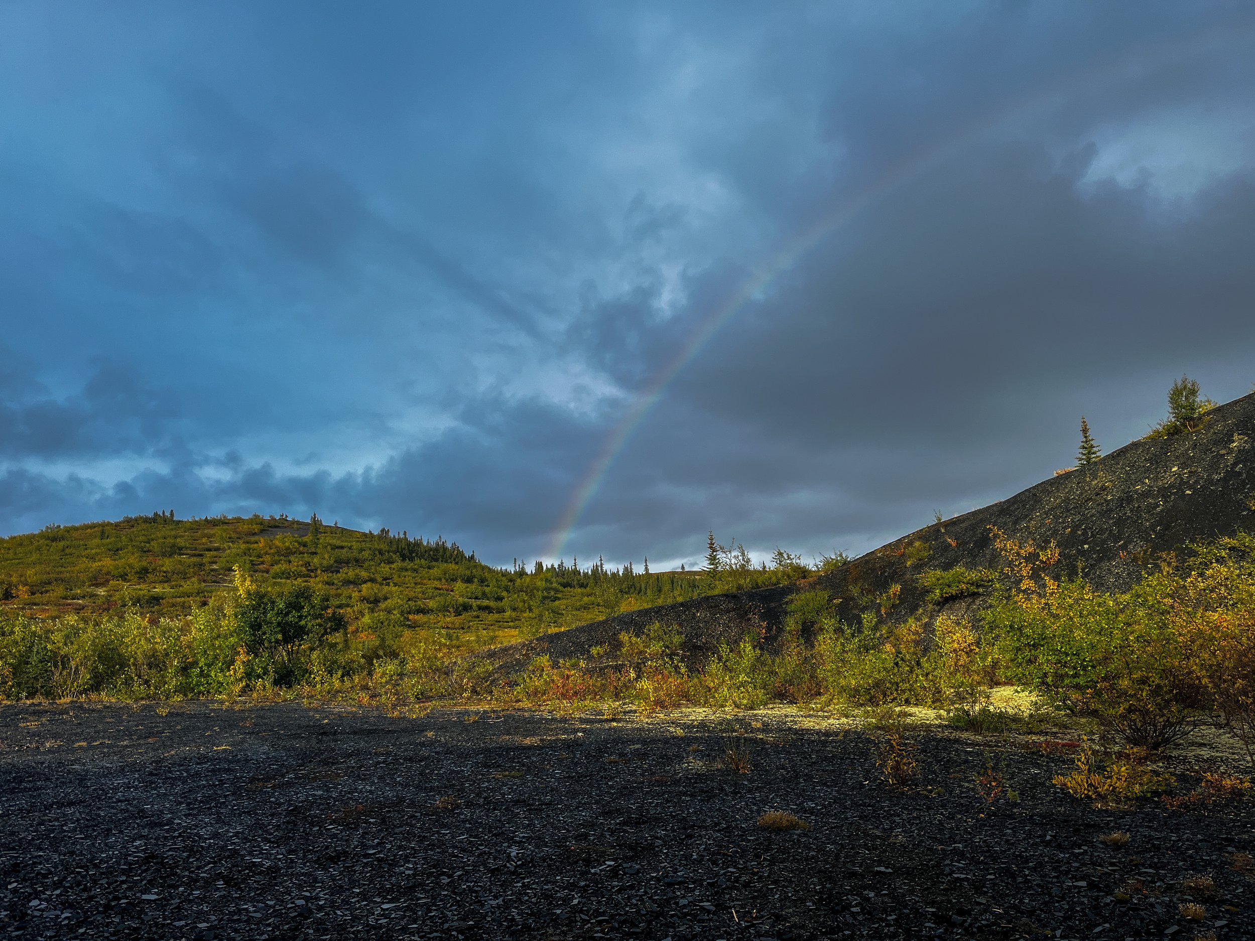
After getting heart rates under control, we went back to preparing supper, although the menu had changed from a legit meal to just a dehydrated one. To top the evening off, after a brief rain shower, we were treated to a beautiful rainbow, which only added to the magic of this place, and I went to sleep only guessing what tomorrow could bring.
The next morning, I woke to the pitter-patter of raindrops on the tent, so before it progressed into a full-on shower, I got up and packed up. Doug and Diane were pushing all the way to Dawson City today, so they left earlier than I did, but I eventually caught up to them as bears along the road have a tendency of delaying the progress of any road trip. The rain continued off and on until we made it to Eagle Plains. I stopped there for lunch while Doug and Diane carried on towards Dawson.


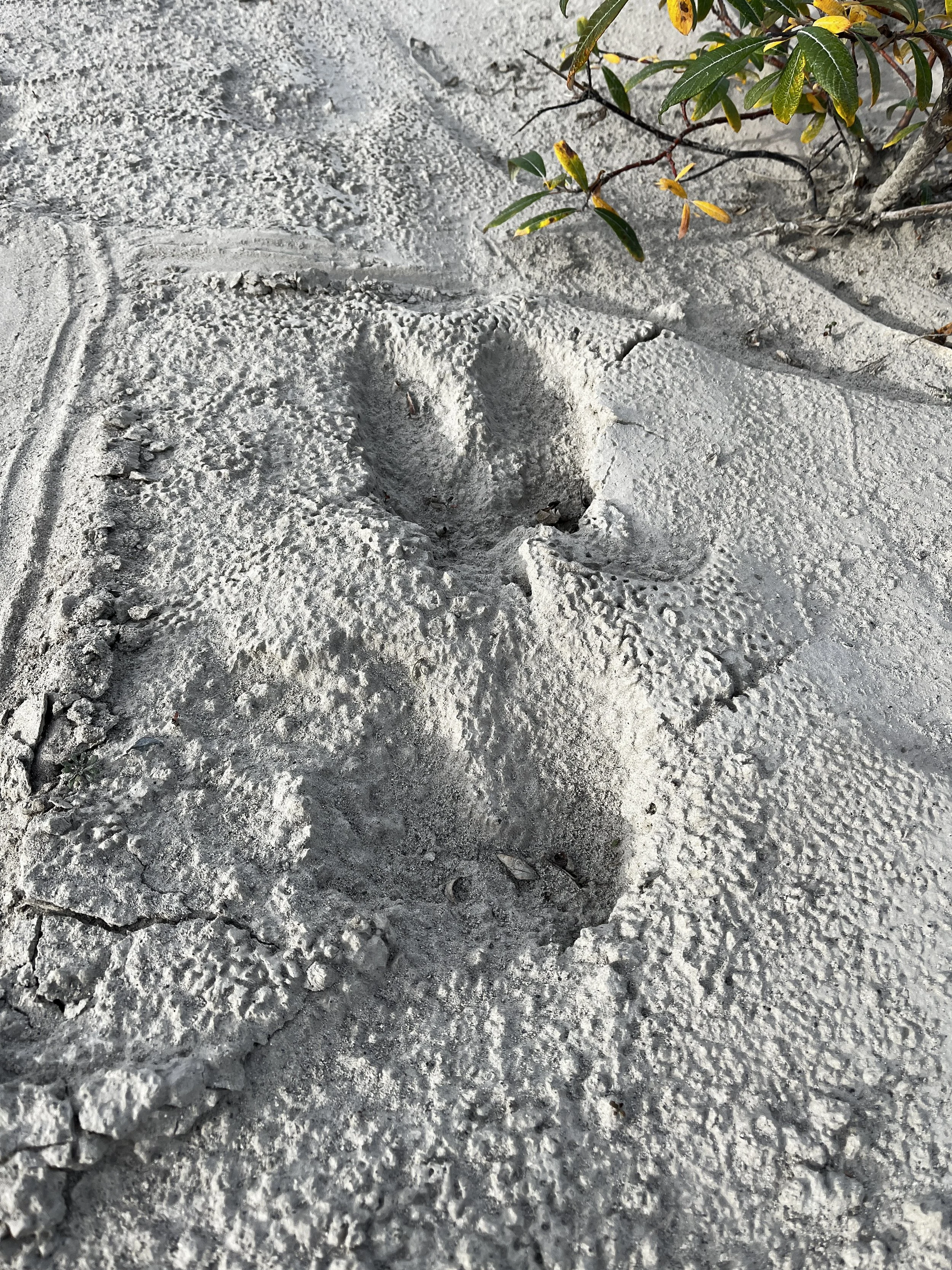
Layka and I were soon on the road again after finding a potential campsite on iOverlander, just to the north of Tombstone Territorial Park. A dried riverbed at the base of a cliff of black rock surrounded by peaks that are known to be the stomping grounds of Dall’s Sheep. We didn’t end up seeing any, but as I was setting up camp, I did find moose and wolf tracks, making me hopeful that we would see or even hear something, but alas, it was not to be. It was still an amazingly beautiful campsite and one that I will camp at again.
As I drifted off to sleep on the last night of our trip, I was reflecting on how quickly my summer in the north had passed and how I had tried to make the most of it by exploring about 15,000 km in the three months I was here. It also reminded me of how the hourglass of life is always in motion, and you never know when the sands will run out. I went to sleep thinking about how I could keep the momentum going to make sure that, whatever time is granted to me, I use it the wisest I can.
The next day, we quickly packed up and made it back to the beginning. The Dempster Highway is full of challenges and adventure, but to date, it is one of the most rewarding times of my life. I urge anyone who has a taste for adventure to find a way to explore this wonderful area, as it will leave an indelible mark on your soul.
As always, thank you for reading, and if you liked it or have a story of your own trip to this area, please leave a comment, also, follow us on the social channels found at the top of the page for more adventures.