Kenai, Denali and the best Campsite ever!
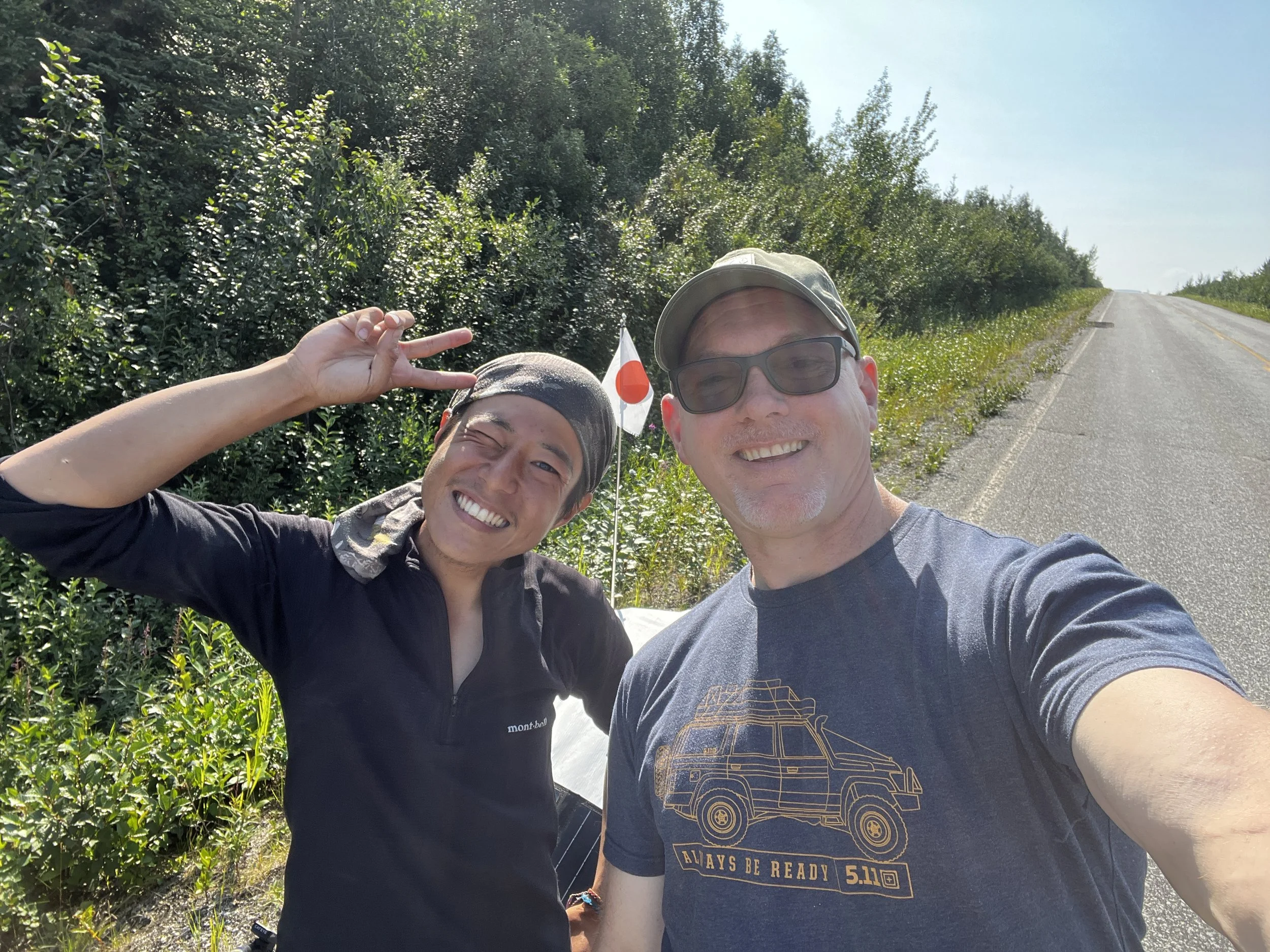
So, July is almost over and I’m already halfway through this summer’s adventure in the Yukon. I realized that I have a handful of trips from last summer and a few more from the fall that I need to catch up on so be ready for a furious onslaught in the next while. I promise to keep them on the regular from here on in. With that, the next trip I’d like to share with you is an amazing trip, where Layka and I spent 6 days travelling a gorgeous 2200 km loop that took us to some of the most spectacular places you can visit in Alaska. Ironically enough this trip took place almost exactly a year ago! The date was July 25th, 2023, and after packing up it was already about mid-morning by the time we headed off along the Top of the World Highway. Soon after making our way past Chicken, AK, we luckily came across a familiar smiling face. Atsushi, the young Japanese man whom we met in June along the Dalton Highway who had started his Pan-Am walk to Argentina in June, had made it all the way from Prudhoe Bay to the outskirts of Chicken. After catching up for a bit I wished him well on his adventure, passed him a few supplies and we carried on.

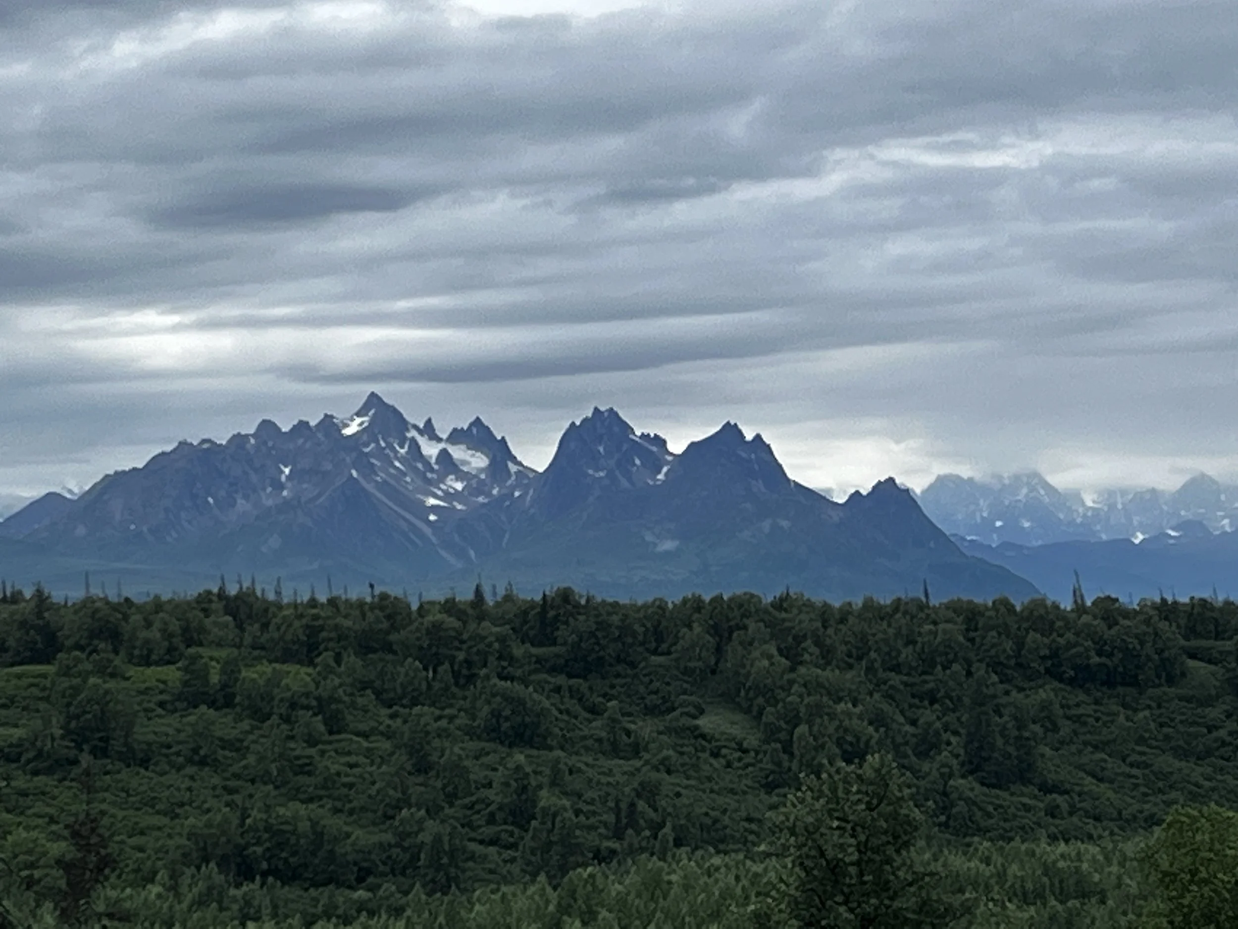
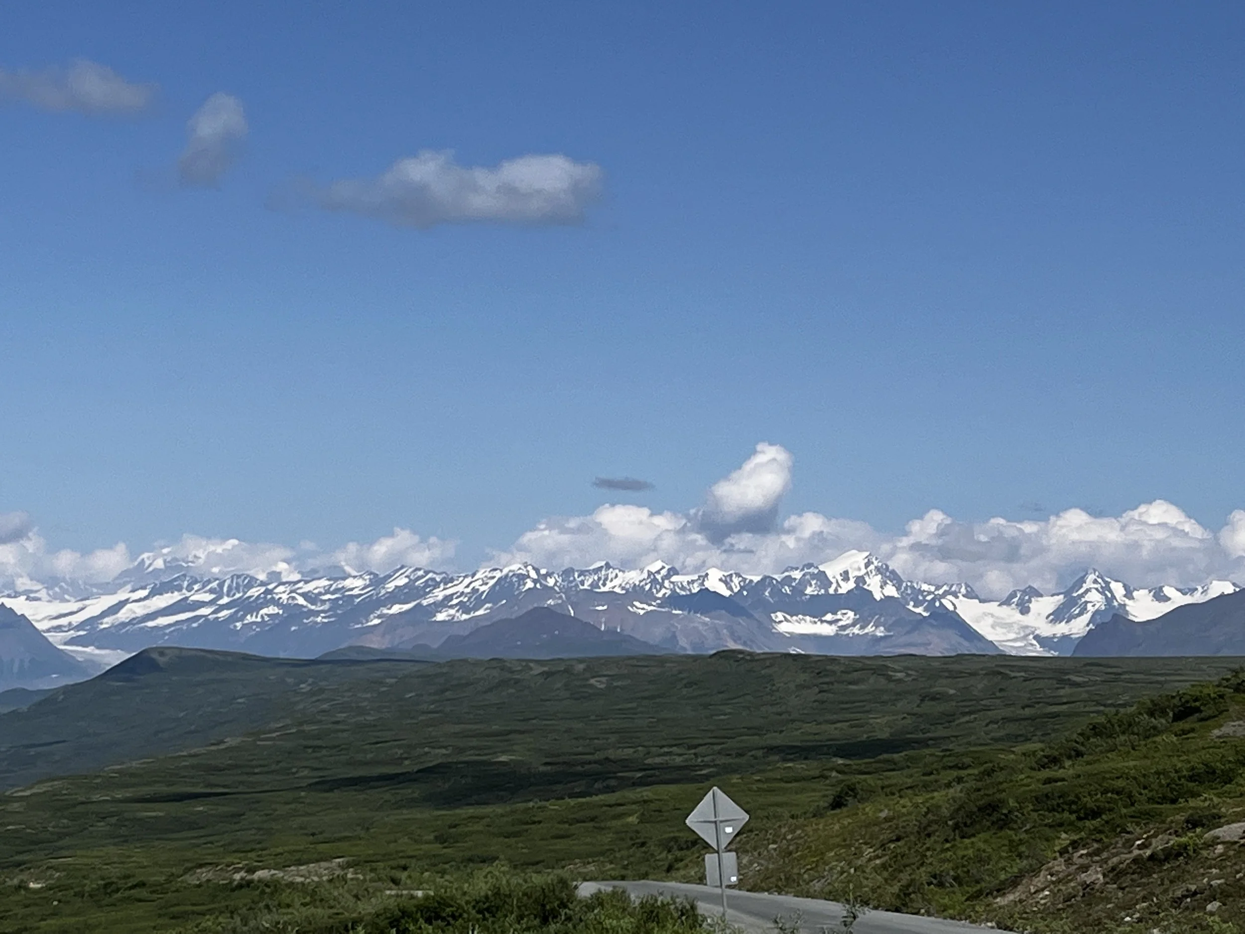
After stopping for food and fuel in Tok, AK, we headed west toward Chitina, AK and the road to the Wrangell-St. Elias National Park and Preserve, one of the largest national parks in the US and according to Wikipedia, is larger than 9 US states and is about the same size as Bosnia and Herzegovina. The weather up to this point had been fairly cloudy but as we continued, the clouds gave way, and I was in awe by the majestic view of the rugged snow-capped peaks the park is famous for.
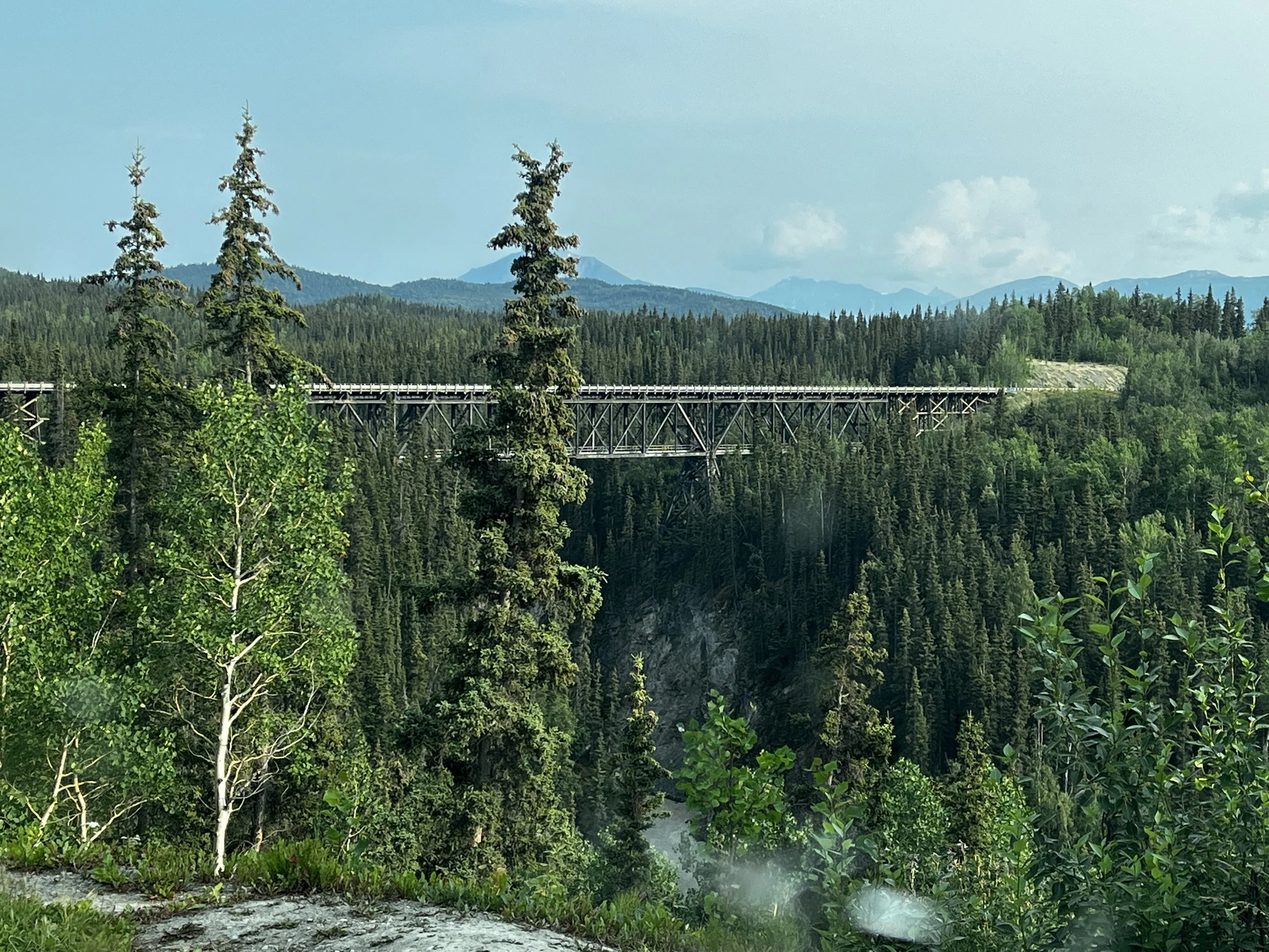
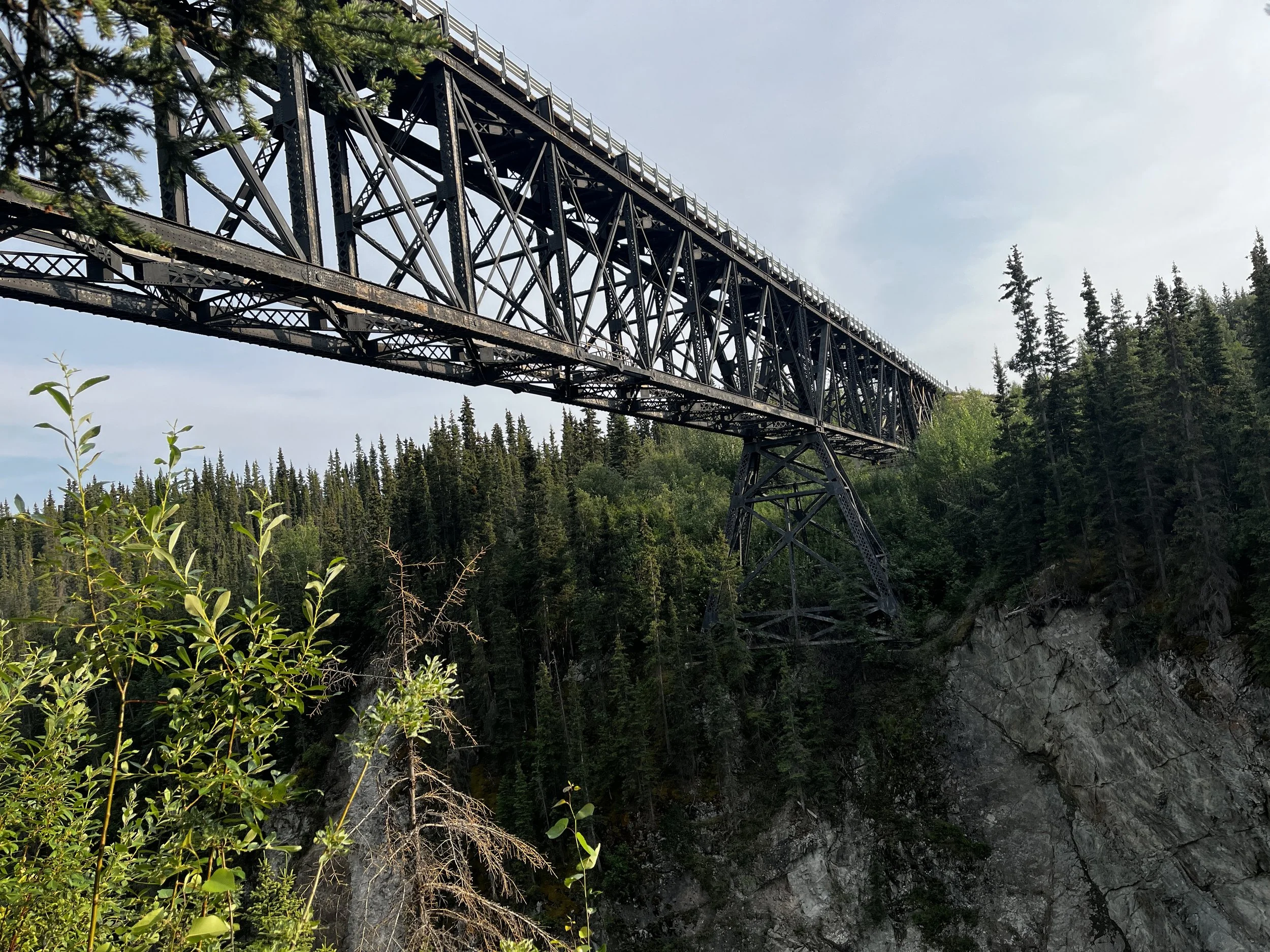

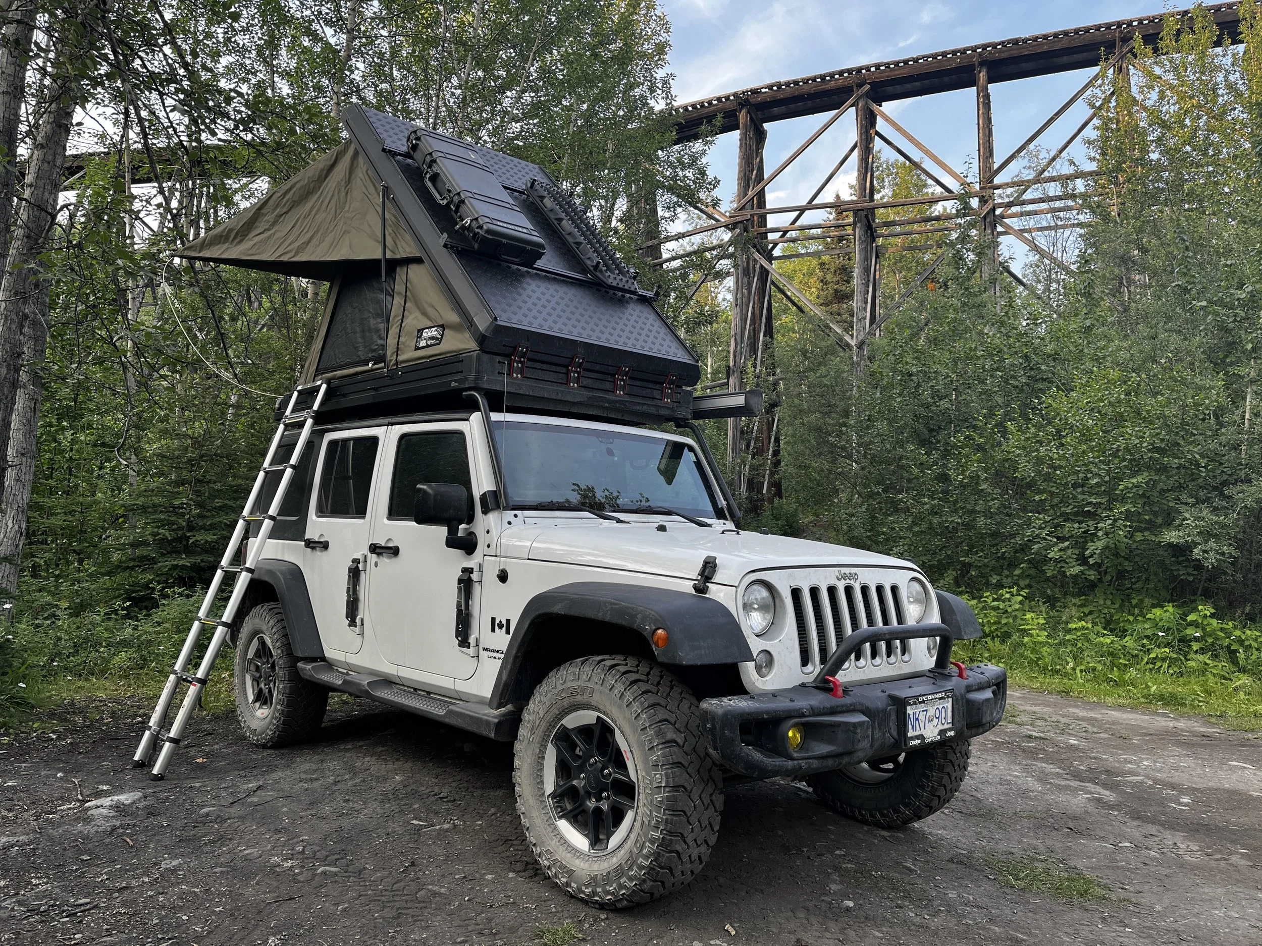
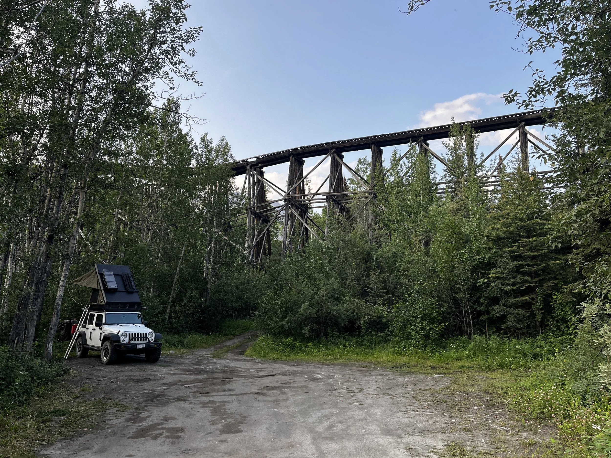
Our intended camp for today was under the Kuskulana Bridge, a converted rail bridge but as we had made good time and the bridge was only about one-third the way to tomorrow’s destination, I decided to press on a little further where I found another great campsite that was also tucked under another historic bridge, the Gilahina Trestle Bridge. As we were camped next to a stream, in a narrow valley, with trees all around, the mosquitos were out in full force, so supper was quickly prepped, and Layka and I made a hasty retreat to safety behind the protective mesh of the tent. After finishing supper, I journaled into the night with thoughts of what we’ll see tomorrow when we visit the historic town of McCarthy and the Kennecott Mine.
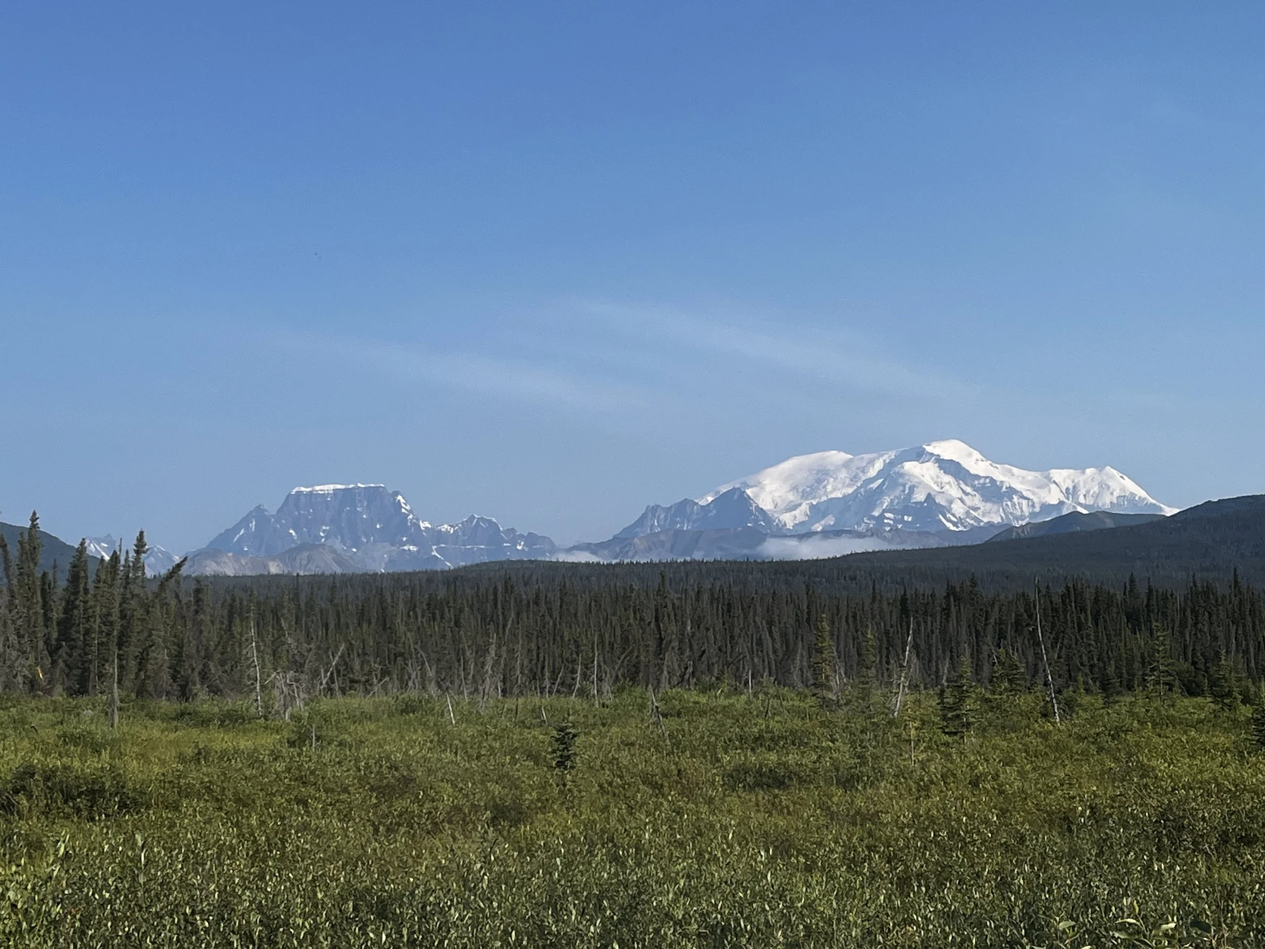
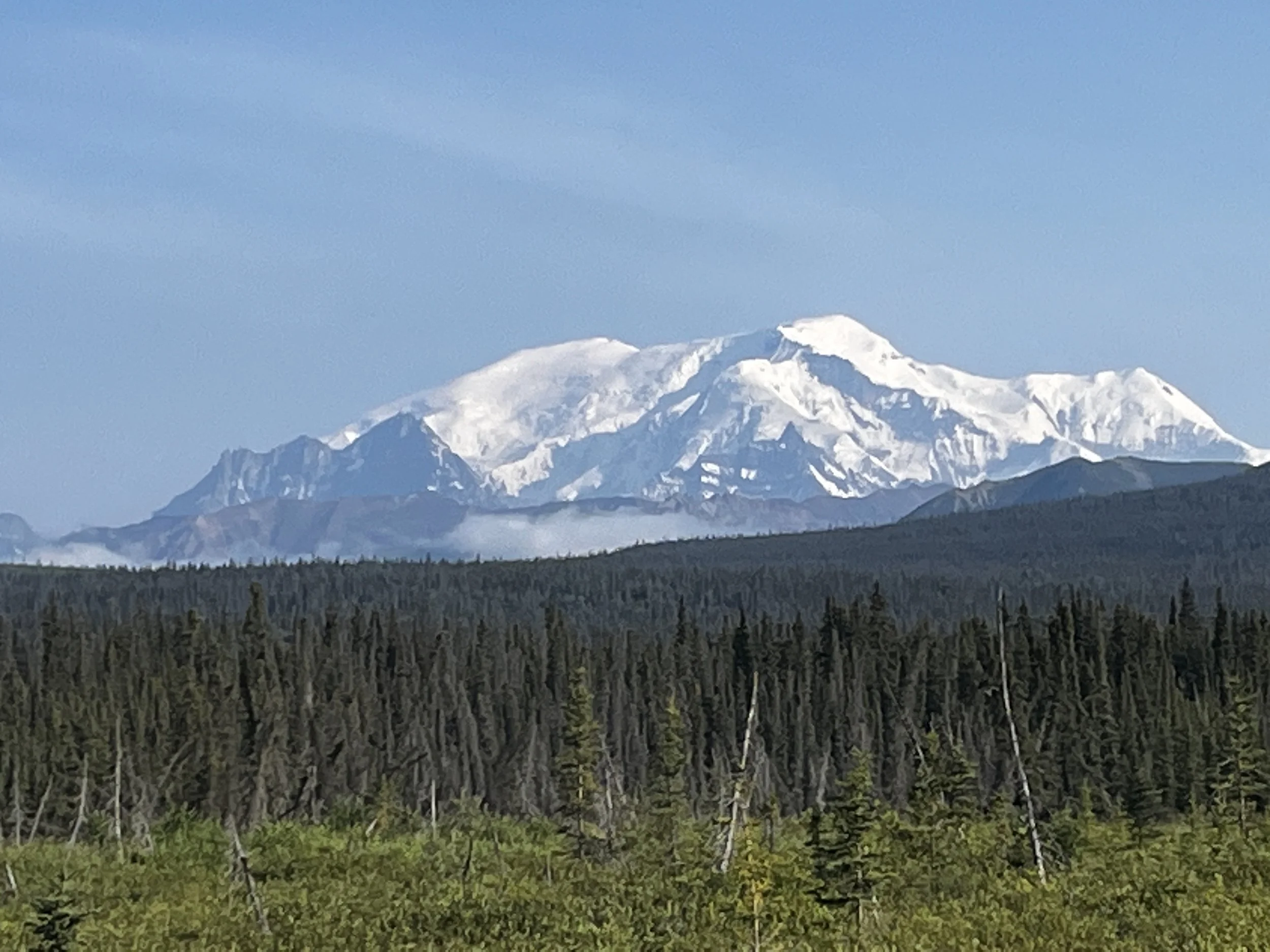
The next morning, we woke to a beautiful blue sky and after a quick breakfast of oatmeal and blueberries, I packed up and we were on our way. As we came out of the gully from where our camp was, the sun illuminated the snow-capped peaks of the Wrangell-St. Elias, providing us with an awe-inspiring view, the vastness of the area and the scale of this mountain range is incredible. The Wrangell-St Elias National Park and Preserve is directly connected to the Kluane National Park and both these parks contain some of the highest mountains in North America, including Mt St. Elias, the parks namesake and the second tallest mountain in North America at 18,008 feet or 5,489 m.
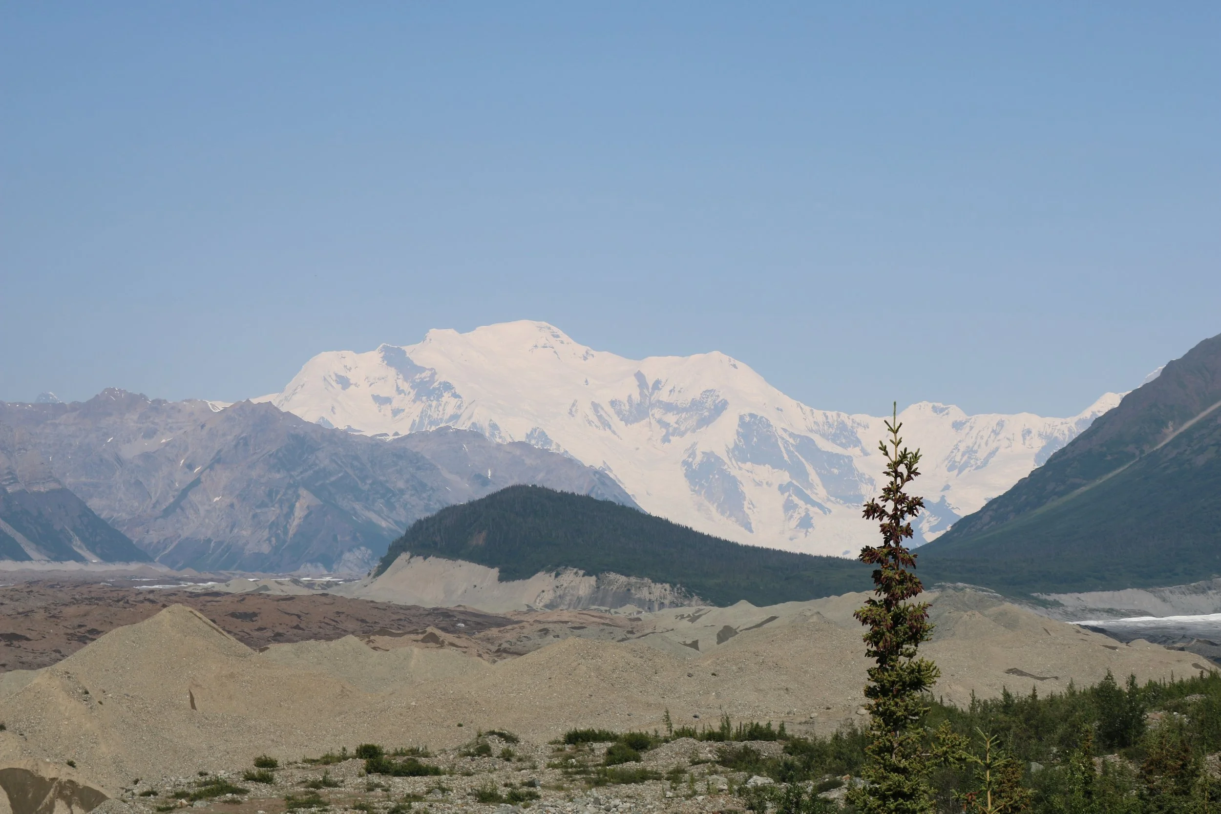
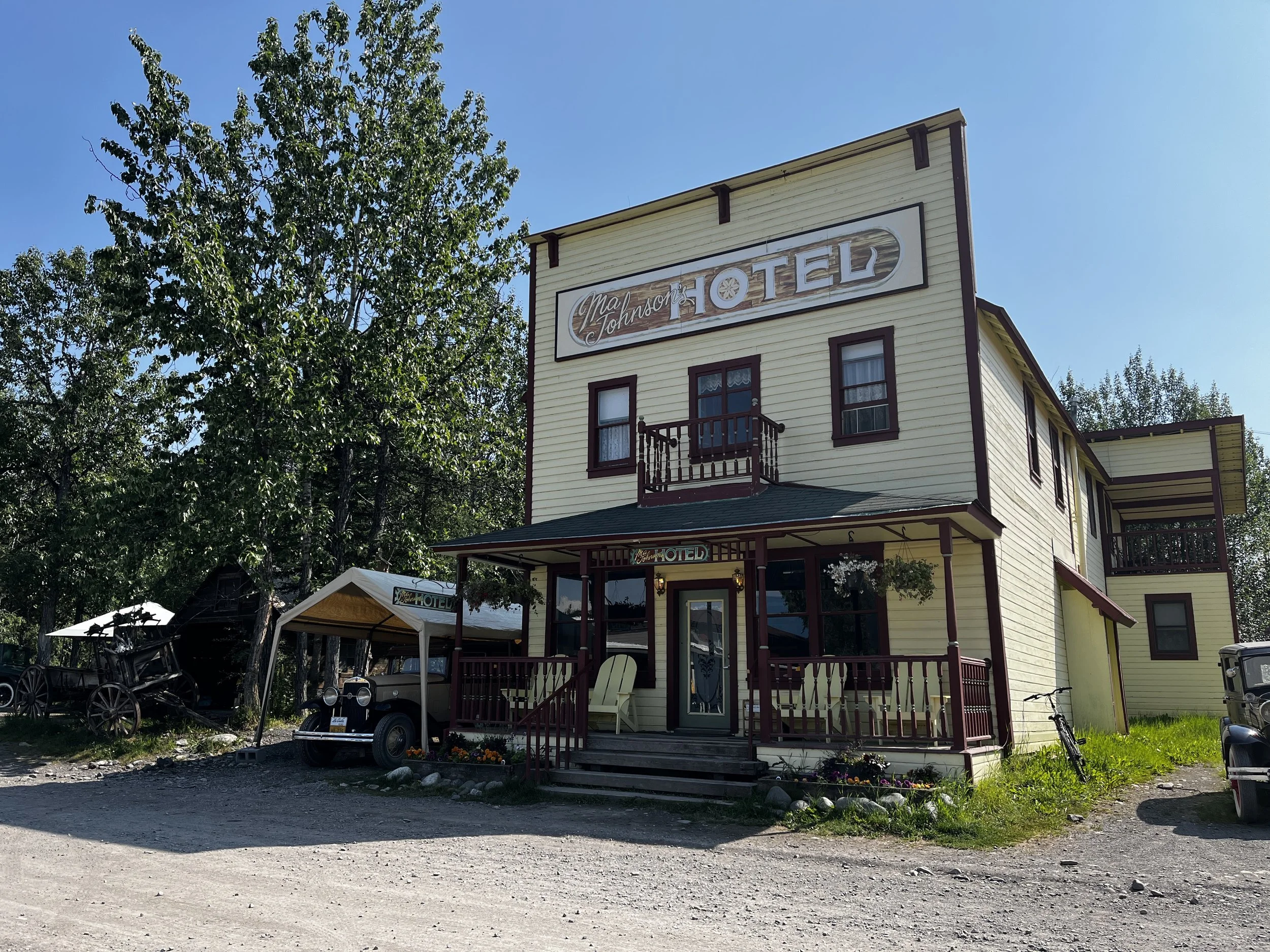
After an hour or so of these stunning views, we reached the outskirts of McCarthy, Alaska, a tiny town torn straight from the pages of a Klondike novel. The town was originally formed as a place for the miners from the nearby Kennecott Mine to come and relax. Even though the mine has long shut down, the town has continued on as a wonderful tourist attraction with a number of the buildings being registered as National historic places with only a couple dozen people still living there year-round.
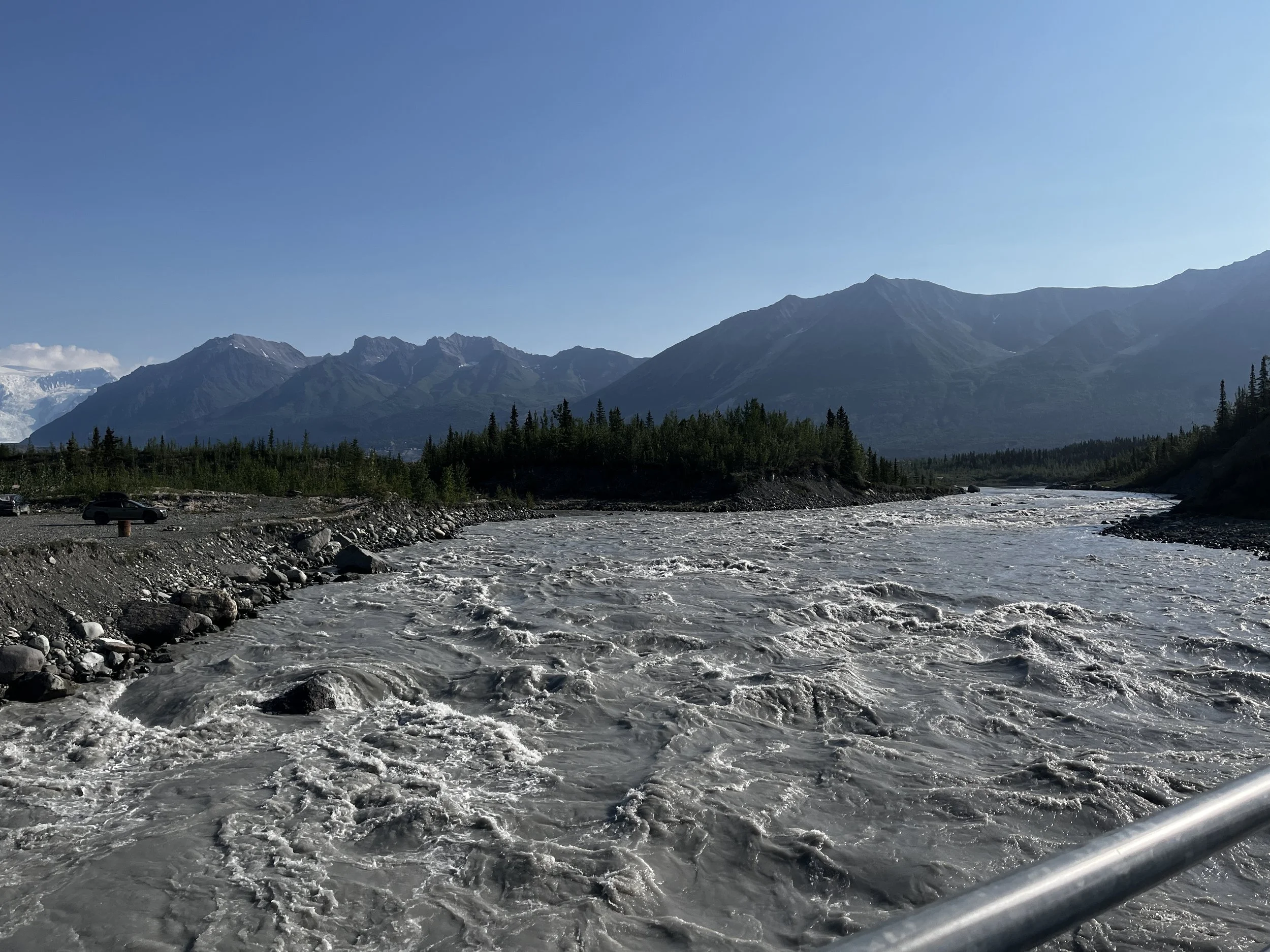
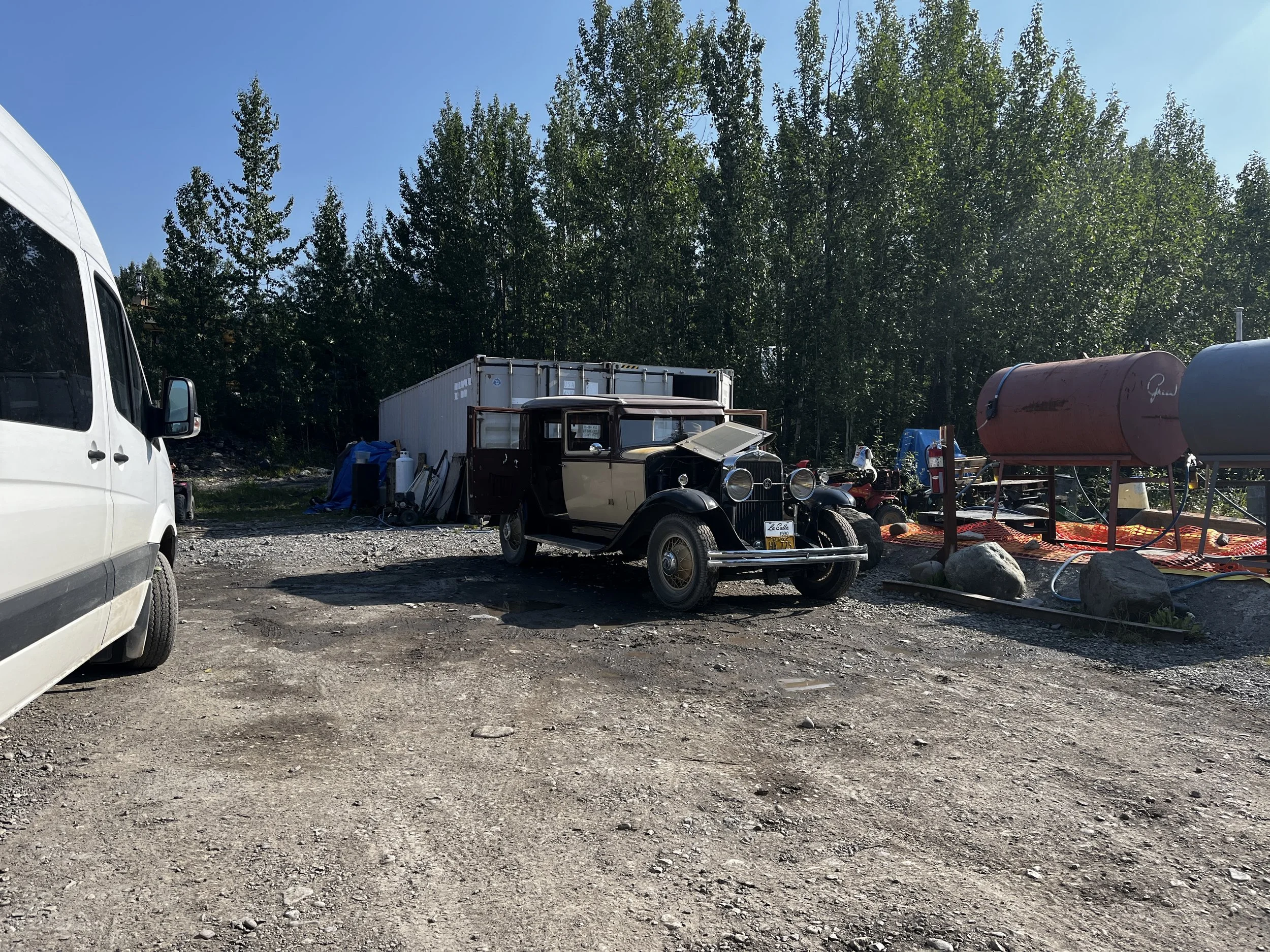
There is a single road that enters the town that is only for the local residents. Visitors to McCarthy must park on the outskirts and walk in. The first leg of the walk is crossing a narrow metal footbridge that crosses the flowing Kennecott River. About 10 minutes later, under a beautiful blue sky, we found ourselves in a quaint little town where time seemed to have stood still. Old cars lined the narrow unpaved streets alongside old houses and shops that were all done up with a historic flavour from a bygone era.
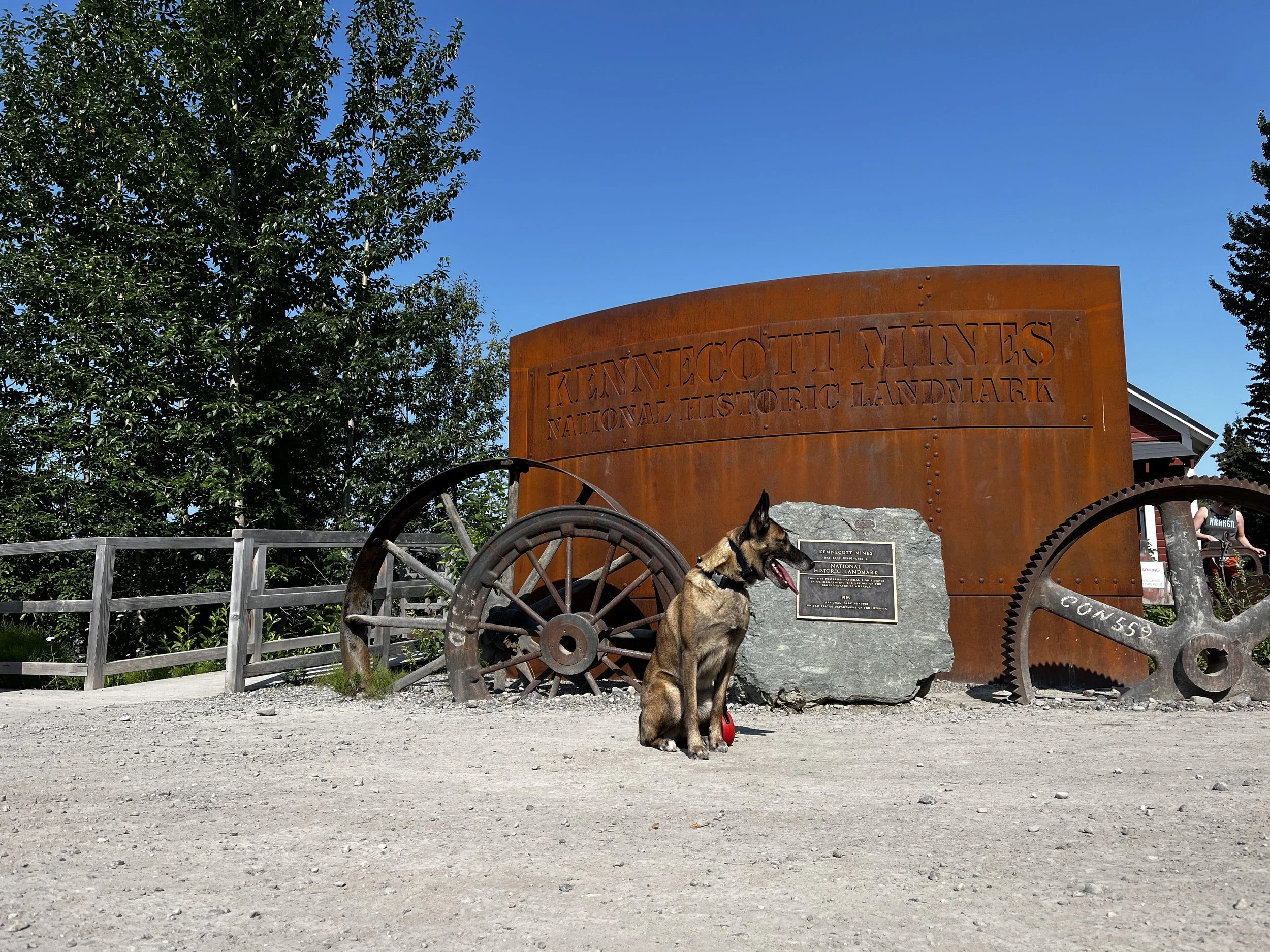
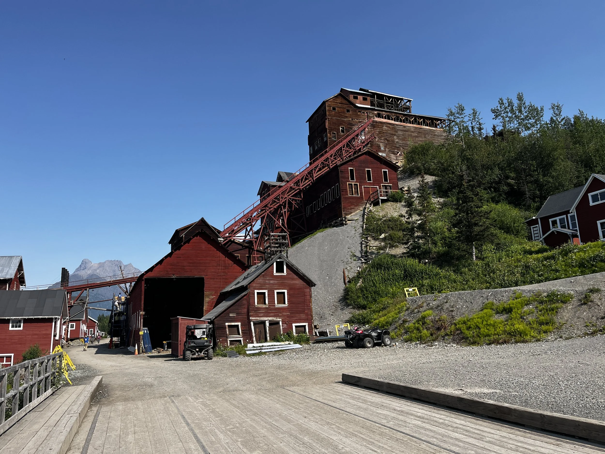
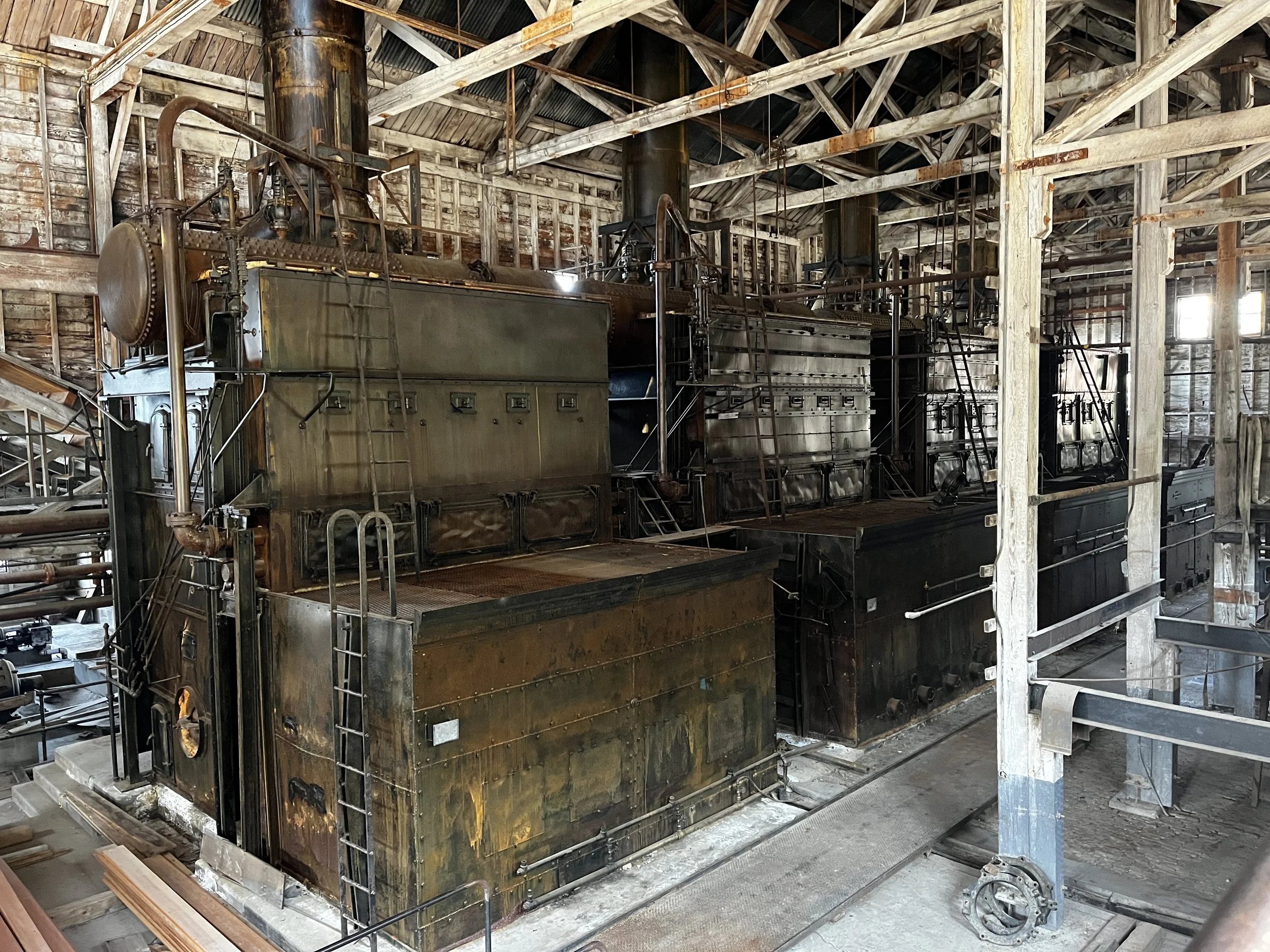
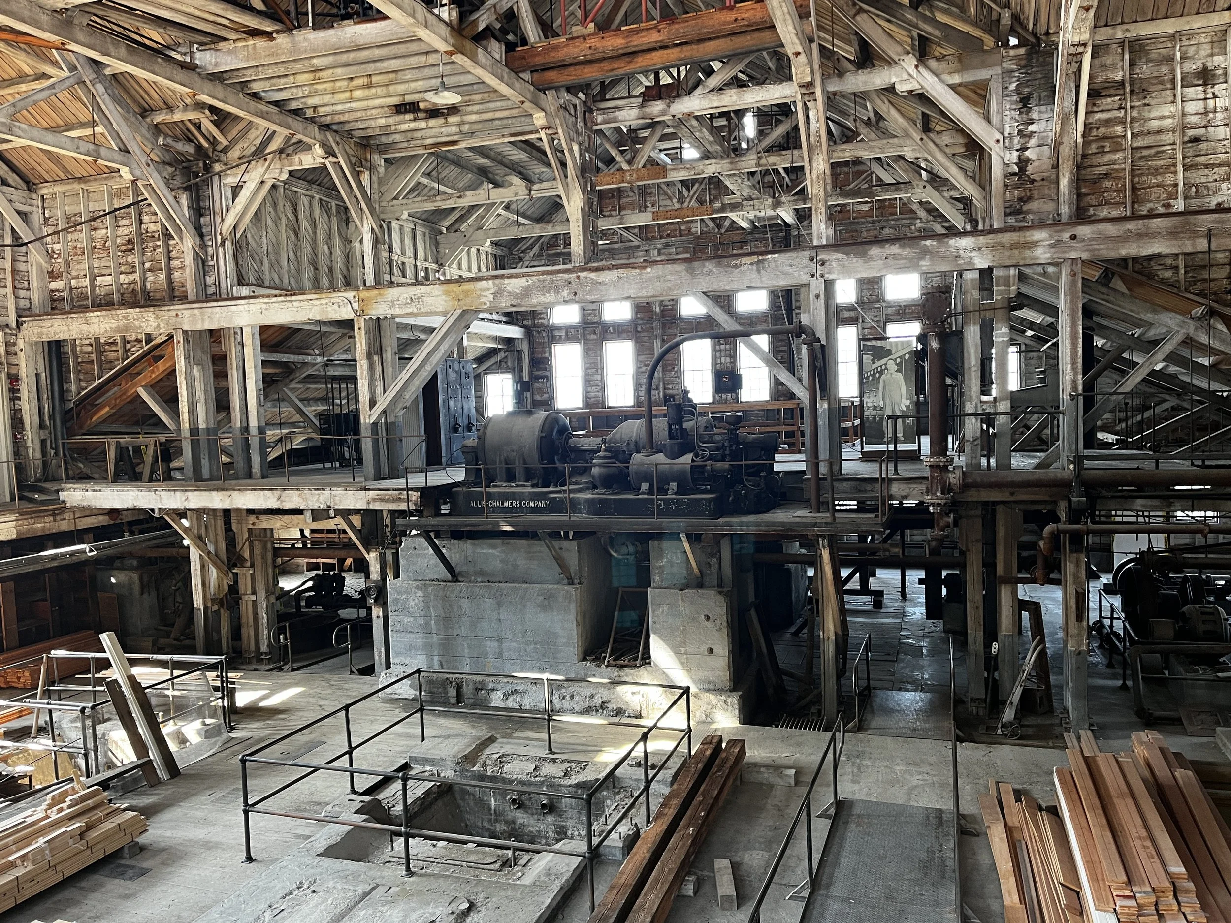
After Layka and I explored the town, we hopped onto the shuttle that takes you a few kilometres up to the Historic Kennecott Mine. Copper was discovered here in 1900 and a few short years later the Kennecott Mine was complete. Numerous buildings, including its own power plant along with 27 miles of tunnels were completed and copper was mined here until 1938 when it was closed. It was in the 1980s when the mine and the nearby glacier became a popular tourist attraction and was designated a National Historic Landmark in 1986.
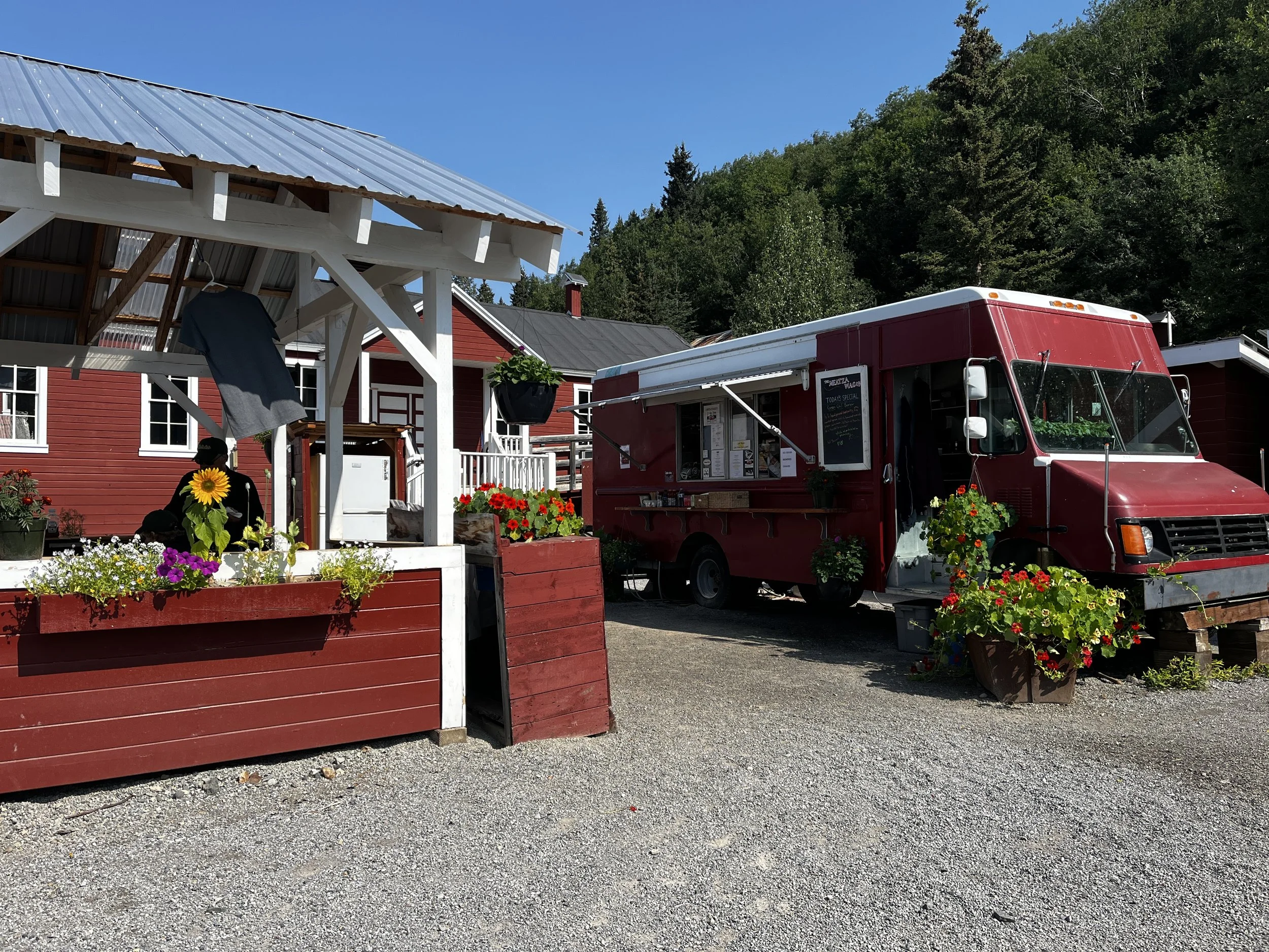
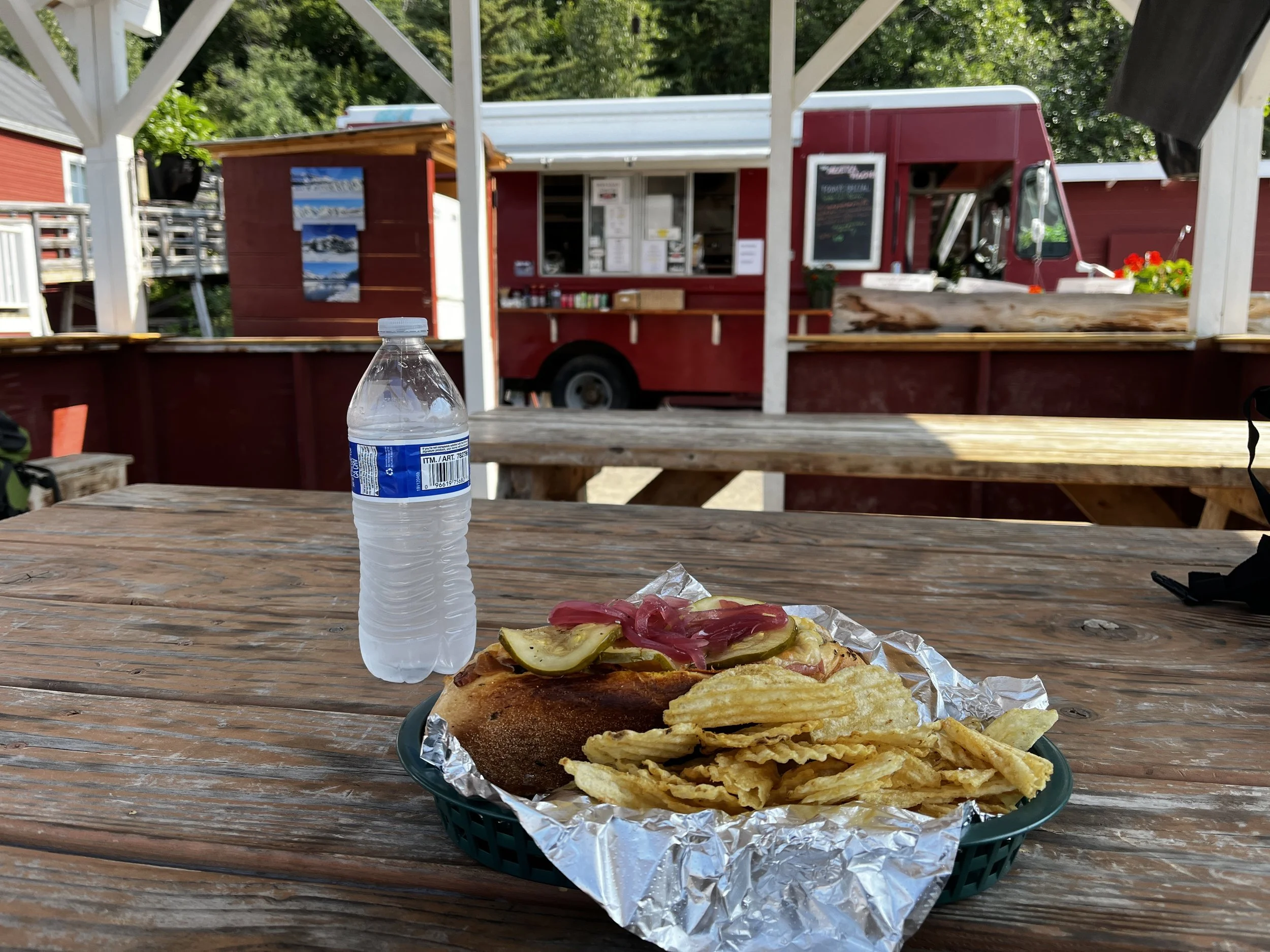
After returning from our journey into the past I was feeling a bit peckish and spotted the “Meatza Wagon” a food truck located behind the mine and had a delicious “3 Little Piggies” sandwich! This bad boy had pork, bacon and prosciutto in it! Oh so good and absolutely hit the spot!
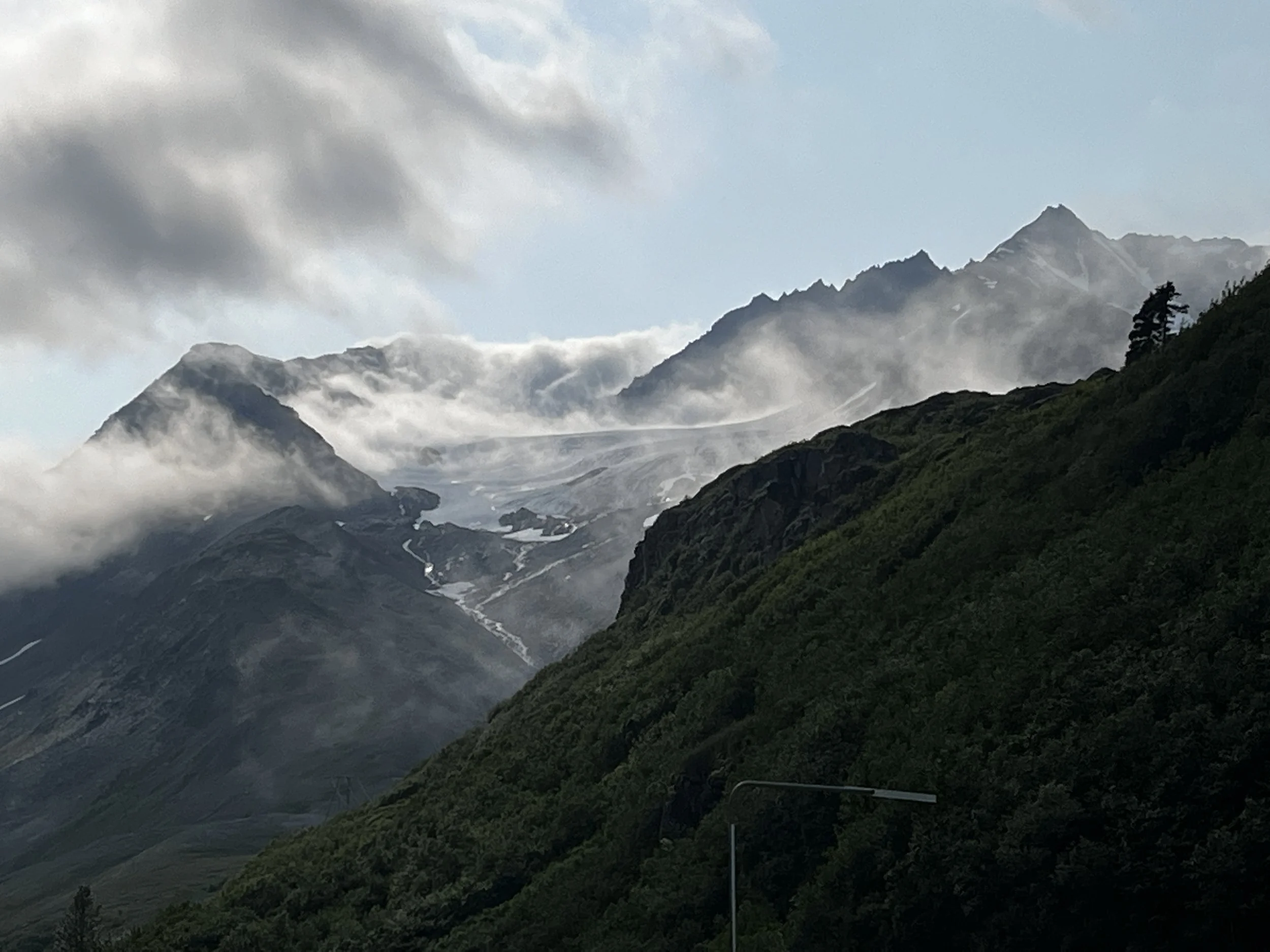
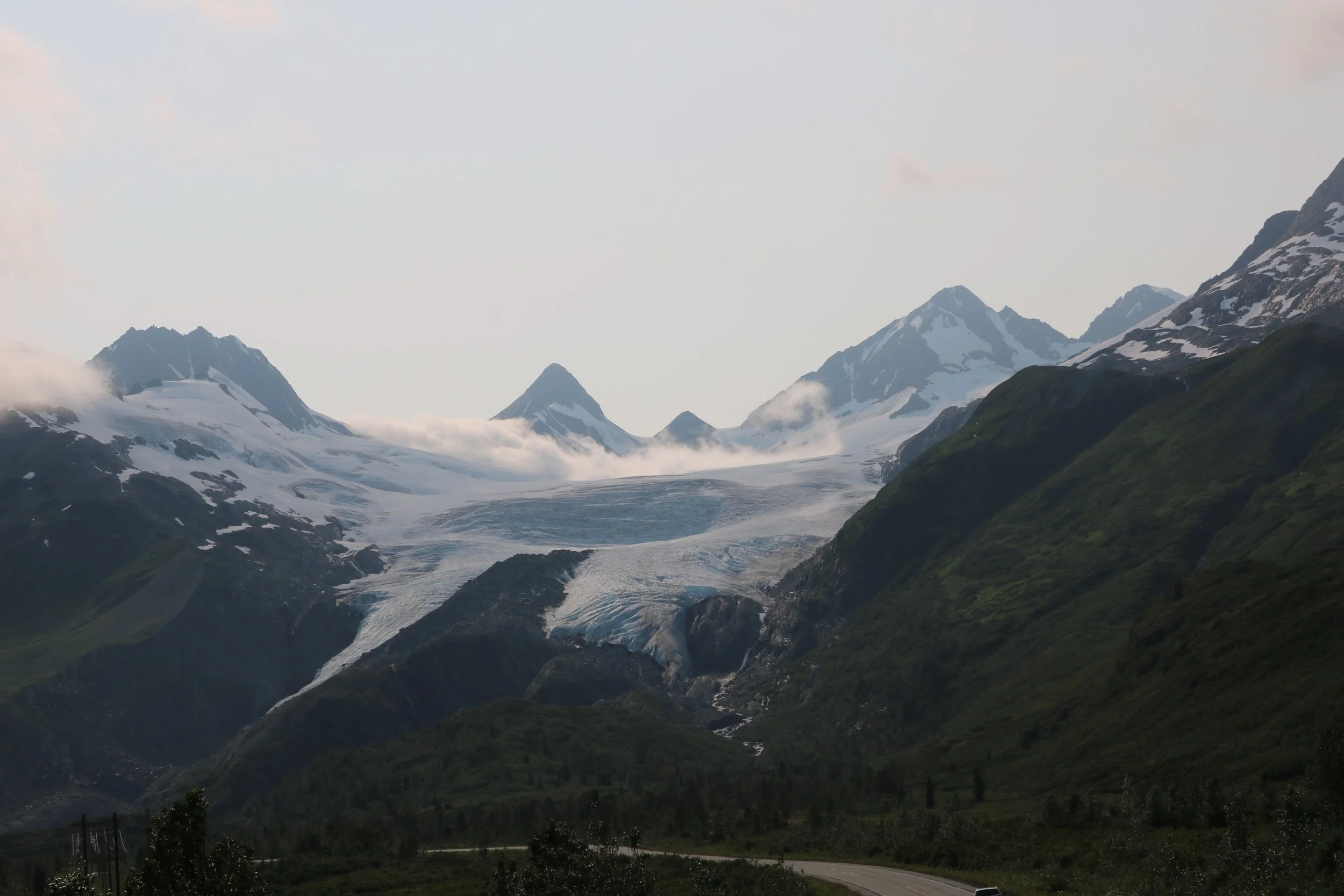
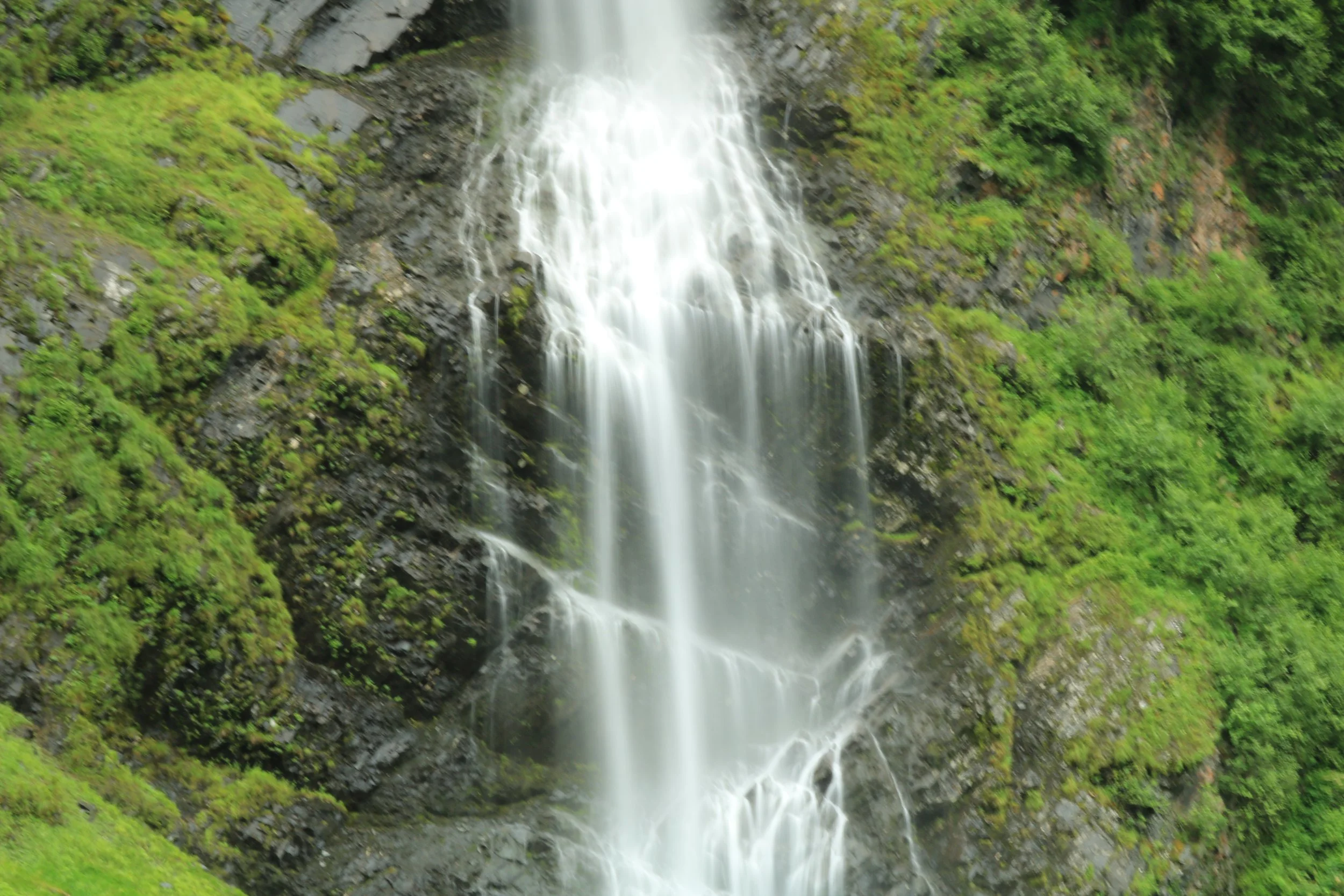
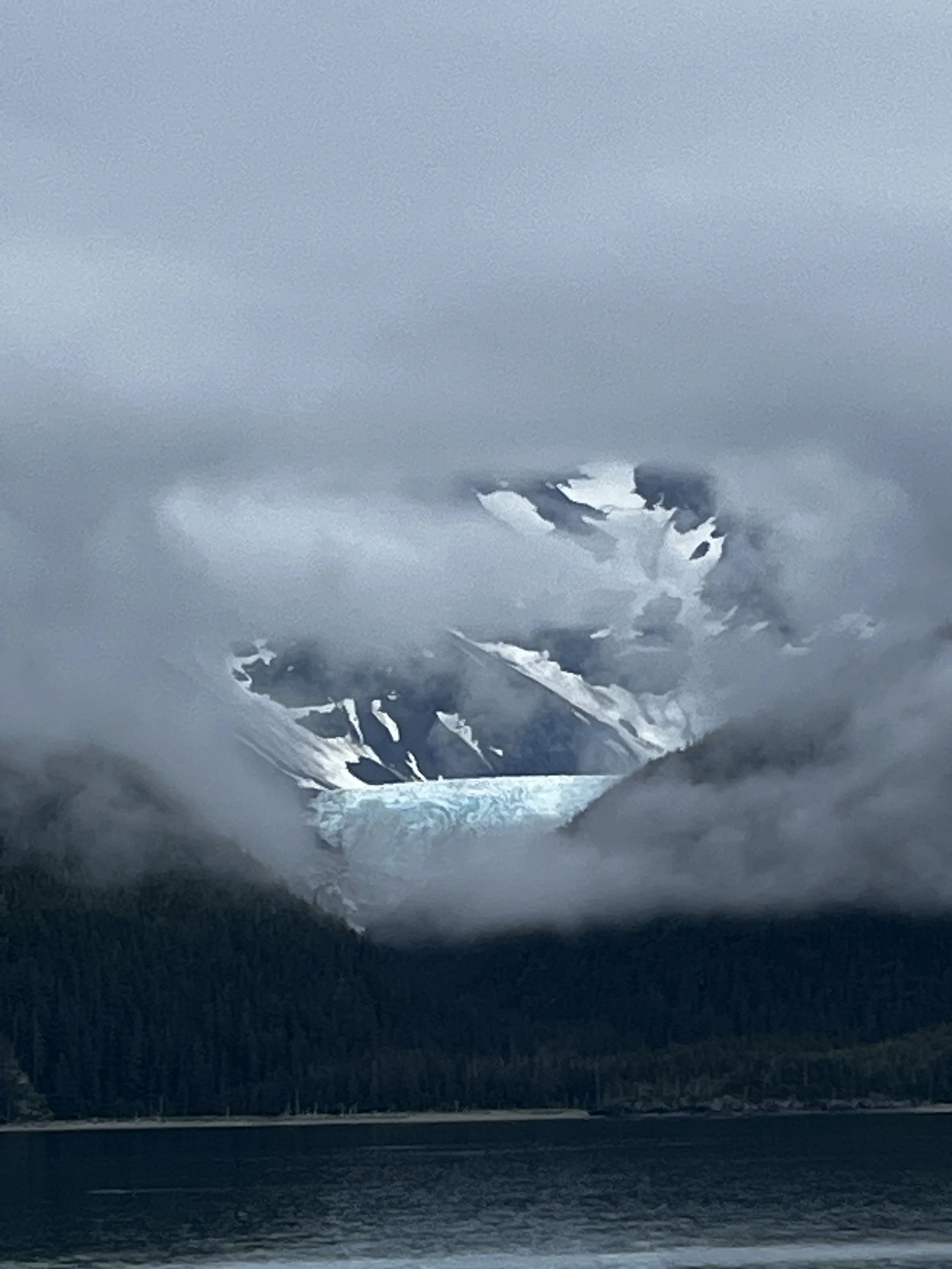
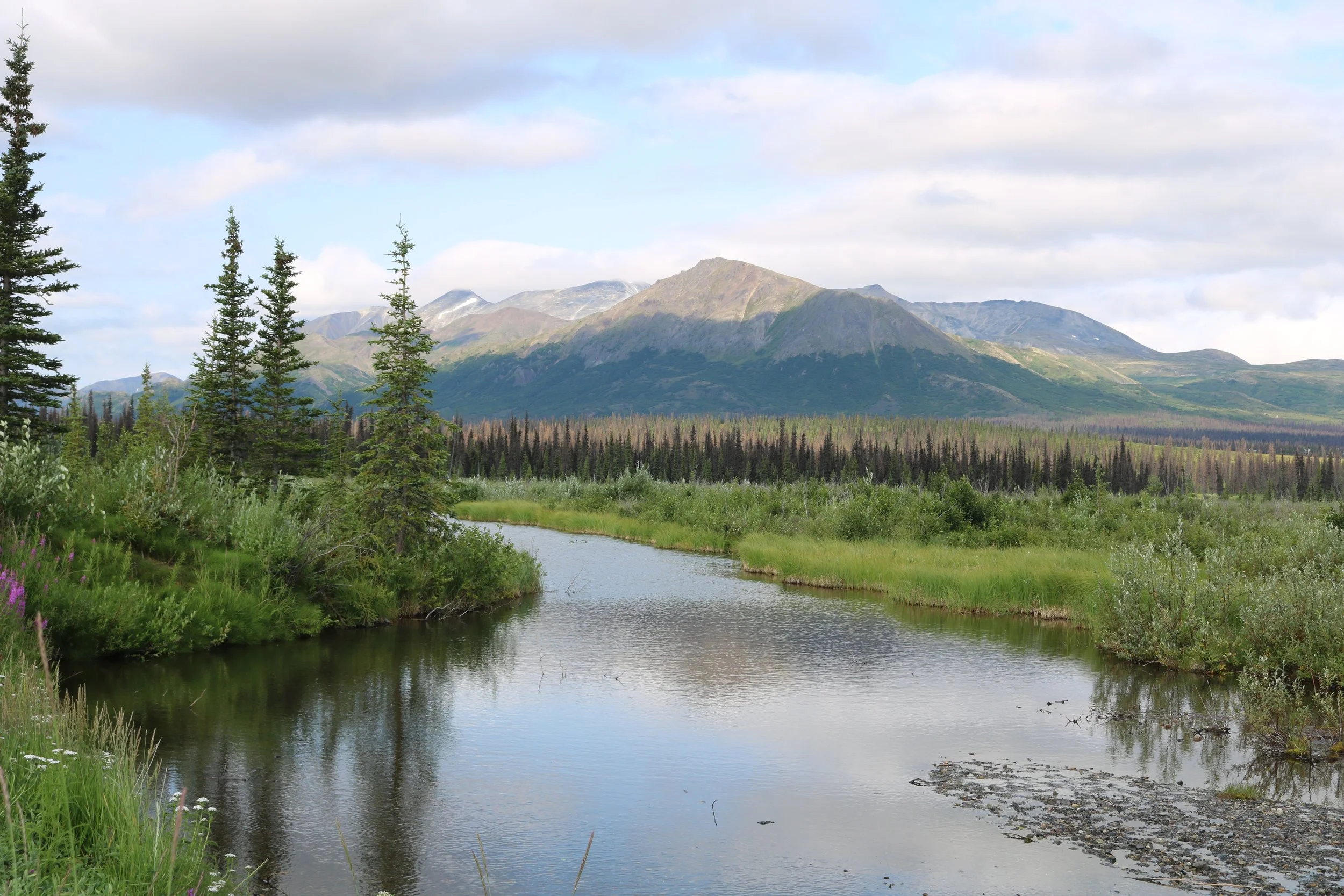
After making our way back to the jeep we began the second part of our trek as we headed towards Valdez. I had a reservation for the ferry to Whittier the next day and wanted to get to Valdez with enough time to be able to explore. The closer we got to Valdez the mountains closed in and seemed to swallow the road. The weather followed suit as the clouds covered some of the higher peaks, even with that the drive down the valley was stunning with huge glaciers and epic waterfalls.

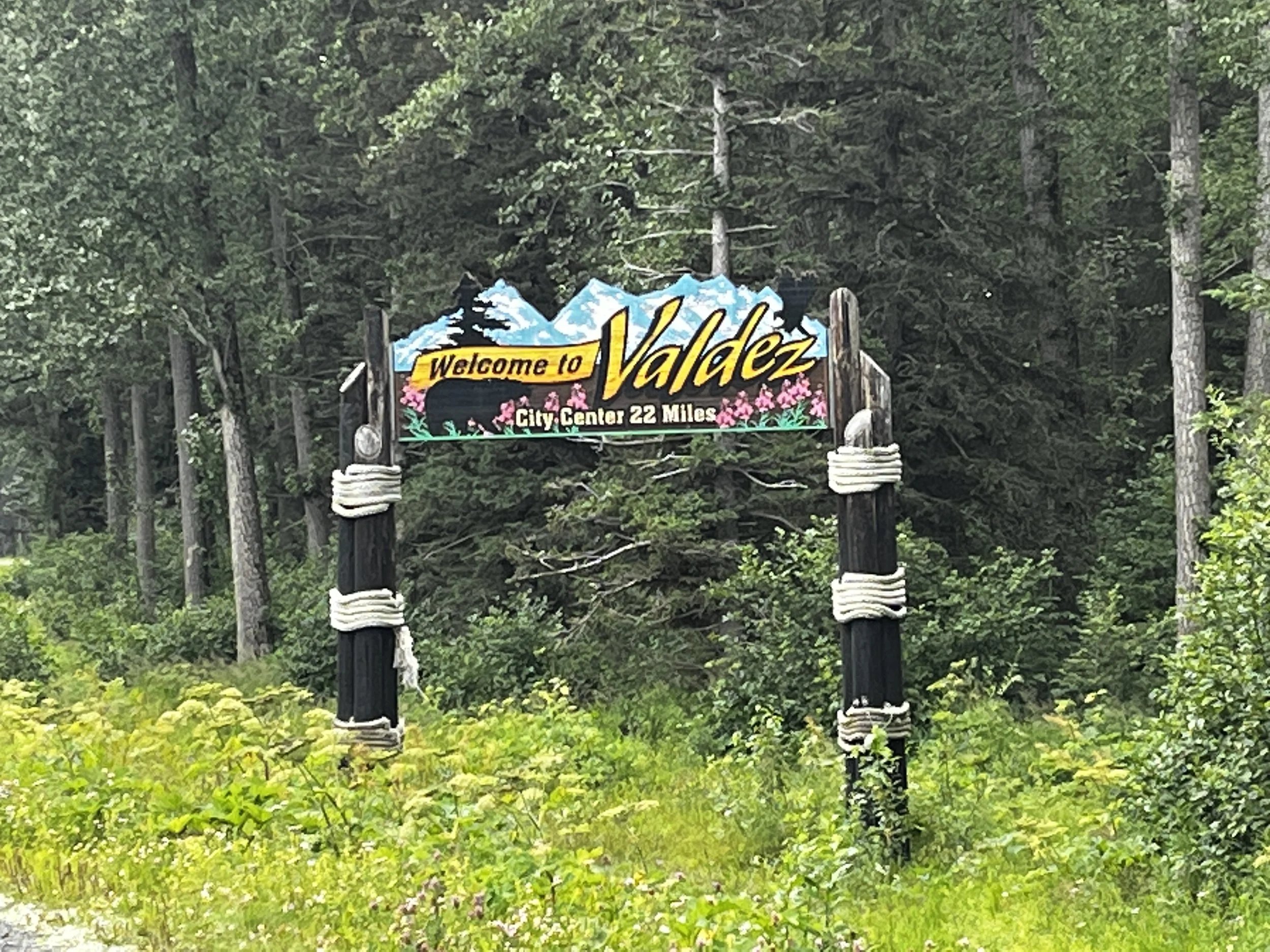
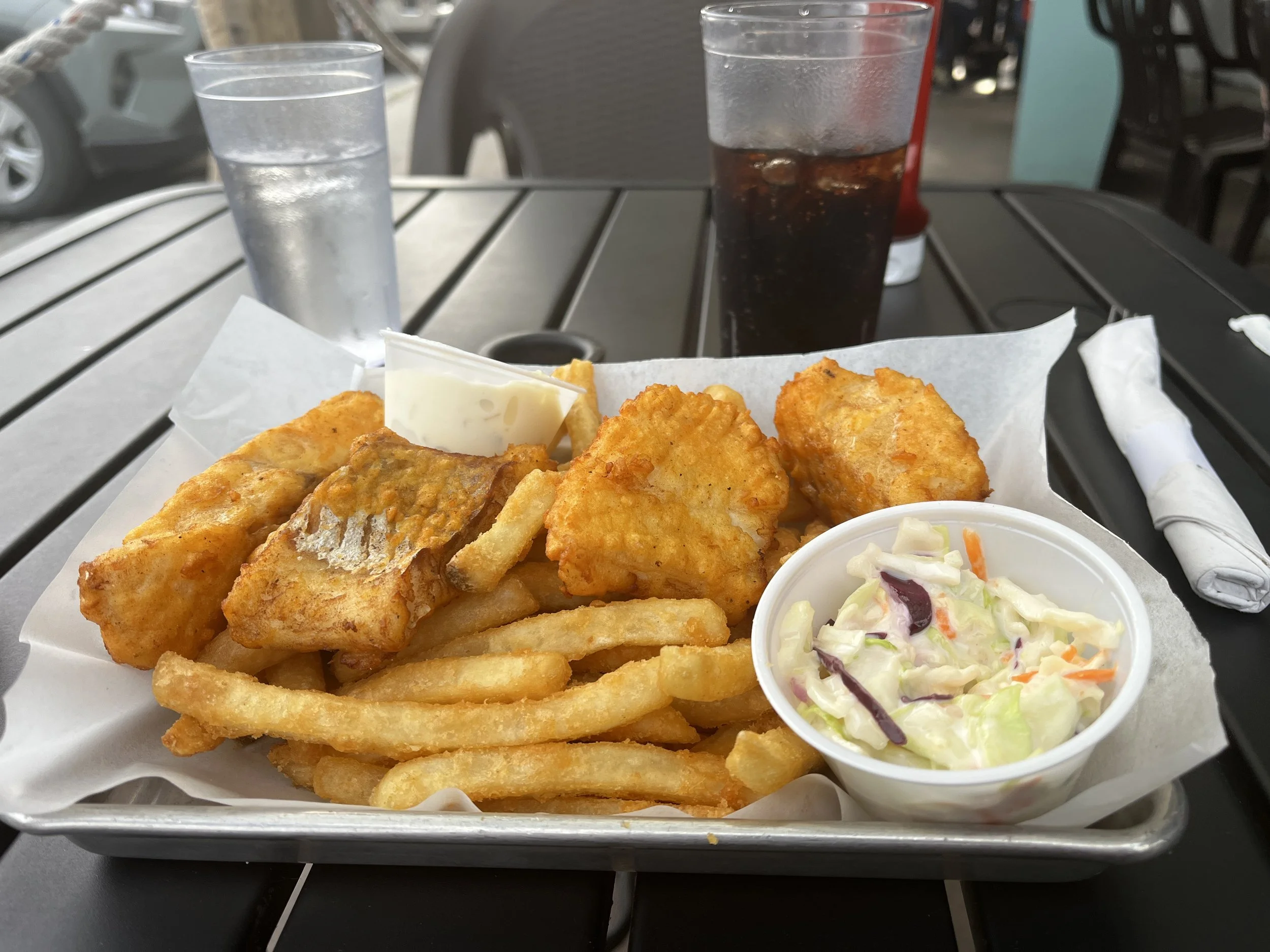
We made it to Valdez and the end of the Richardson Highway around 6 pm and man I was hungry! I found the highly recommended “Fat Mermaid” and had, of course, Fish and Chips. It was as delicious as you would expect and would definitely have it again! Afterward, we did a bit of exploring, we drove to the Valdez Glacier Lake, a beautiful glacial-fed lake with huge chunks of floating ice. Layka and I explored around the shoreline while a family was out paddling their kayaks in amongst the ice. The wakes of their boats rippling in the mirror-like water. We then found an epic campsite on a gravel bar along the Lowe River. Camp setup was quick and so was heading to bed as we had an early ferry to catch.
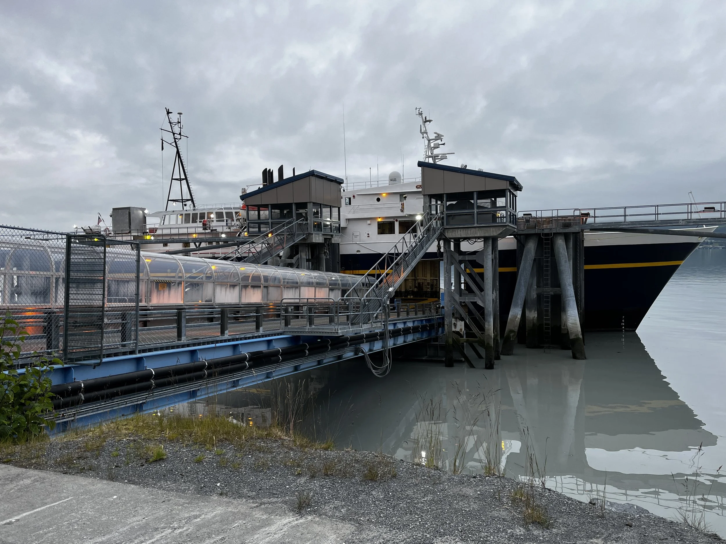
I didn’t have the greatest sleep and morning came fast. You know that feeling when you’re so worried that you’ll miss an early alarm that you can’t sleep that well? That was me! So, at 4 am, I was up and at it. While the water was boiling for coffee, I was packing up the tent, feeding Layka and getting ready to move out. Shortly after that, we were lined up at the terminal for our trip to Whittier.
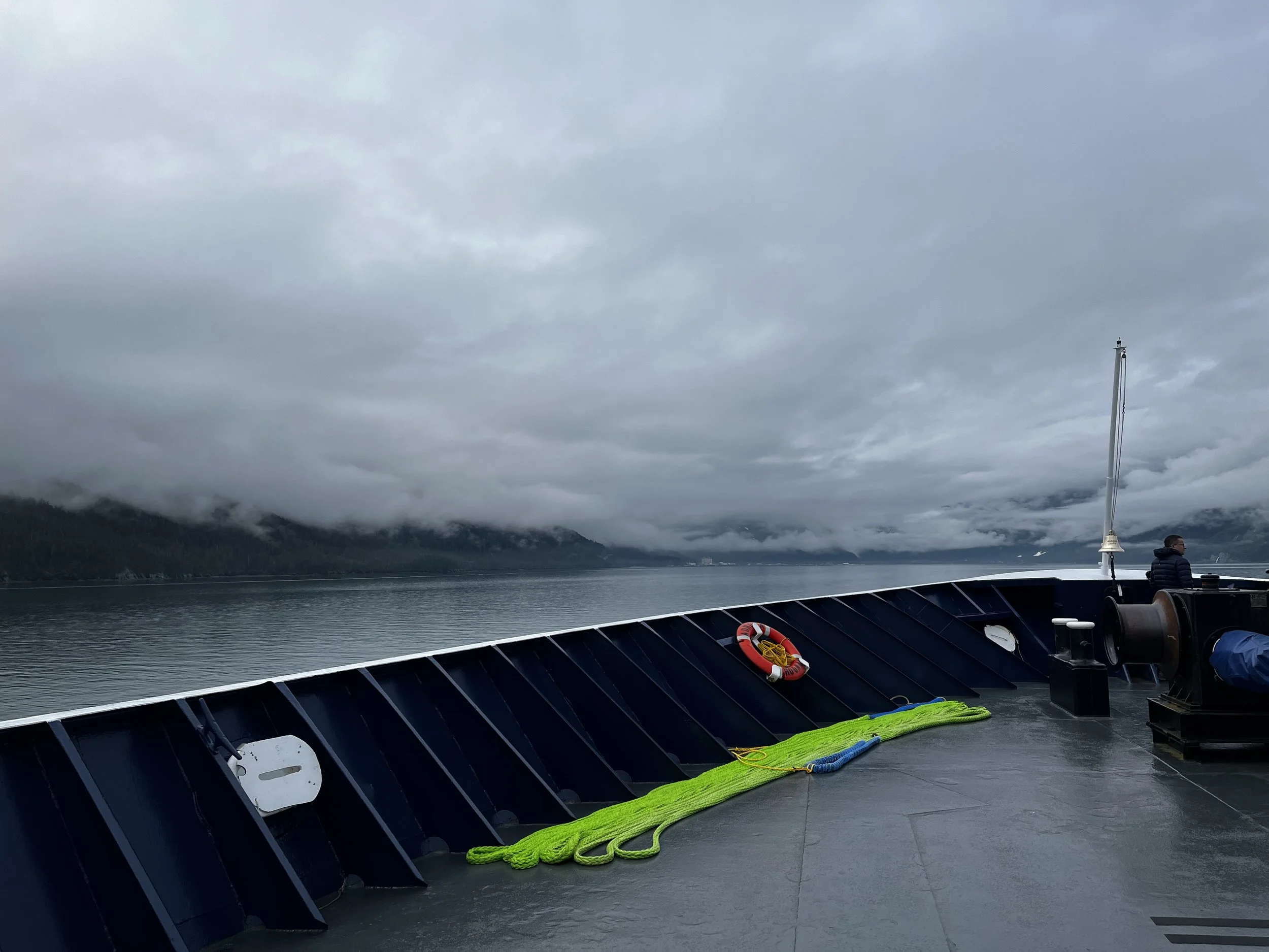
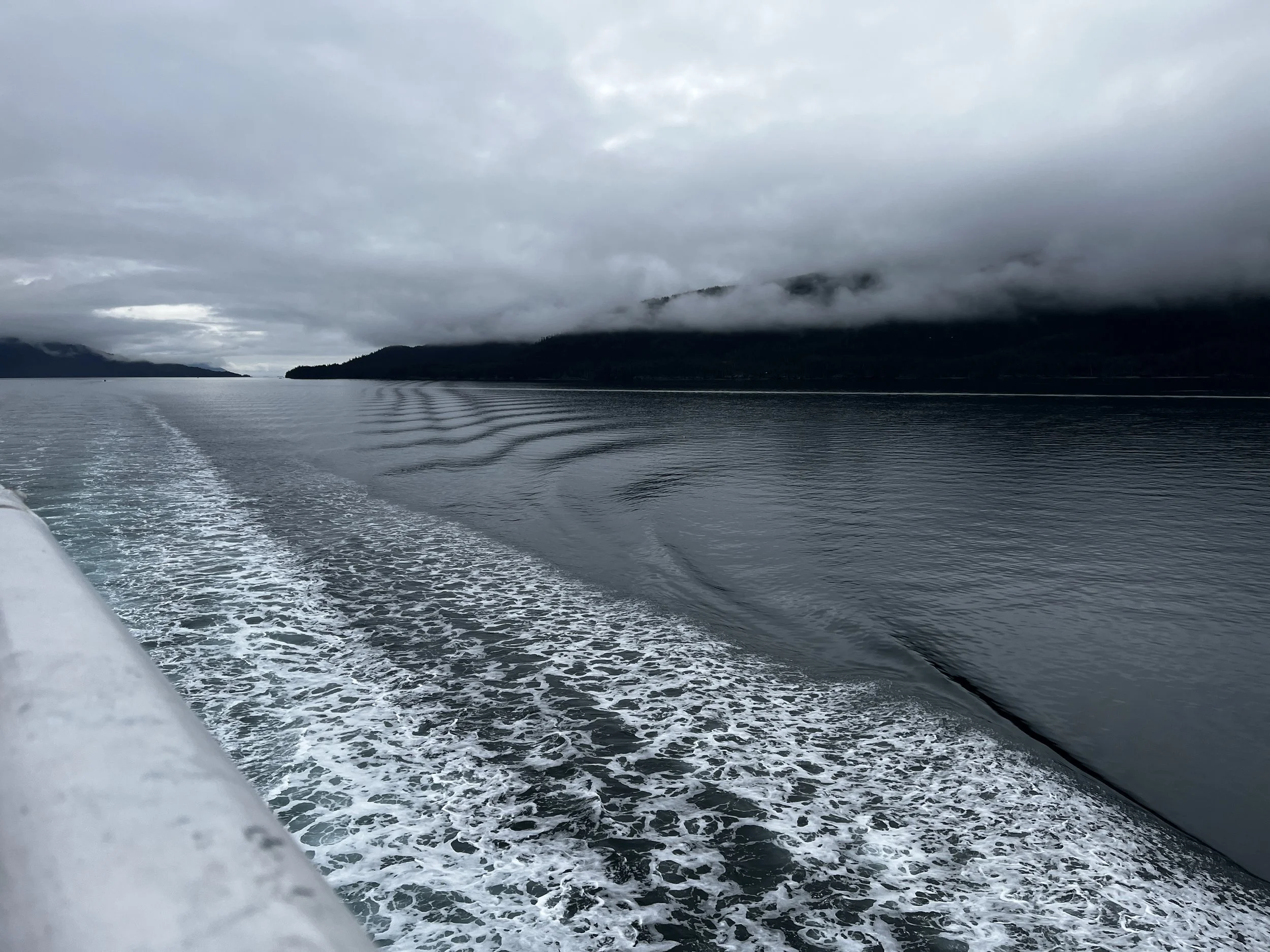
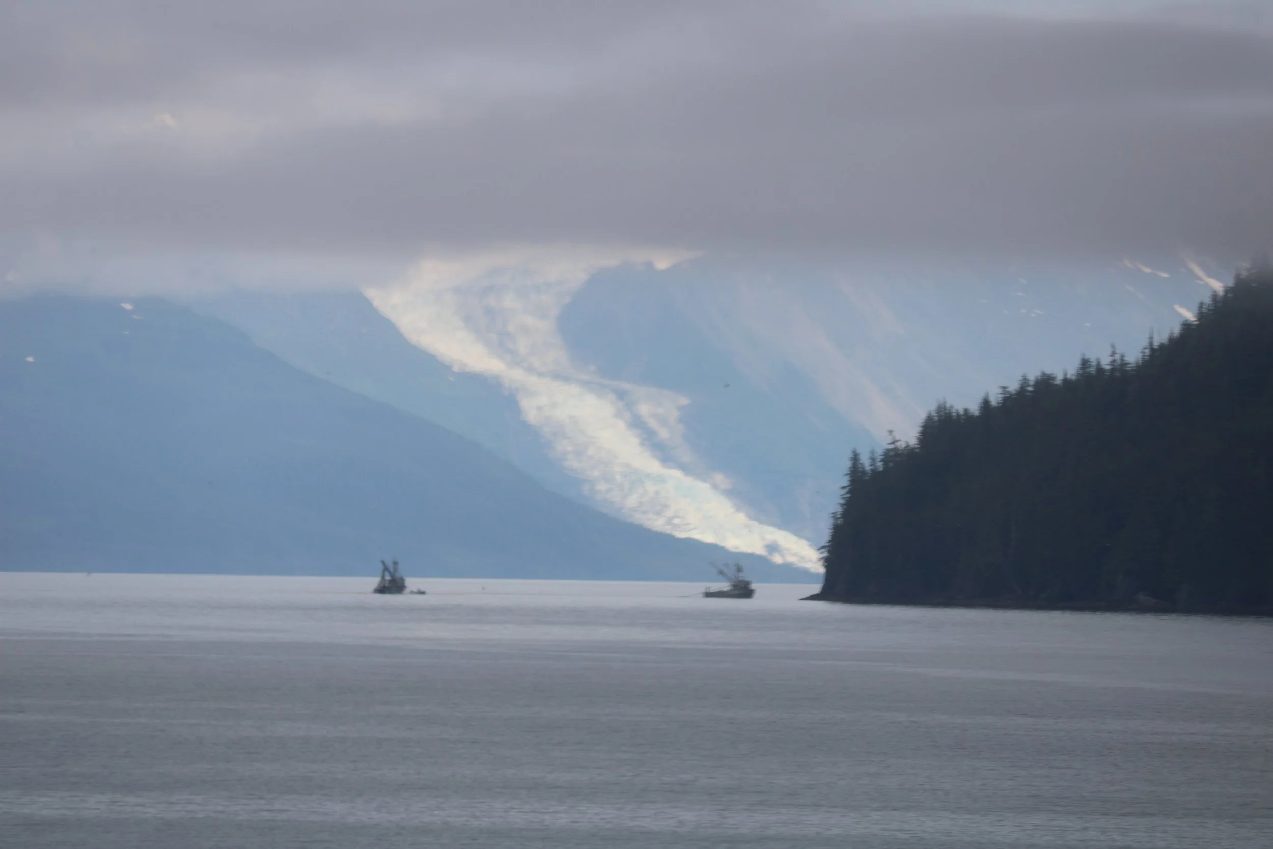
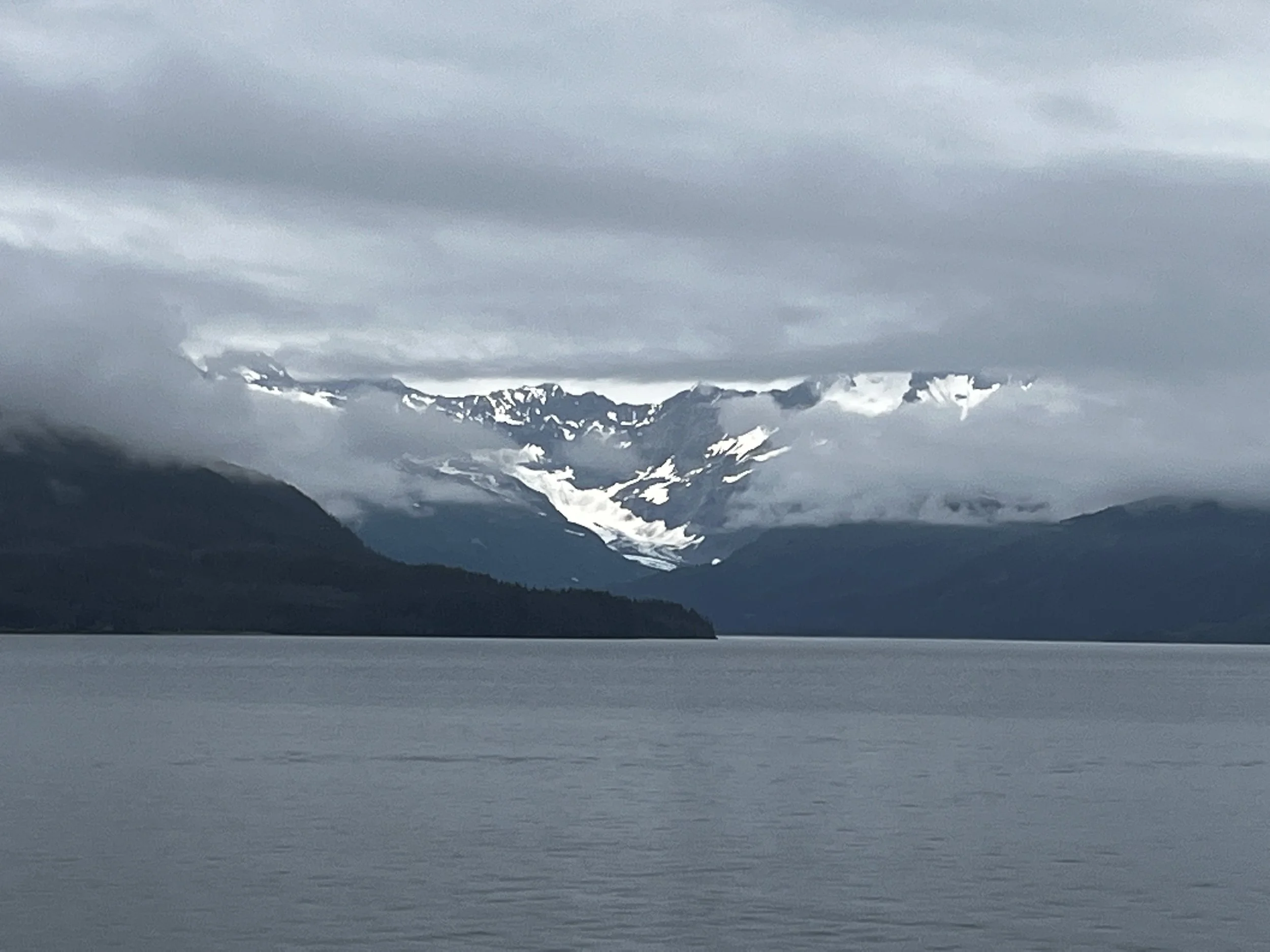
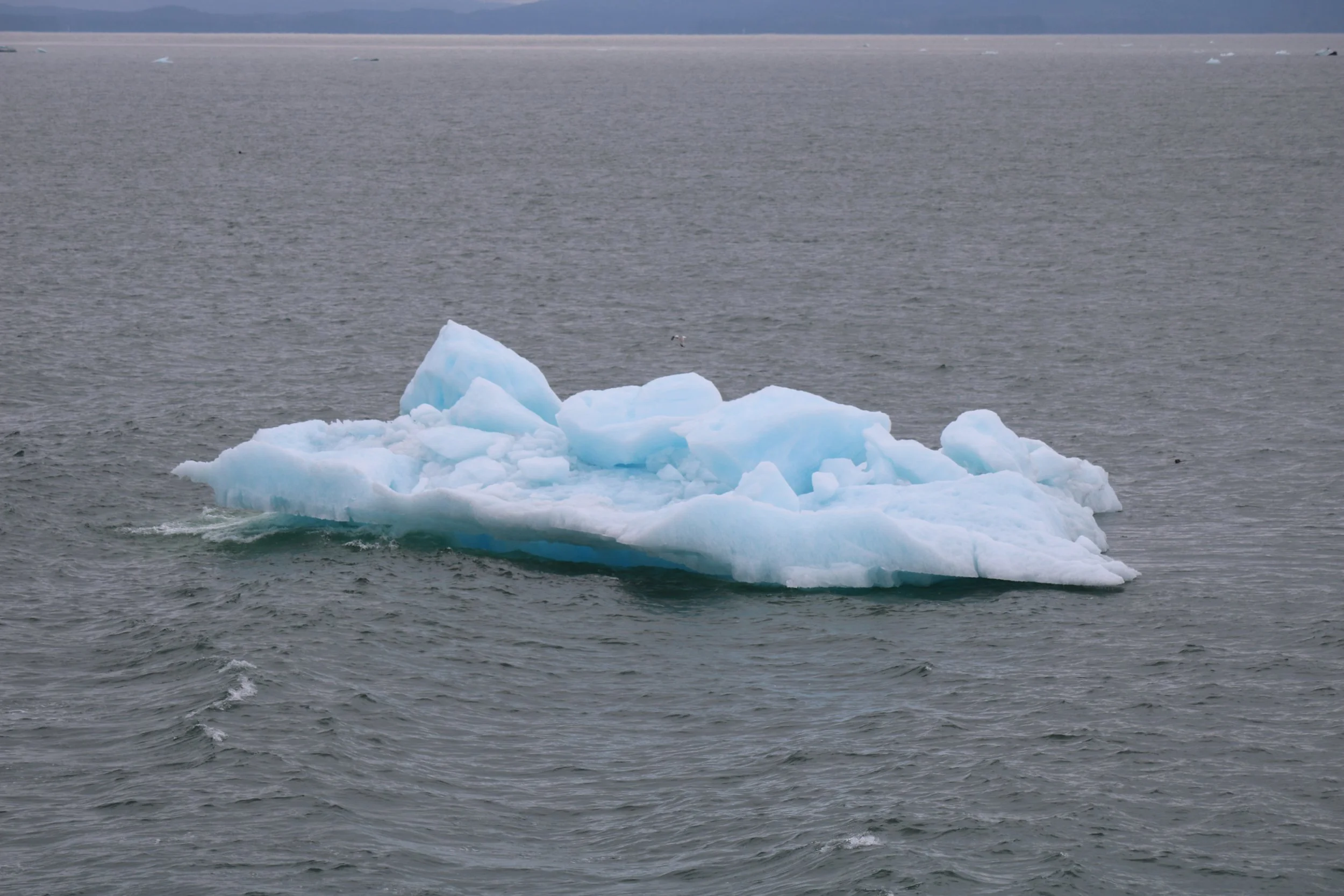
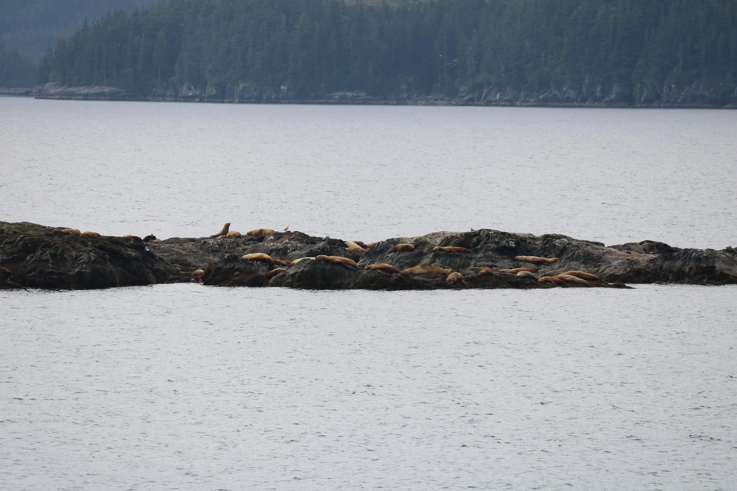
As we left Valdez and headed into Prince William Sound, the cloudy weather from the day before had lingered with low-hanging clouds hiding the mountains from view but making for a very magical feeling along the coast. As we passed by Columbia Bay, we slowly maneuvered through a huge glacial minefield with chunks that had calved off from the massive Columbia Glacier floating randomly into the sound making their way toward the open sea. Thoughts of Titanic ran through my head but quickly were replaced when we started spotting Sea Otters rafting together way out in the open ocean along with Sea Lions all huddled together on an exposed rock. The captain also came over the PA and indicated the location of the spot where the ill-fated Exxon Valdez ran aground in one of the worst environmental disasters the area has ever seen. 11 million gallons of oil were spilled back in 1986. It’s amazing to see how Mother Nature has managed to heal herself after such a disaster.
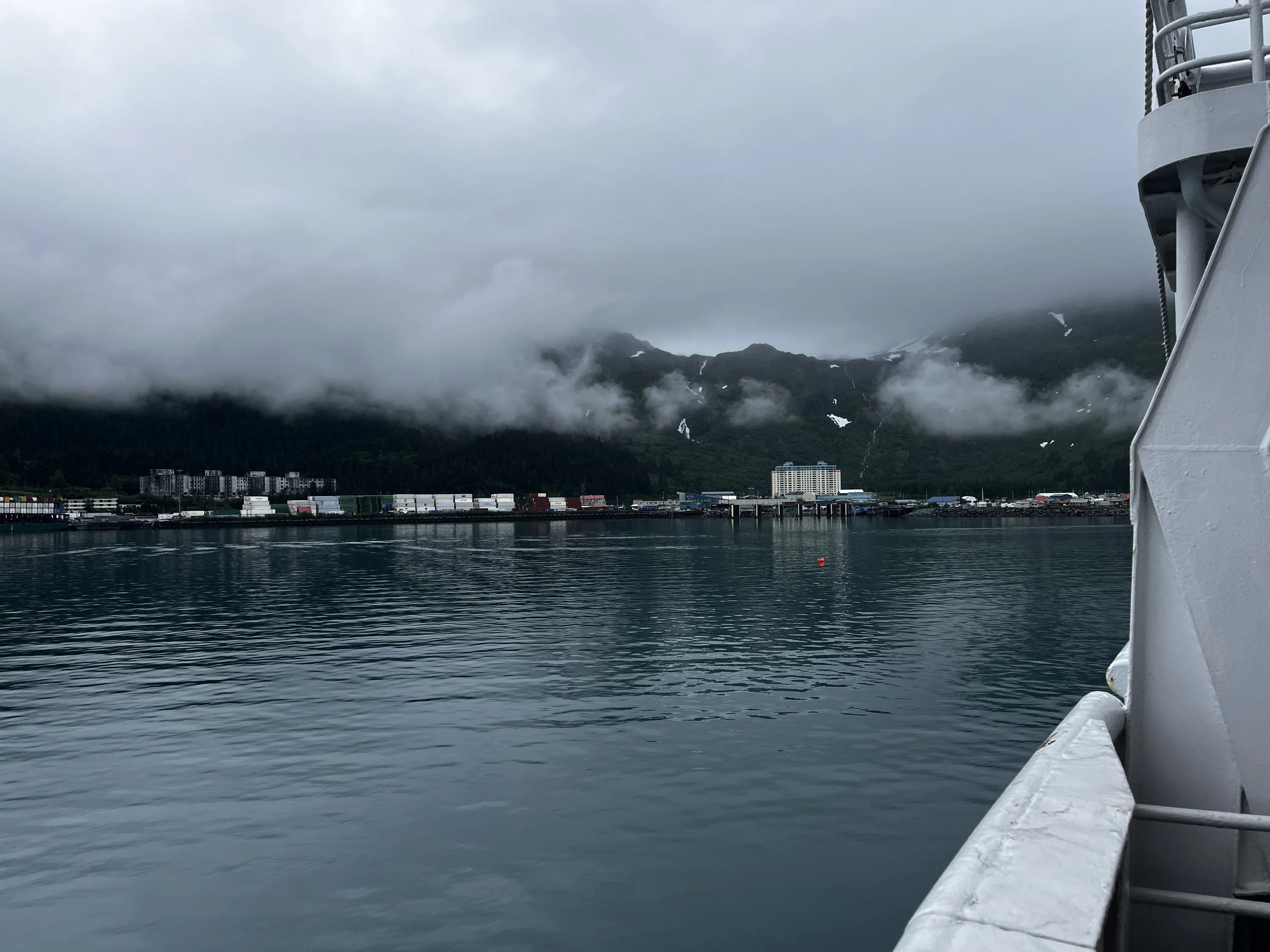
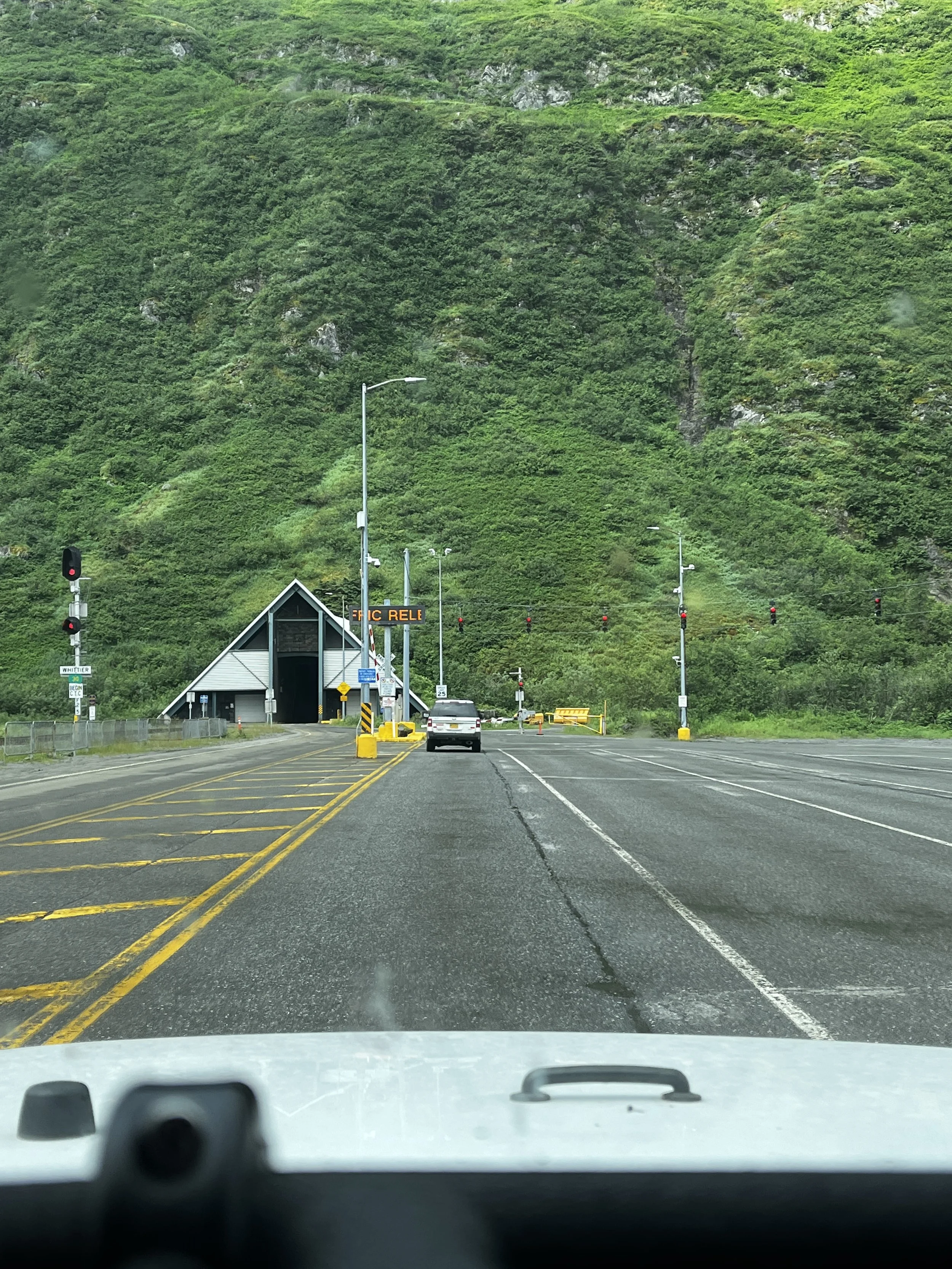
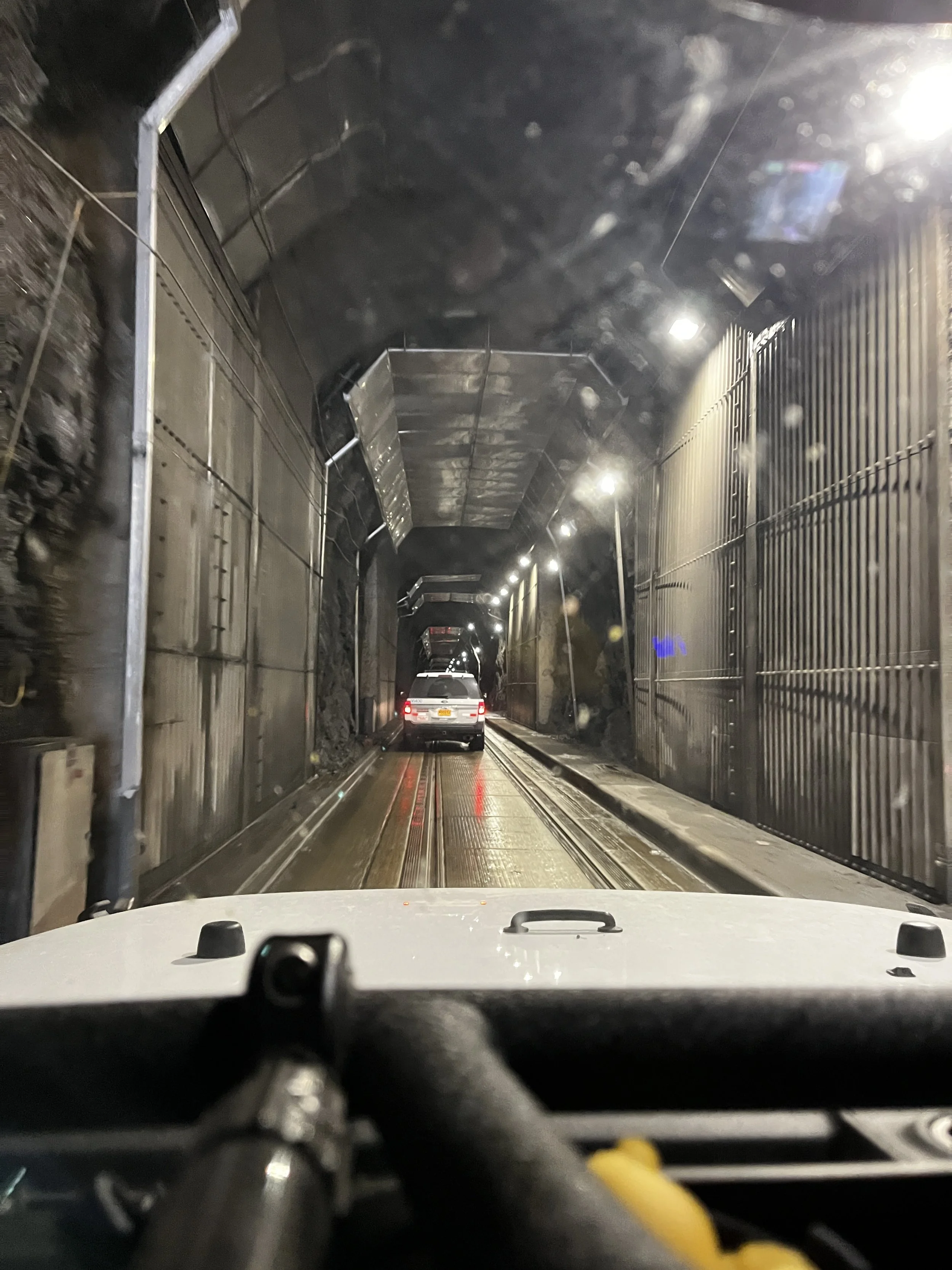
Soon we arrived in Whittier, a unique little port town where the majority of its 200 year-round residents live in the only apartment building in town. The 14-story “BTI” apartment building not only houses the residents but is also home to the town’s school, hospital and city government offices. The town is connected to the rest of Alaska by the longest combined rail and highway tunnel in North America. The 4 km long converted WW2 tunnel is a single rail track and single lane vehicle track. There is a 20-minute or so rotation of vehicles going north and south and while we were waiting a train made the journey north through the tunnel as well. A very unique Alaskan experience for sure!
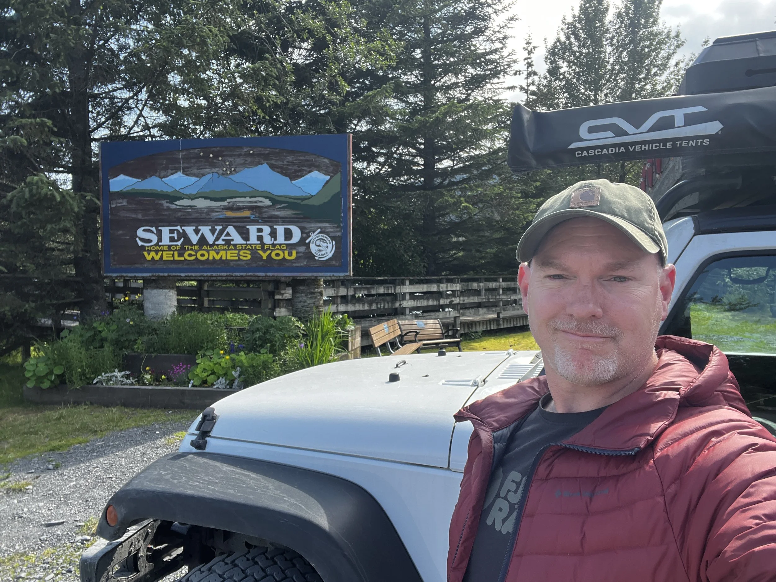
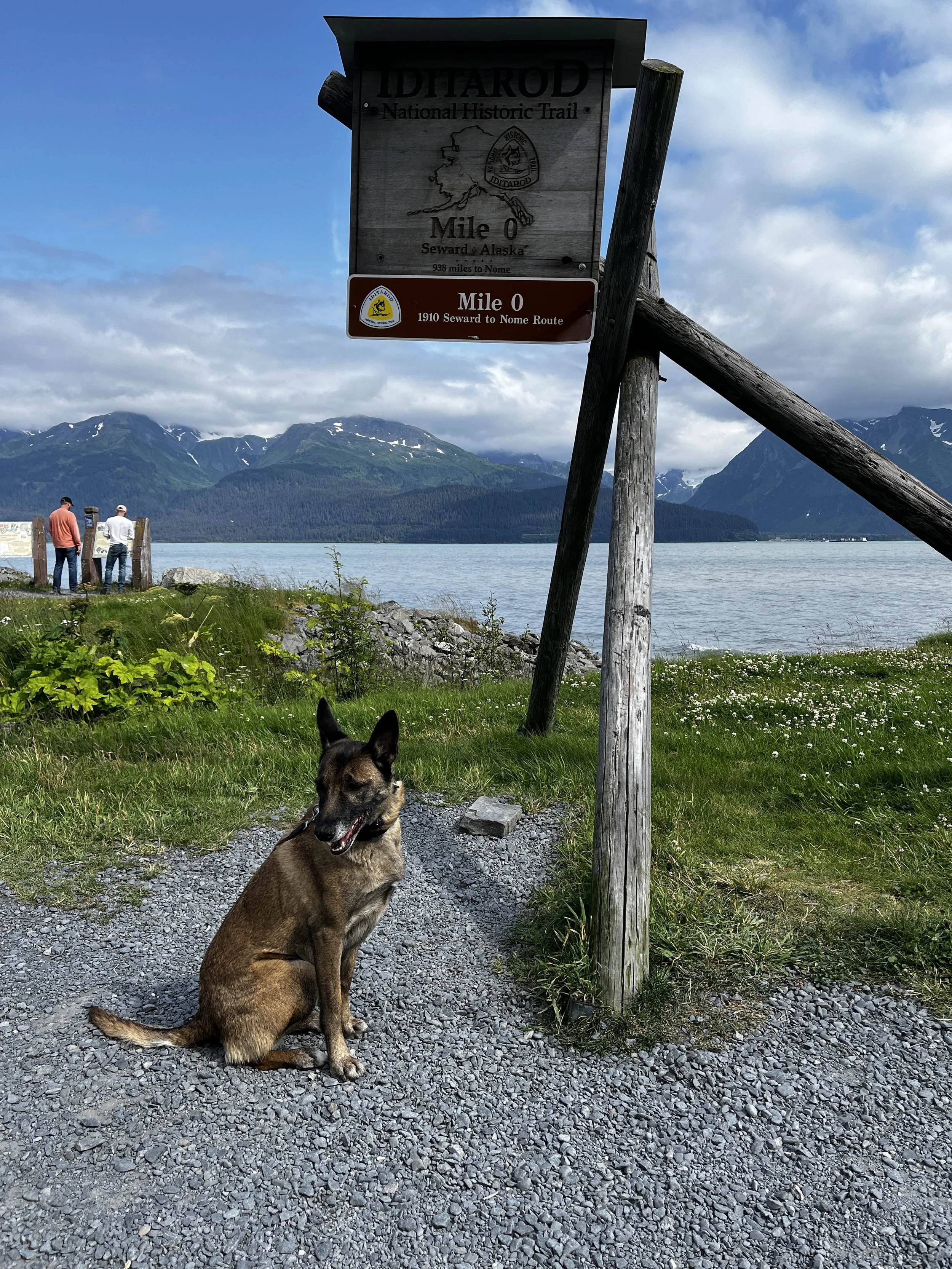
Shortly after exiting the tunnel, we turned west toward the Kenai Peninsula, Our destination for today is the quaint seaside town of Seward. The approach to Seward was very picturesque, the road winded its way between mountains as it slowly descended toward the sea. A classic Alaskan adventure is the Iditarod, a sled dog race that covers over 1100 miles. The traditional start follows the old dogsled mail route with Mile 0 being located in Seward. We located the Mile 0 marker near a seaside park and look for the selfie that I took of Layka below.

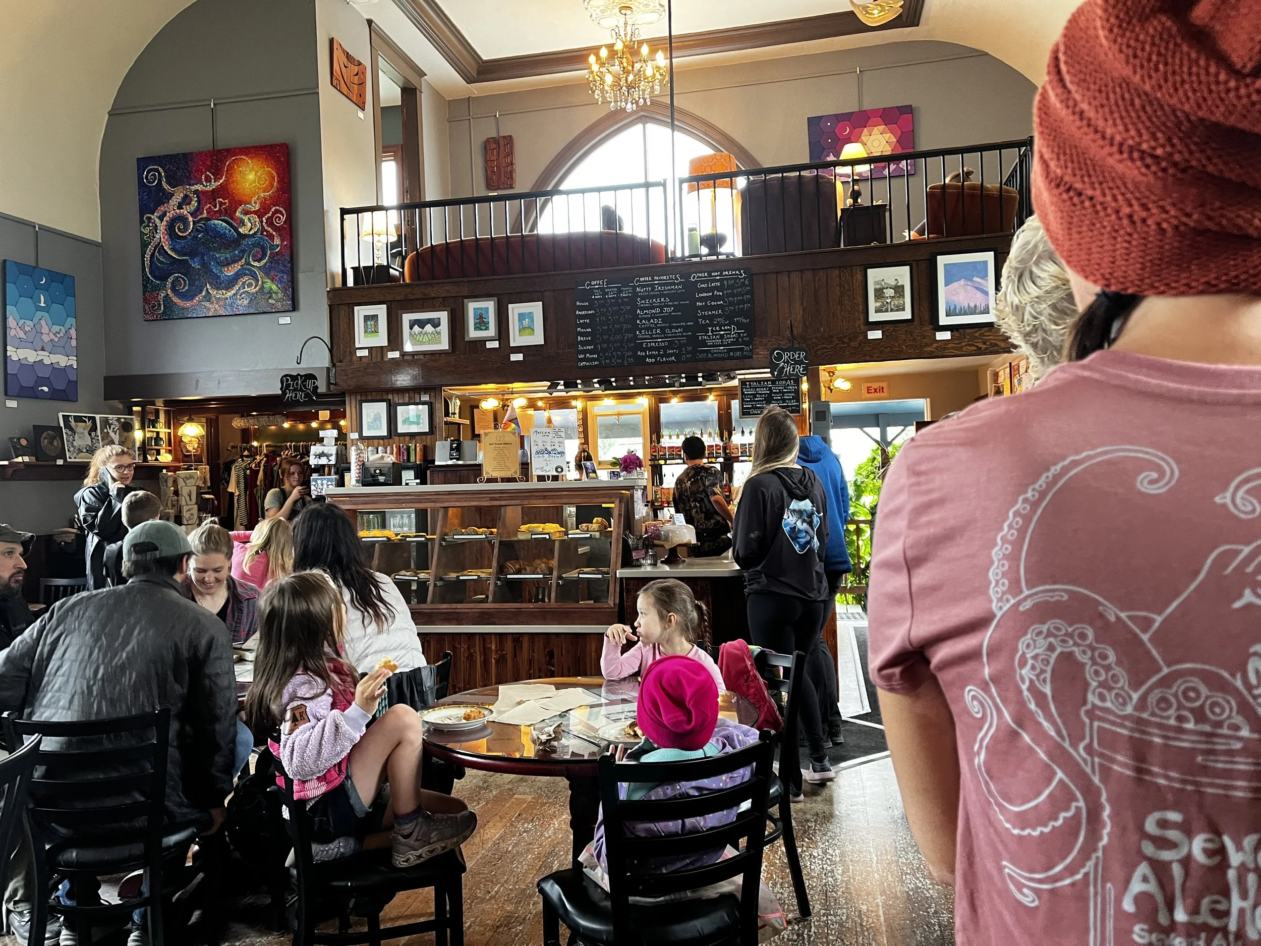
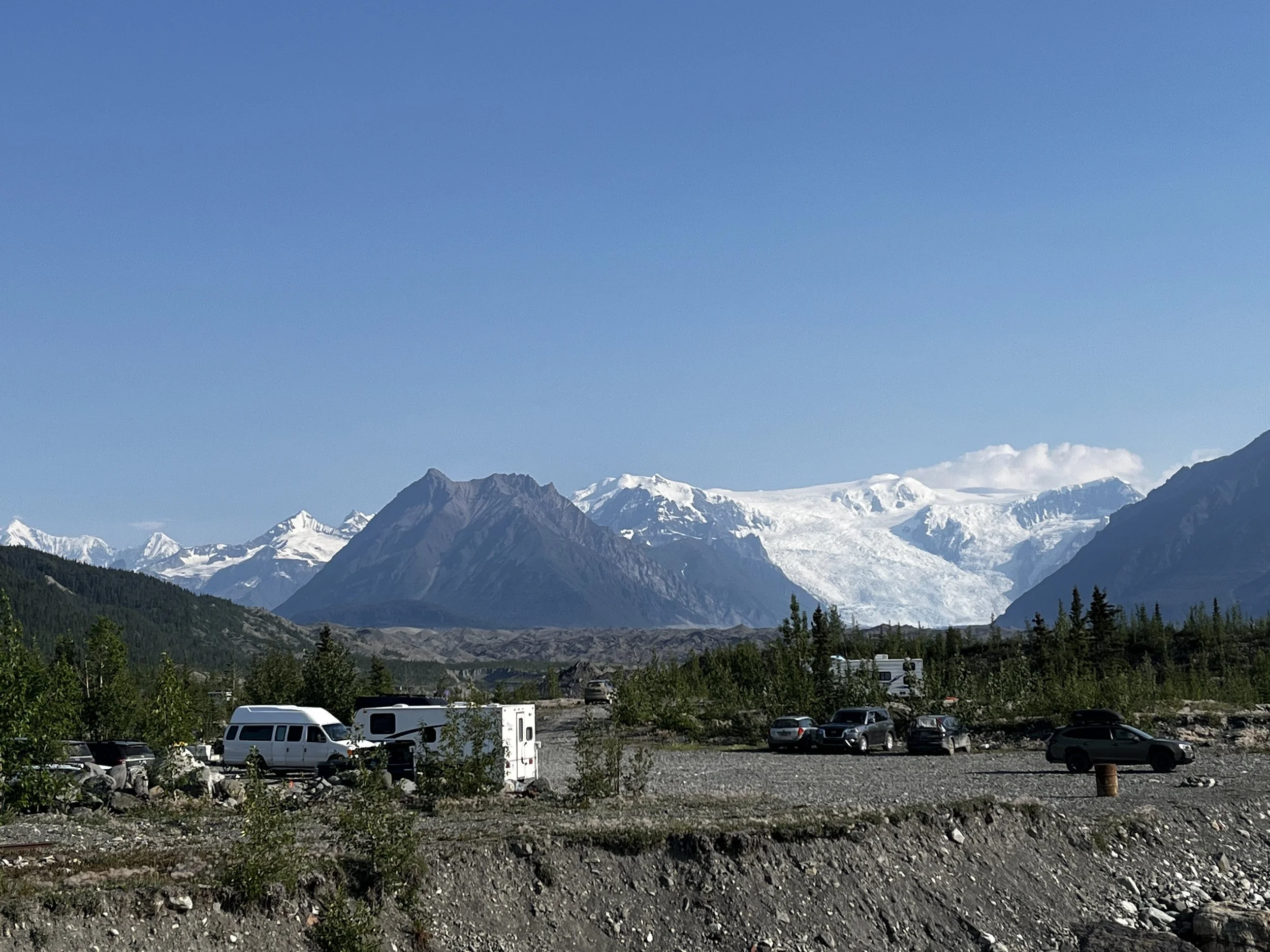
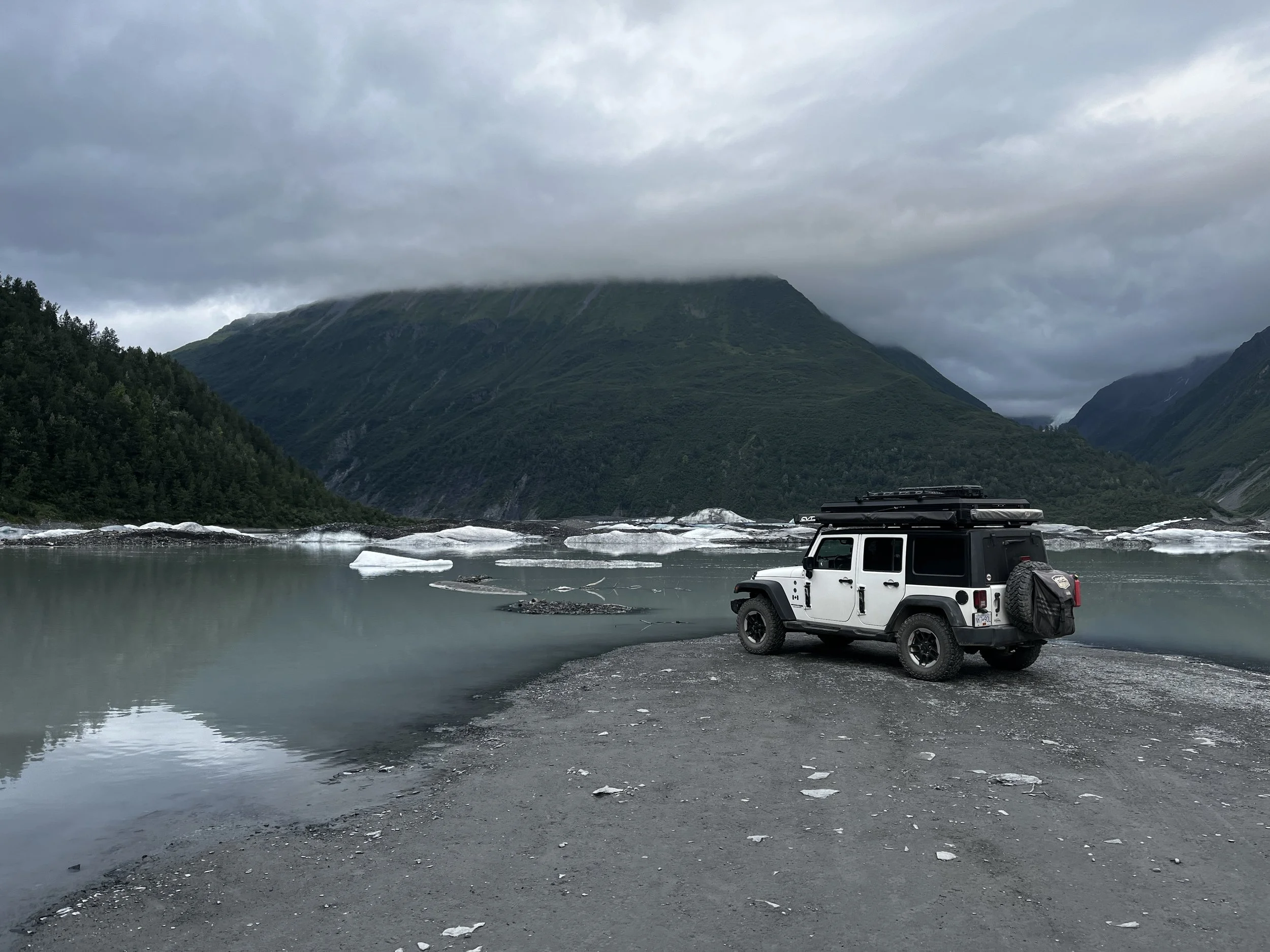
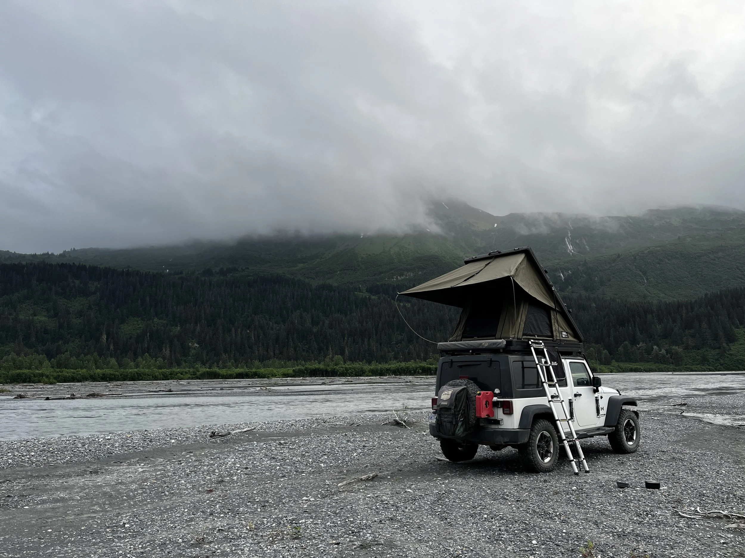
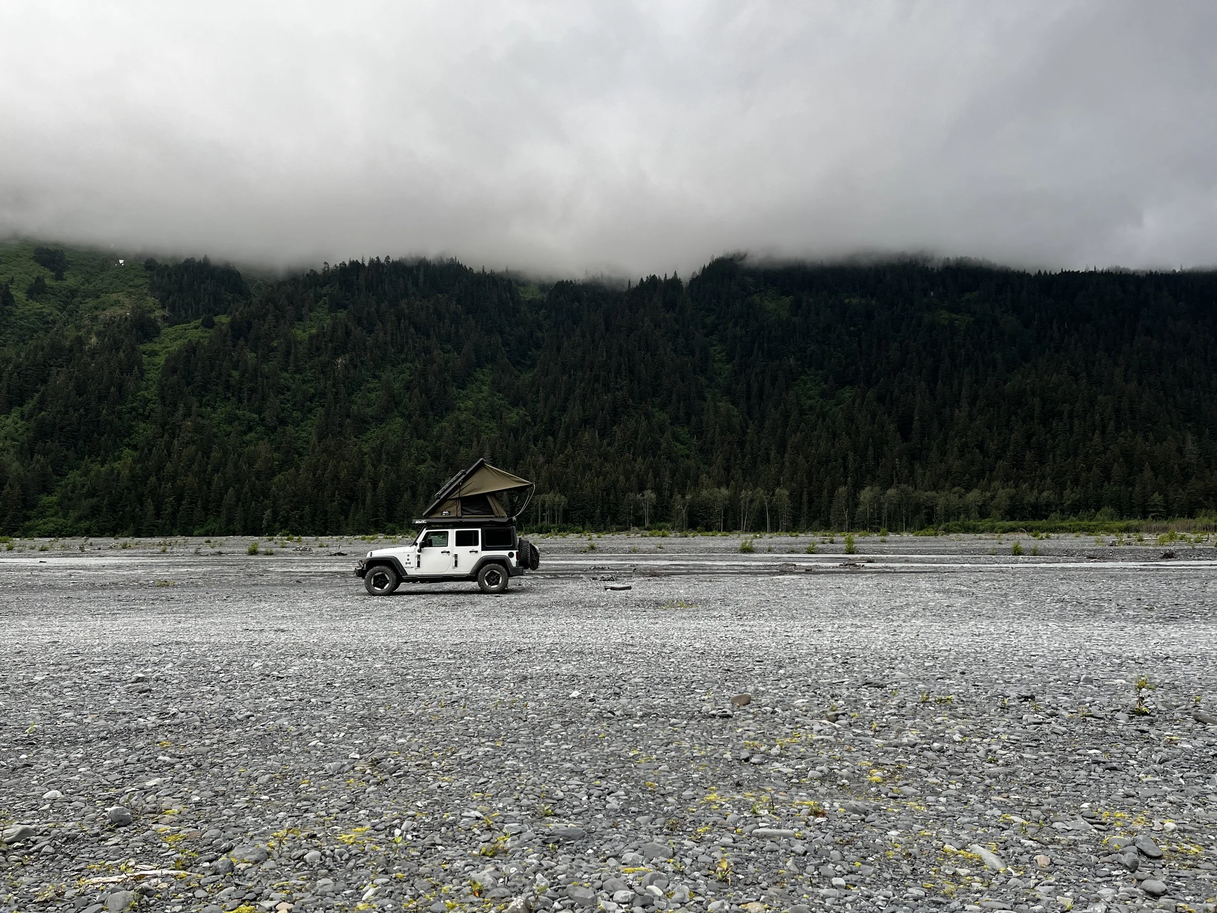
We continued exploring the town and found the very cool Resurrect Art Coffee shop. A repurposed church that now displays various works by local artists that you can admire while you enjoy delicious coffee and numerous baked goods. If you make it to Seward, definitely make the stop and try for yourself. After a quick sampling, I refuelled the Jeep and picked up a few groceries before we headed off to find an amazing campsite on a massive gravel bar along the Resurrection River, a truly stunning location at the footsteps of the Exit Glacier. As I maneuvered the Jeep onto the gravel bar there were many rigs of various shapes and origins, but this place is so vast that it was easy to find our own place to settle down for the night.


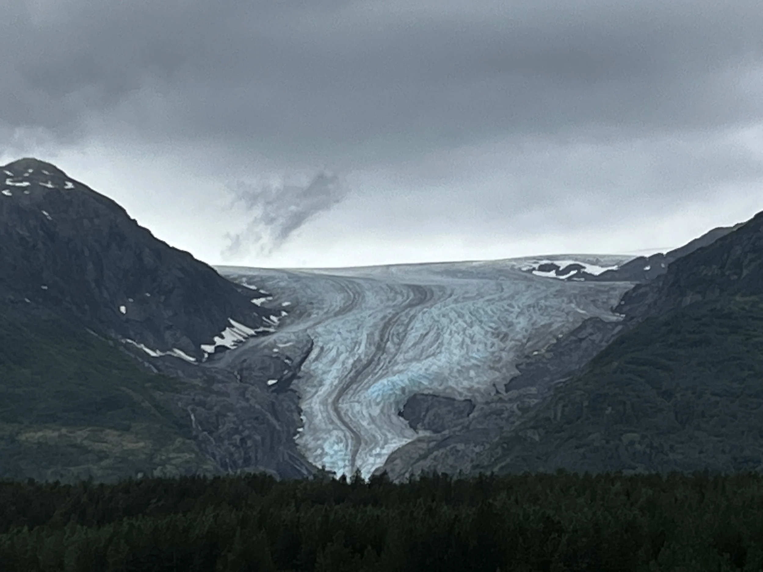
The next morning, we awoke to low-hanging clouds which blanketed the high mountain peaks that towered above us the day before. The temperature was pleasant, and I only needed a light jacket while I enjoyed my morning coffee and an omelet. I packed up camp and headed towards the Exit Glacier, I was hoping to take a short hike up as I heard that you could actually walk on the glacier, but as I approached the entrance to the trail there was a very distinct “No Pets Allowed” sign. As I didn’t want to leave Layka for too long alone in the Jeep, I decided to just work our way back to the roadside lookout that we passed on the way in and snap some pictures of the glacier from there. I decided to turn the disappointment of not being able to go for a hike into a positive by heading back to the Resurrect Art Coffee shop as a good cup of coffee fixes everything right!
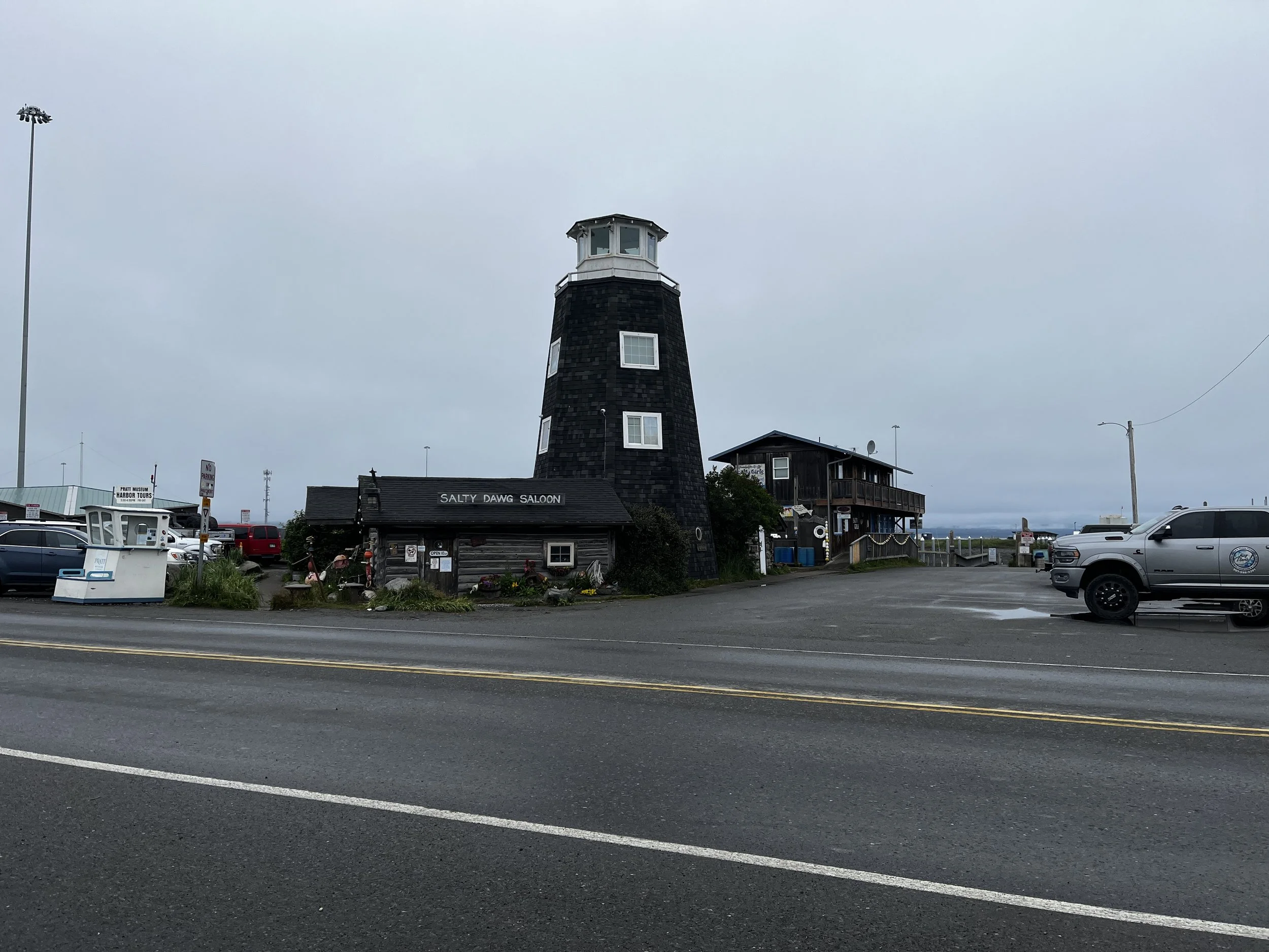
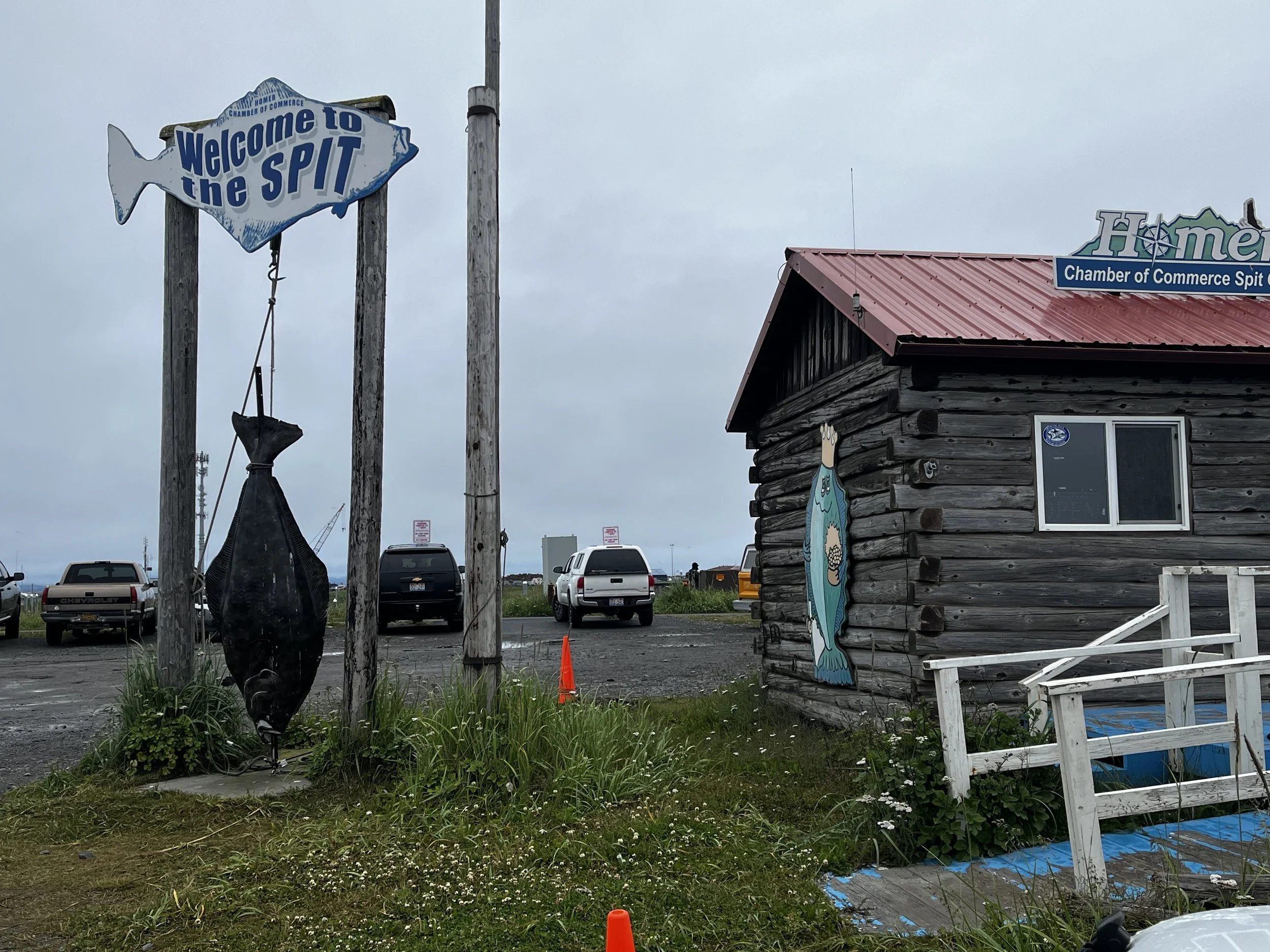
After grabbing a coffee and a couple of road cookies we were on the road to explore more of the Kenai Peninsula, today’s destination being the quaint seaside town of Homer. The trip there was nice but with the low-hanging clouds, the snow-capped peaks of the area were concealed from view and by the time we approached Homer, rain had started to fall. One of the main attractions to Homer is the famous Homer Spit, a 7.2 km (4.5 mile) bar of terminal moraine that juts out from the mainland into Kachemak Bay and is the second longest spit in the world.
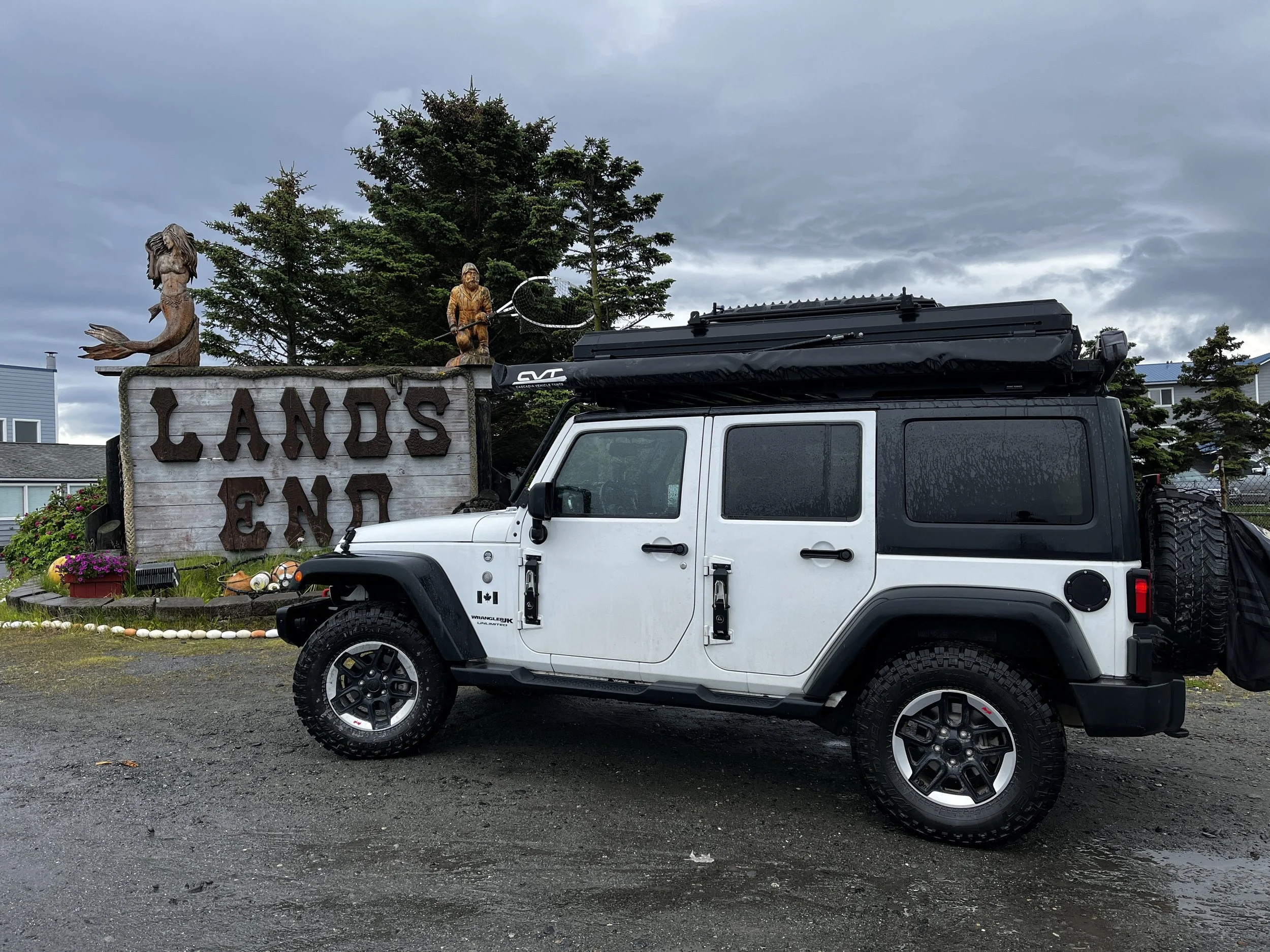
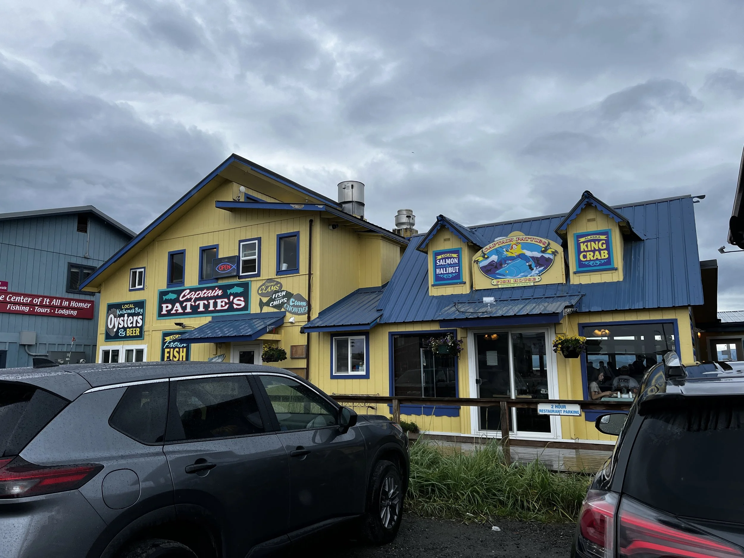
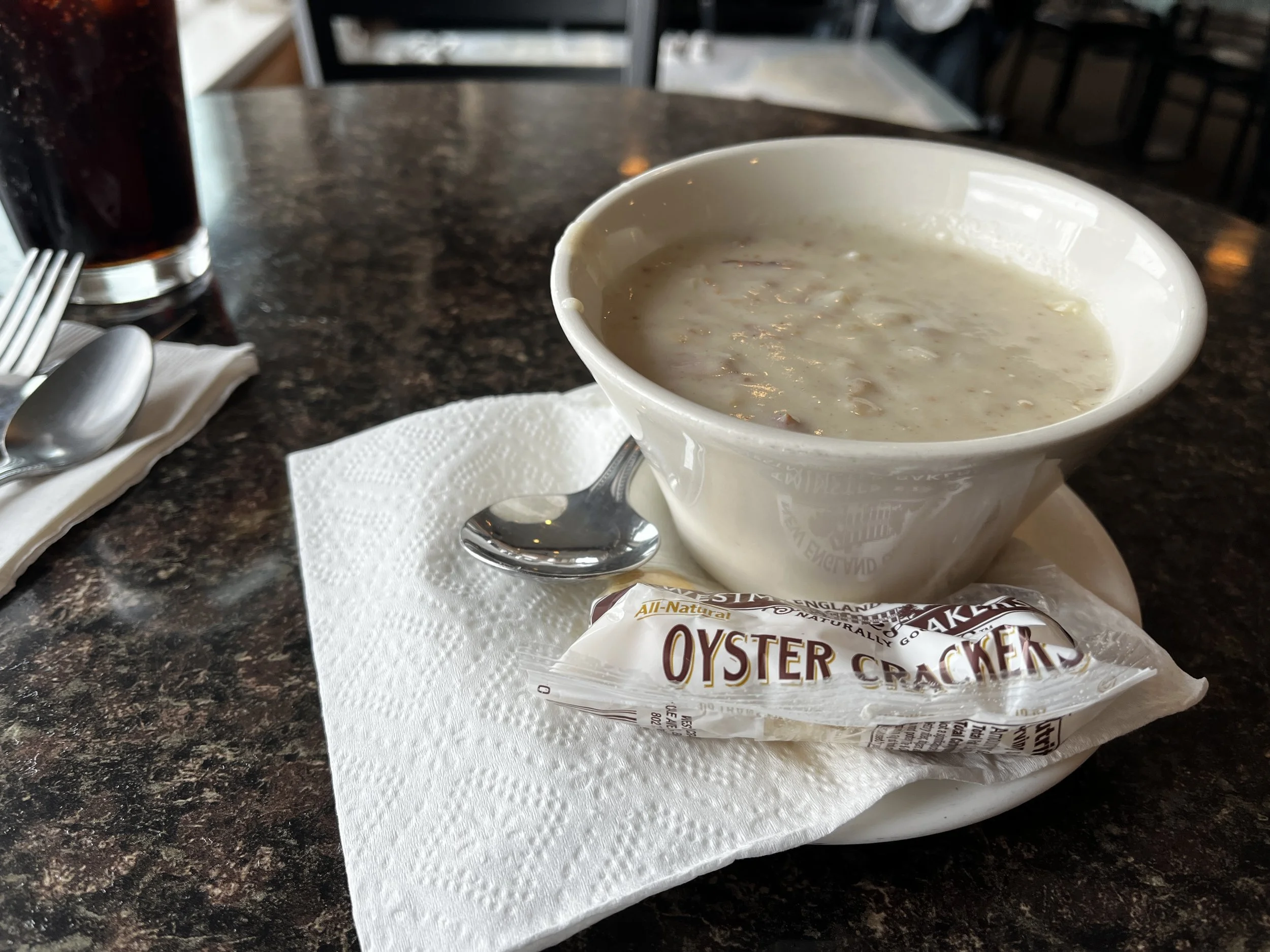
I drove the Jeep as far as I could and took a picture in front of the “Lands End” sign before trying to find a campsite. I was hoping to find a spot at the Homer Spit Campground but as I drove in, I noticed the No Vacancy sign. I went in to ask anyway in case they had any cancellations but unfortunately, they hadn’t. My next thought was to find food and work on other camping options so I went to Captain Pattie’s Fish House to have Halibut and Chips, what else would you have in the halibut capital of the world! I even went full send on clam chowder as well! It was amazing and highly recommend you stop by if you find yourself here!

While waiting for dinner, I located another potential camping spot on iOverlander that was still along the spit, but closer to the beginning of it. After my delicious supper, I headed off to find the campsite and when I did there were still a few spots remaining and we found a great spot that backed onto the beach with a beautiful view of the ocean. The only downside was that the campground was along the main road down the spit and traffic noise was a constant companion until the wee hours of the morning.


After a very interrupted night’s sleep dawn came and as I exited the tent, I saw that the tide was way out so before packing up, Layka and I went for a walk along the massive beach. With the water’s edge being so far away, all kinds of little creatures were exposed and gulls were shuffling about scavenging whatever they could find for breakfast. Also taking advantage of the retreated tide were two massive juvenile bald eagles, their even larger mother was watching over them from a distance as they foraged away. As Layka and I were walking, one of the juveniles looked at us curiously and approached closer to us. I wondered if it was contemplating the possibility of carrying Layka away or not. We gave it its space and continued on with our walk.


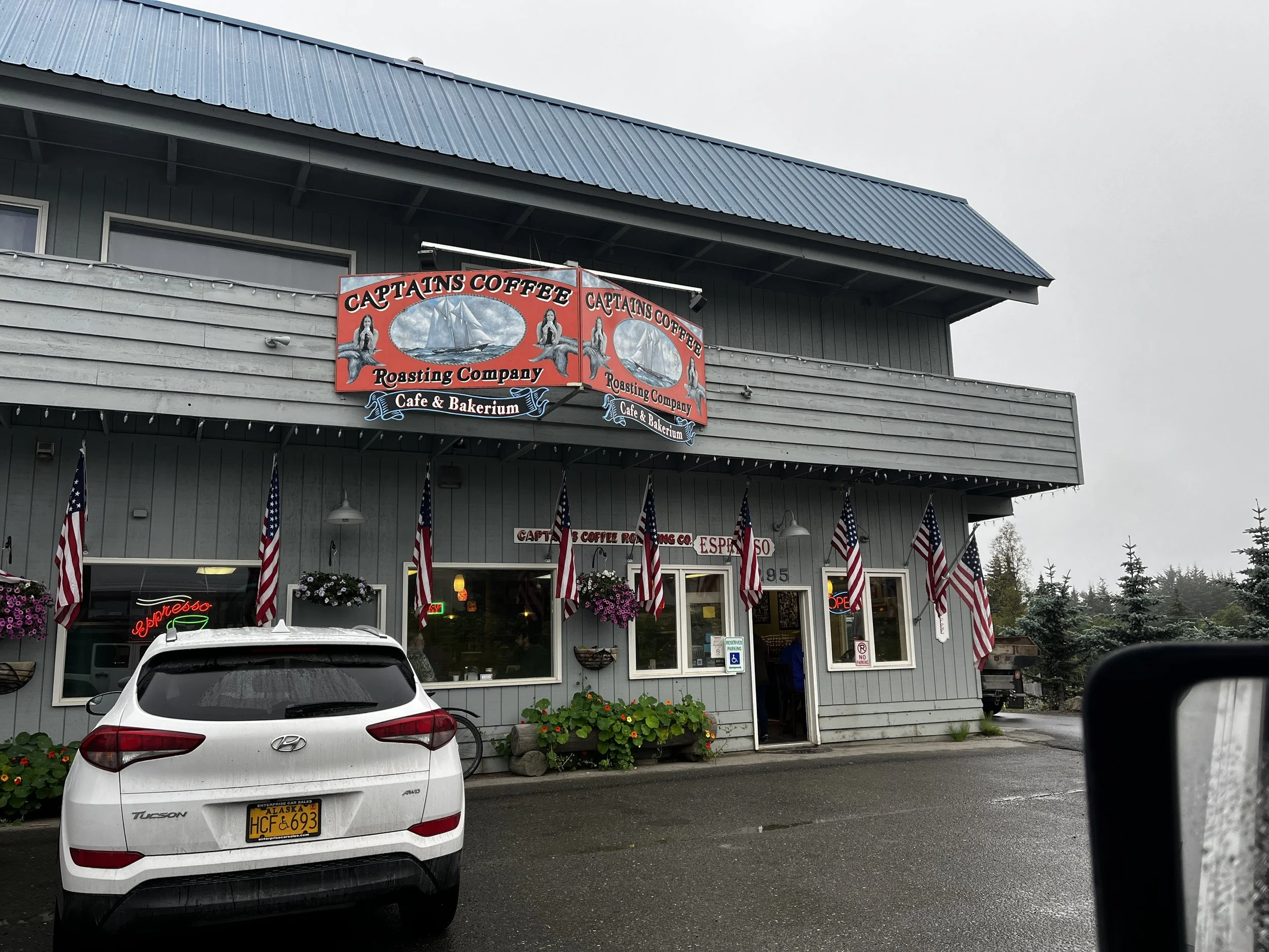
After our walk, camp was cleaned up and put away and then we headed for the Captain’s Coffee Roasting Company, a local coffee shop that came highly recommended by a friend of mine. I was in line for a coffee and eyeing a delicious-looking cinnamon roll when I had a truly Alaskan / American experience. An older man came in and said loudly that there was a Ford truck out in the parking lot and its horn was going off. He then added, “I have my gun in my truck if you want me to put it out of its misery”. It definitely caused a chuckle in the shop.

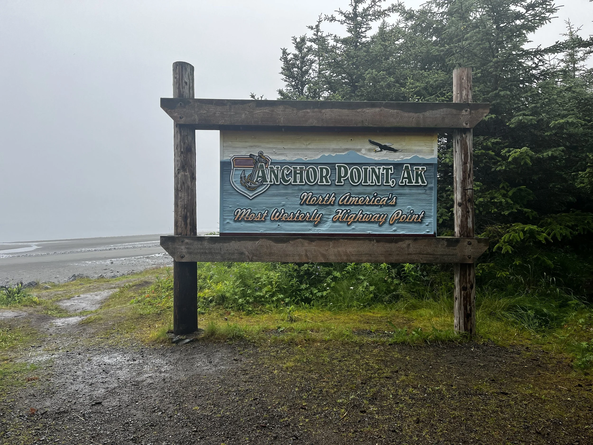
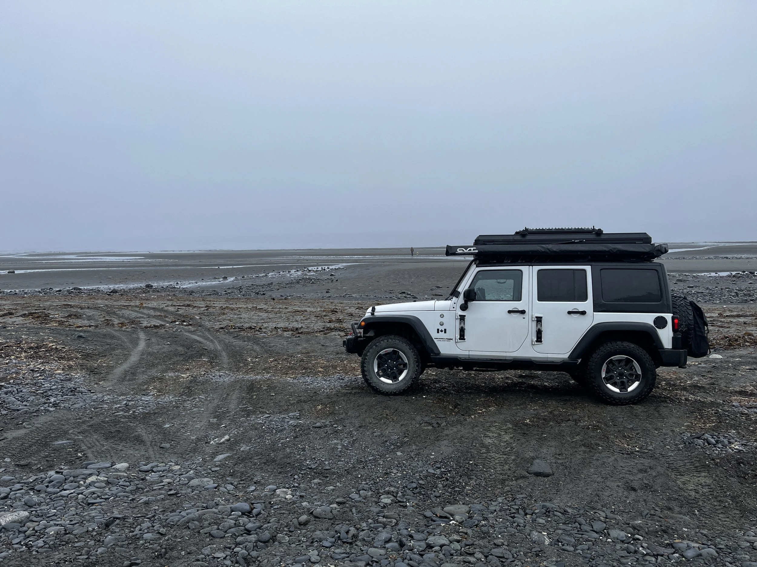
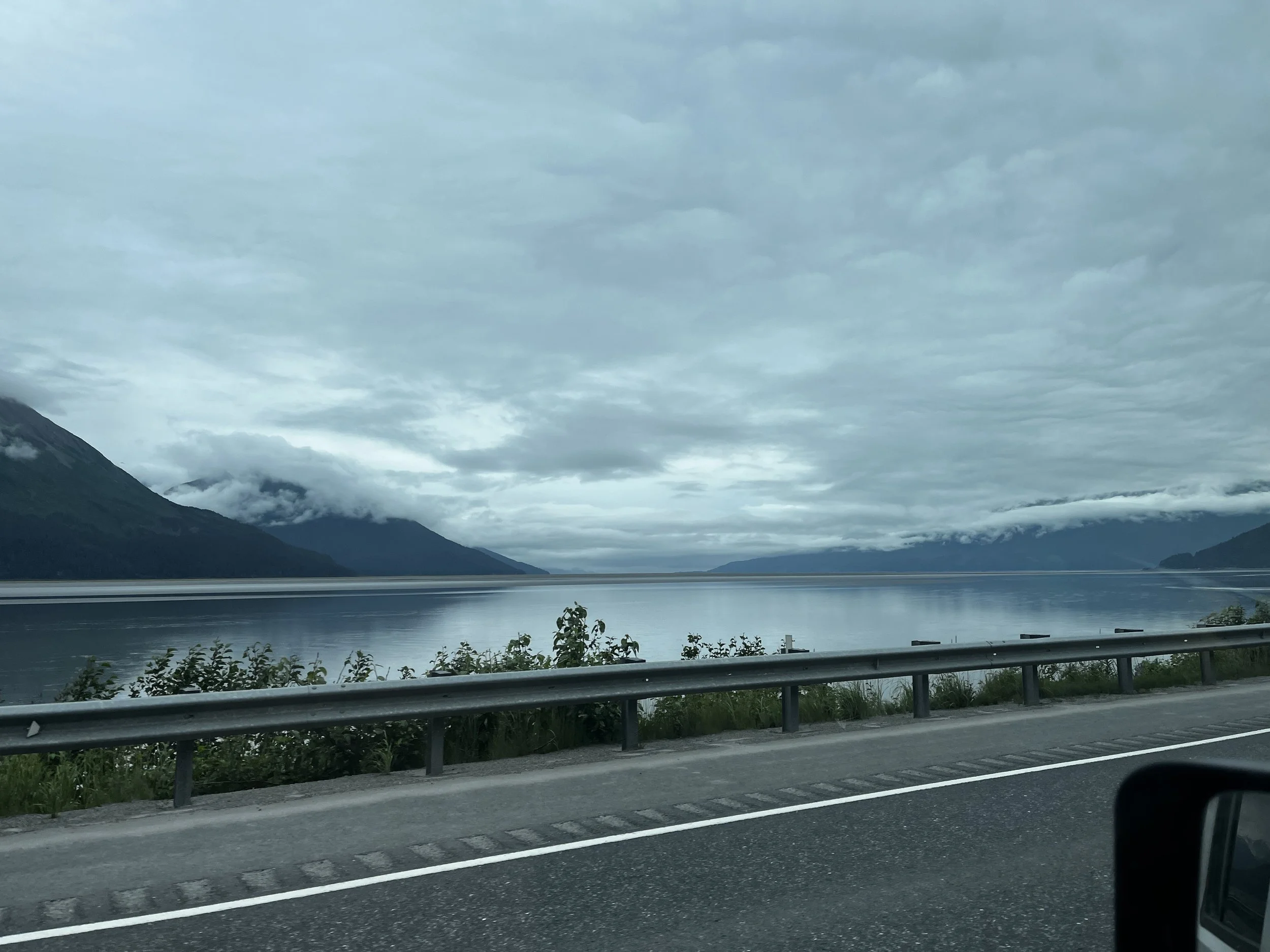
With a coffee and a cinnamon roll in hand and no shots fired we carried on as we headed back towards Anchorage. Along the way, we made a necessary stop at Anchor Point, the furthest west that you can drive on a contiguous road in North America. On a clear day from here, you can see the beautiful Mt Redoubt and the Iliamna volcano across the waters of Cook Inlet but due to the clouds that seem to be my constant companion on this part of the trip, we had no such luck. Either way, it was still amazing to be at this special place. I drove the jeep down to the beach and took some pictures before we continued onward towards Anchorage. Along the way you drive along the Turnagain Arm where there is the possibility of spotting Beluga Whales swimming along but when we drove by the tide was out so we could only see the extensive mud flats. Still spectacular scenery but seeing Belugas in the wild would have been amazing.
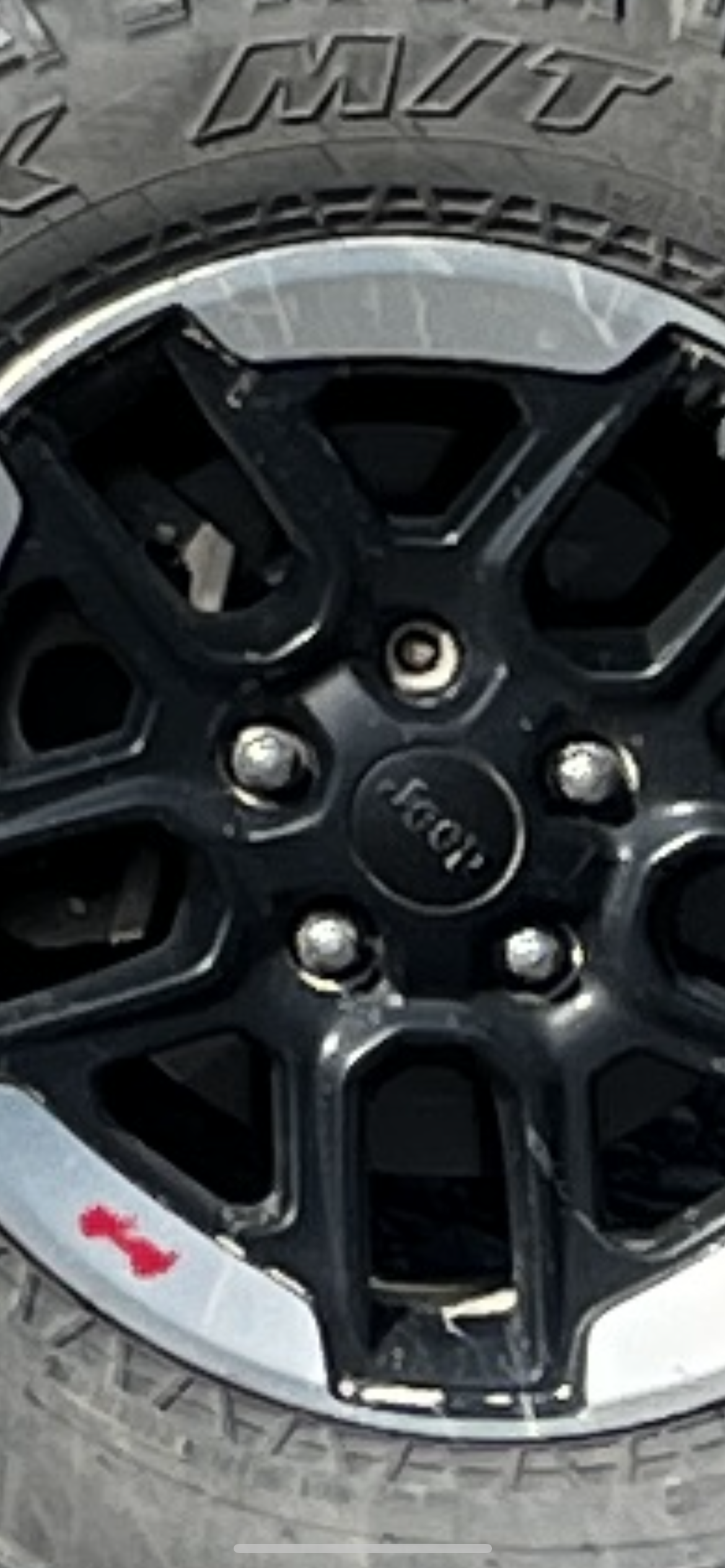
Soon we made our way into Anchorage, the main objective here was to get the Jeep in for an oil change as I had been putting a lot of miles on her with all the exploring we’d done. During the servicing, it was found that I was also missing a lug nut on a wheel in the front. I scrolled back in my pictures to see when that could have happened, and I think it must have happened on this trip. Either way, it was good to get it fixed before we headed any further. After the repairs, we jotted around replenishing supplies before continuing our journey.
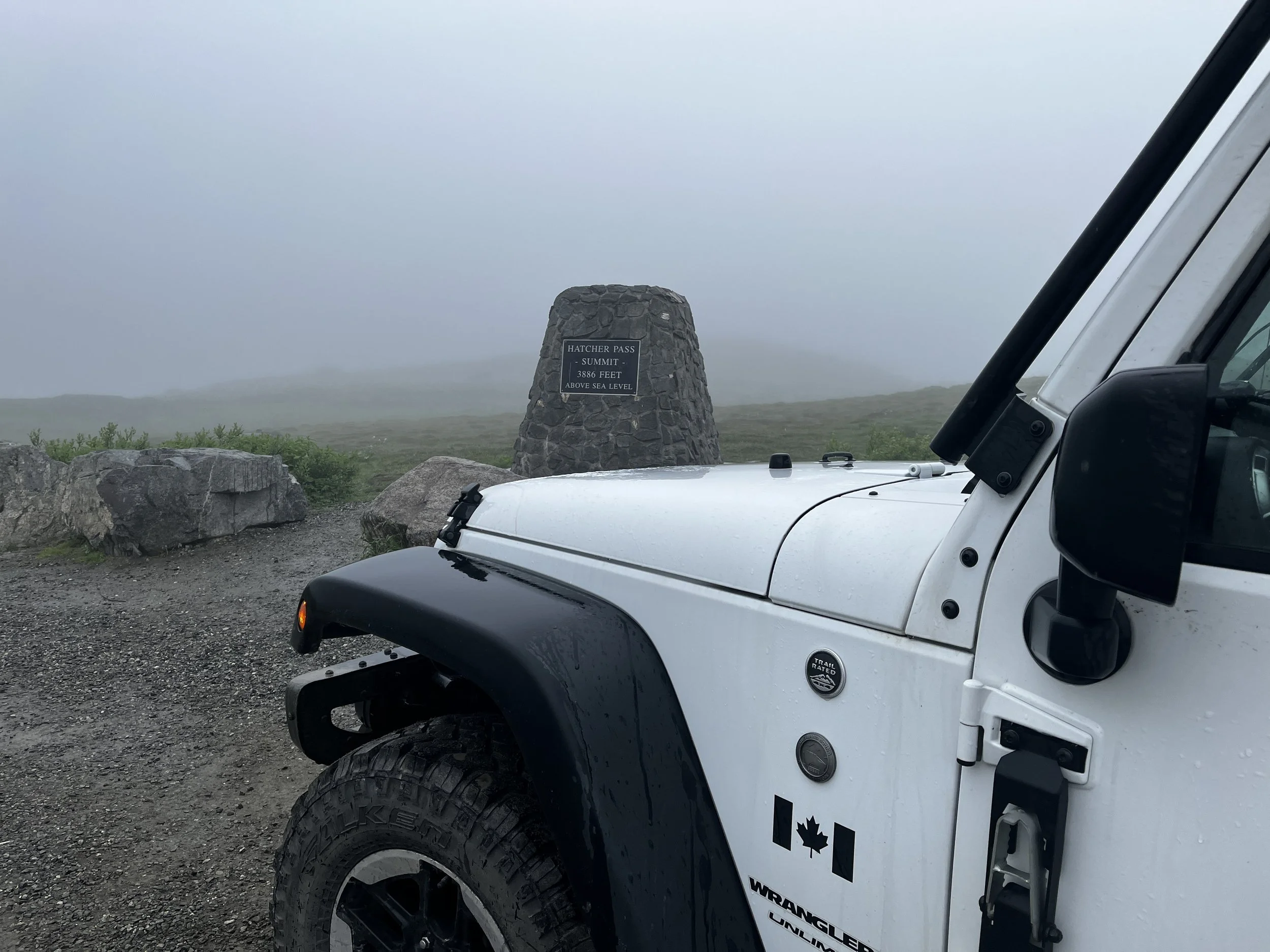

Our route out of Anchorage and on to Denali would take us along Hatcher Pass a relatively short but very scenic mountain road connecting the towns of Palmer and Willow Alaska. Along the way, there are a few notable locations like the Independence Mine State Historical Park and the Summit Lake viewpoint. All these places would have been great to explore but due to the very low cloud ceiling and rain, we carried on past with a promise to come back and explore them again one day. Camp for the night was found a little further along Hatcher Pass, on the other side of a creek that was surprisingly deeper than first expected but nonetheless, we made it through and found a terrific campsite next to a gurgling stream which was a more welcome sound than the street noise from the night before.

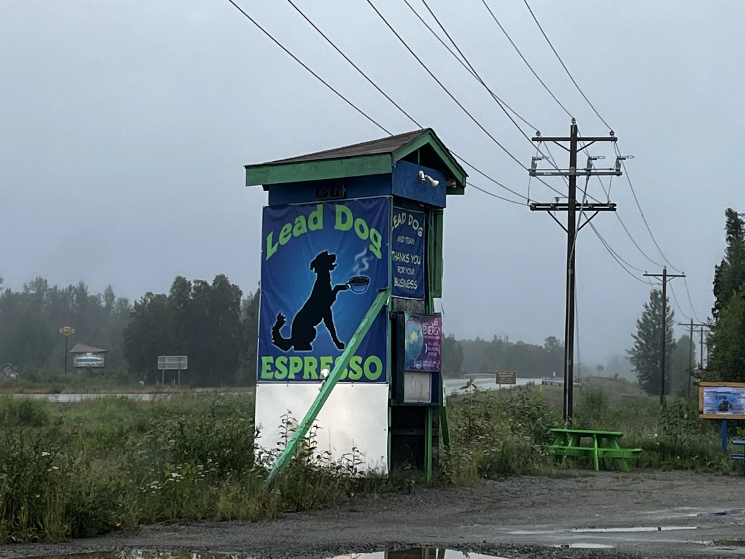
I woke at about 4 am and just enjoyed the natural ambience of the stream, the wind and the rain on the tent before getting up at about half past 5. The low-hanging clouds were once again keeping the mountain tops hidden from view which made an air of mystery to the area. A mystery to be solved on a return trip someday in the future! After packing up a wet tent we headed out and after safely making it back across the stream we continued west until the road met with the George Parks highway that headed north to Denali. At the intersection was Lead Dog Espresso, a cute little drive-thru coffee stand that was recommended to me by a friend. After picking up a coffee a snack and a couple of requested stickers we were on our way north toward Denali National Park.
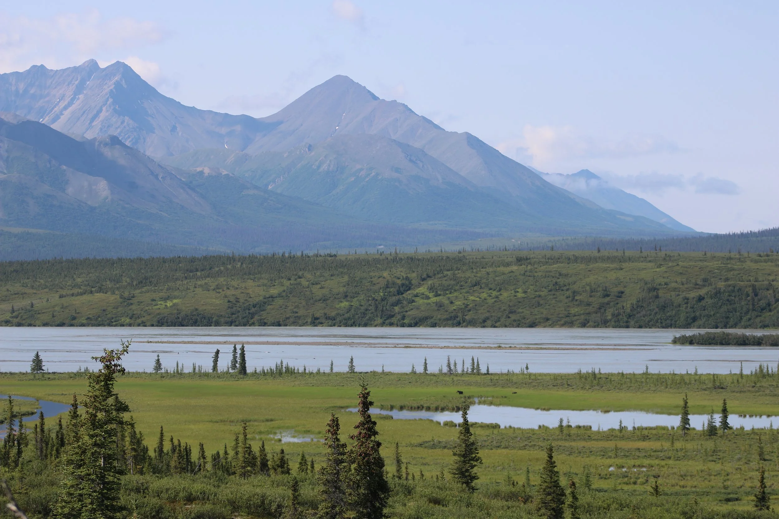
I’ve been told that the weather is rarely clear enough to see the tallest mountain in North America and the namesake of the park and with the weather we’ve had so far on this trip I knew the odds were clearly, not in our favour. Nevertheless, the drive was amazing as the highway followed the Susitna River north to the park's gates. The weather cleared up the closer we got to the park with the clouds lifting slightly to reveal several of the jagged peaks that make up the foothills to Denali. You know that this is a massive range when the foothills are in the 3000 to 4000 metres or 11,000 to 14,000-foot level!

We went as far as the Denali Visitor Center where I entered the gift shop to pick up some souvenirs. I only picked up a few things including, a poster, a couple of T-shirts and a few stickers but when it came time to pay you would think that I bought most of the store! Oh well, the things you do when you’re in these special places. With my wallet lighter we headed back south to the beginning of the Denali Highway, a 215 km or 134-mile dirt highway that joins Cantwell to Paxson, AK. As you travel along you also pass through the Copper River, Tanana (a tributary to the Yukon River) and Susitna River drainages, these are the three main river drainages in Alaska’s interior. When the weather is clear you can soak up the entire grandeur of this amazing area with numerous mountain ranges and glaciers, luckily for us the weather turned, and we had beautiful blue skies.

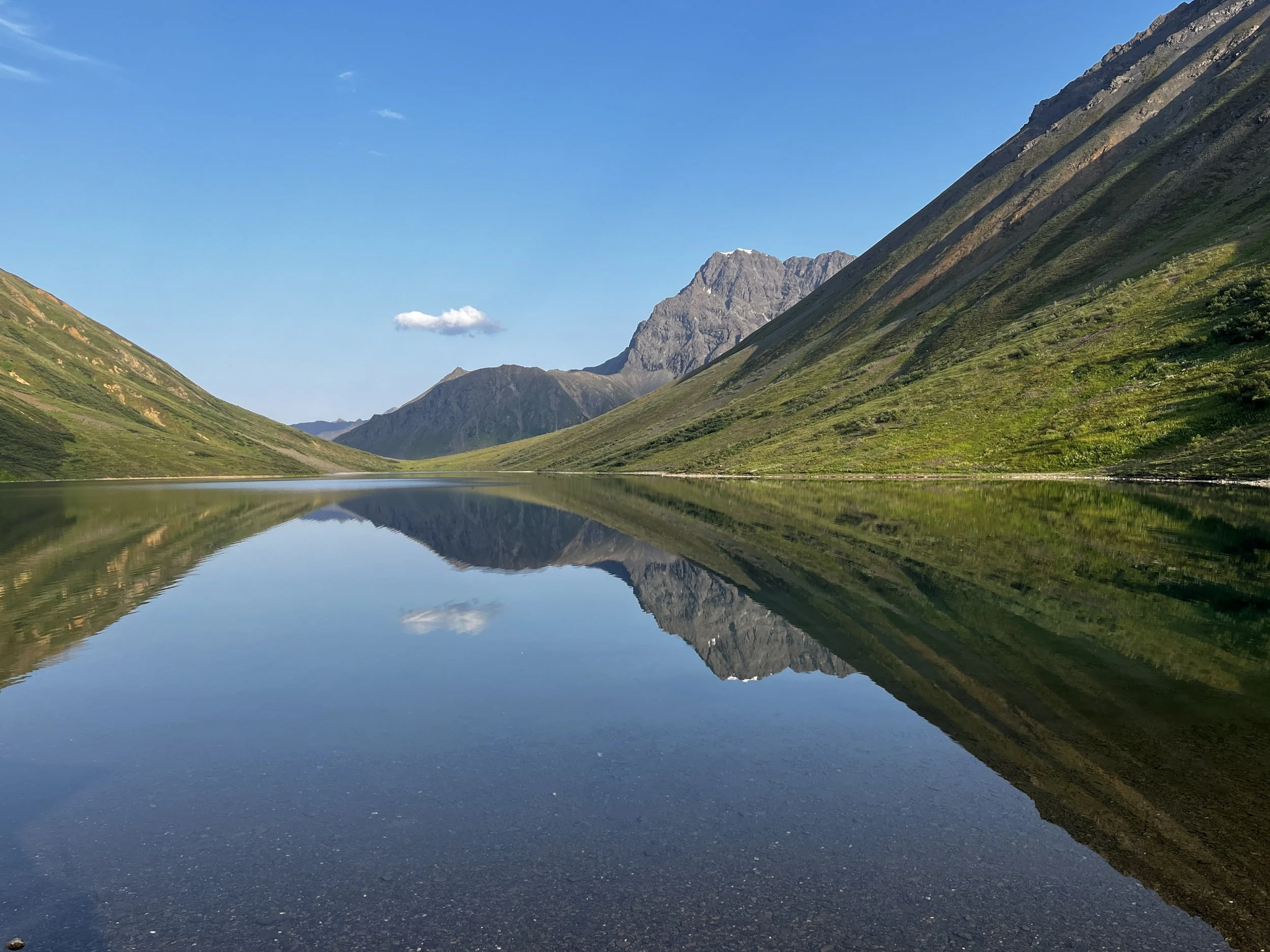
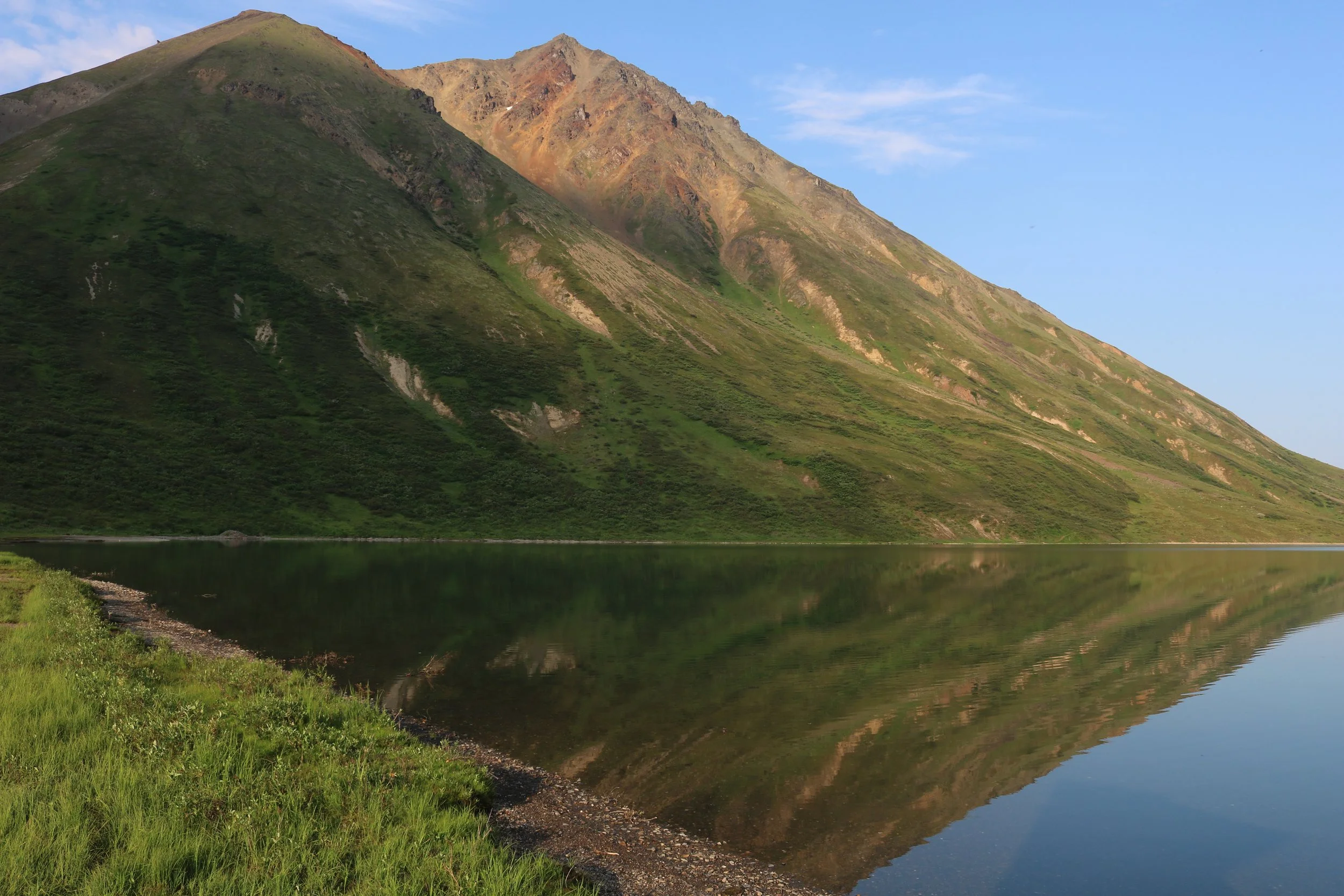
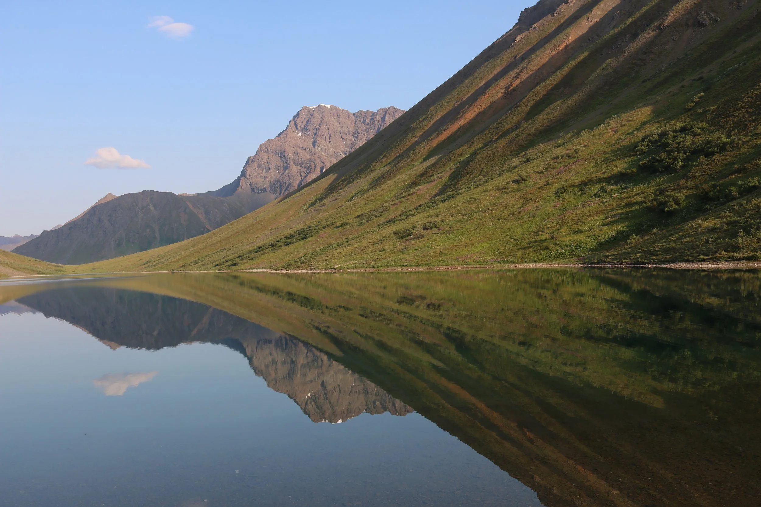
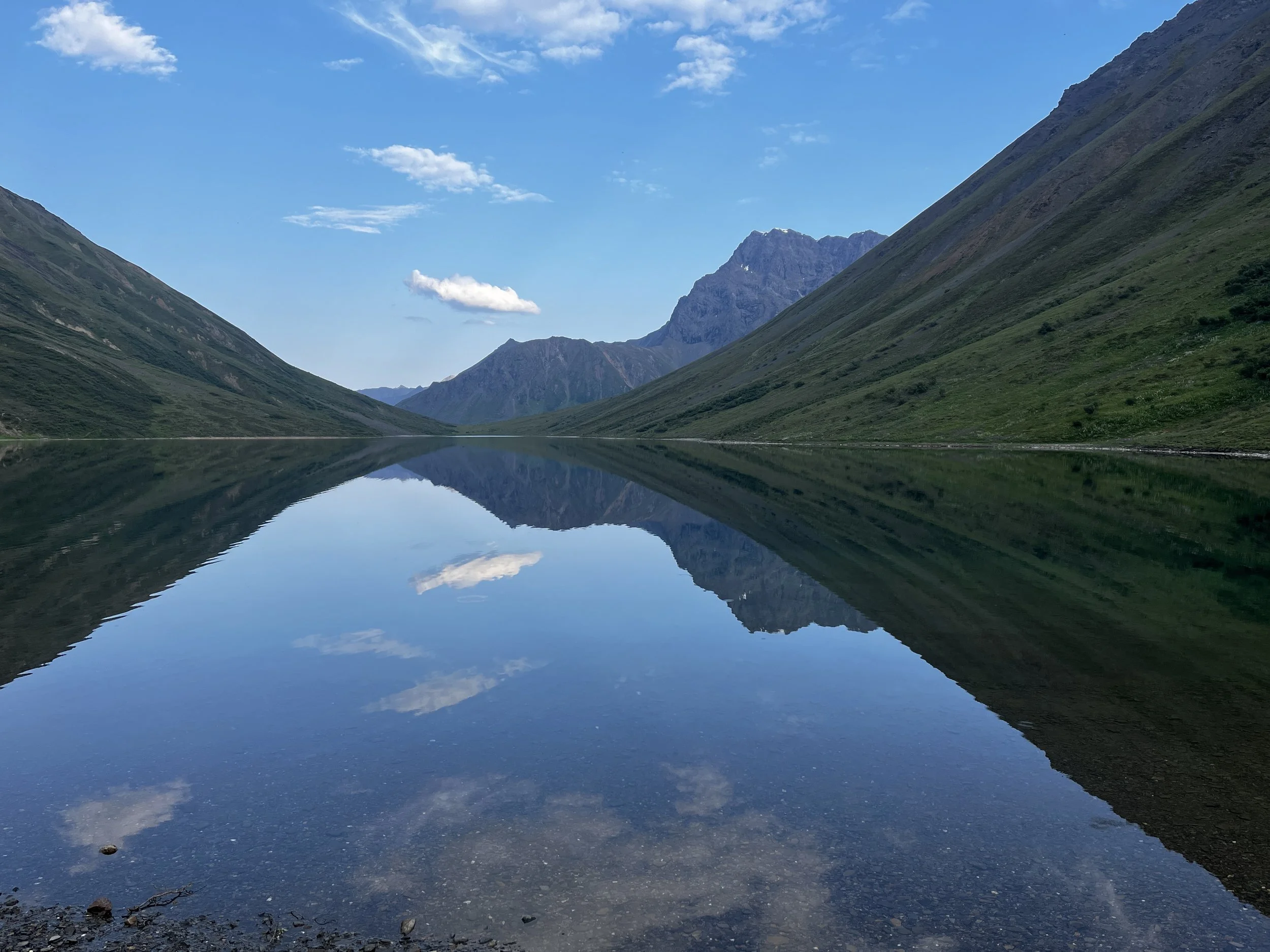
There are any number of spectacular campsites along this road but the one I wanted to find took us on an absolute adventure. On an episode of Lifestyle Overland, they found an amazing campsite along the shores of a lake hidden behind mountains. Roosevelt Lake is located about an hour off the Denali highway up a mining road near the Susitna River bridge. After a few water crossings and navigation checks along the way, the underbrush parted to reveal what may be the most beautiful camp I have ever been to. It was a gorgeous day, the lake was a huge, beautiful mirror, reflecting the green and brown hues of the mountains towering on either side and the blue cloudless sky.
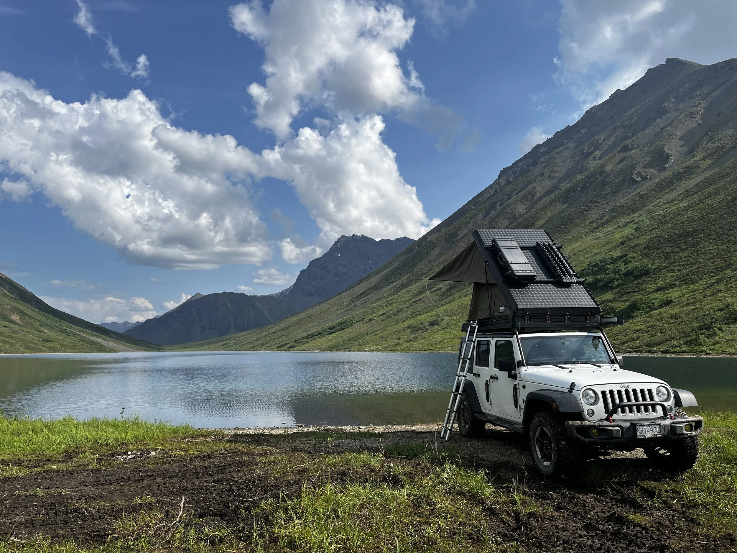
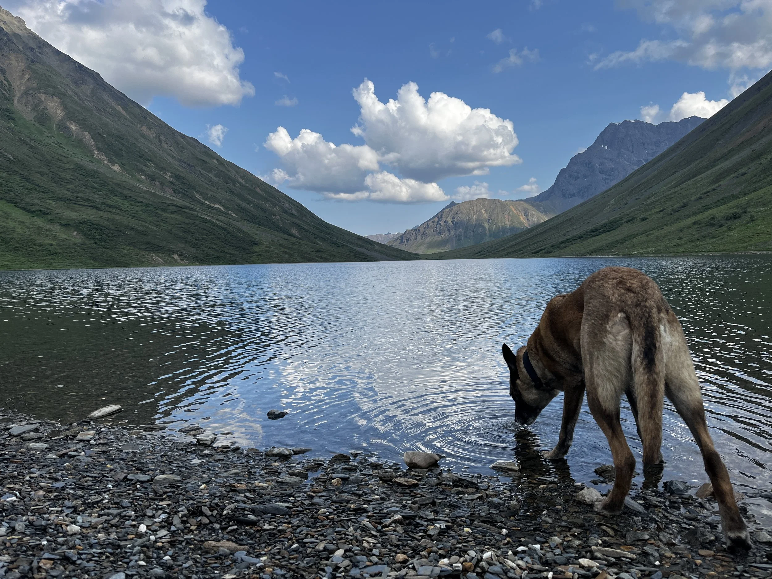
After taking some time to appreciate where I was, camp was set up, made supper and continued to take it all in. Our only companion was a lone beaver who didn’t seem to appreciate having to share their lake with us. Every half hour or so it would swim a large semi-circle around the front of our camp and on every return trip it would slap its big tail on the water in contempt and dive under the surface. Apart from the tail slapping the only other sounds from a nearby stream draining into the lake and the occasional fish jumping. I don’t think I’ve ever been to a more peaceful campsite than this. As evening came so did the onslaught of mosquitos so once again Layka and I retreated to the safety behind the mesh screens of our Bush Company tent.
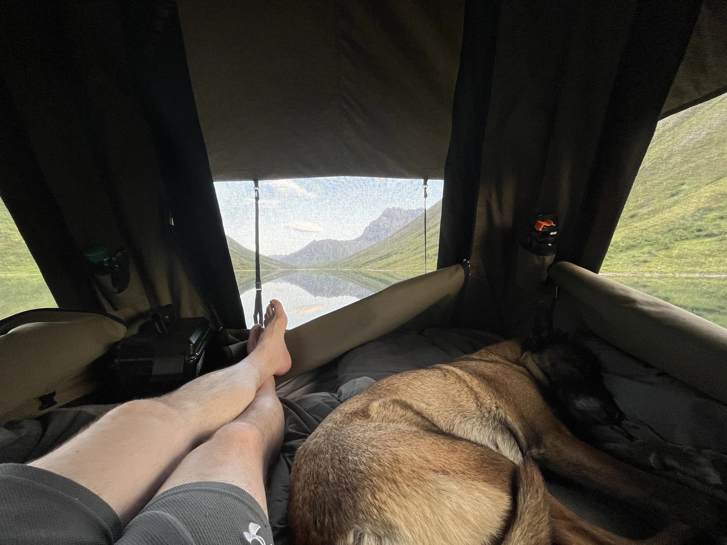
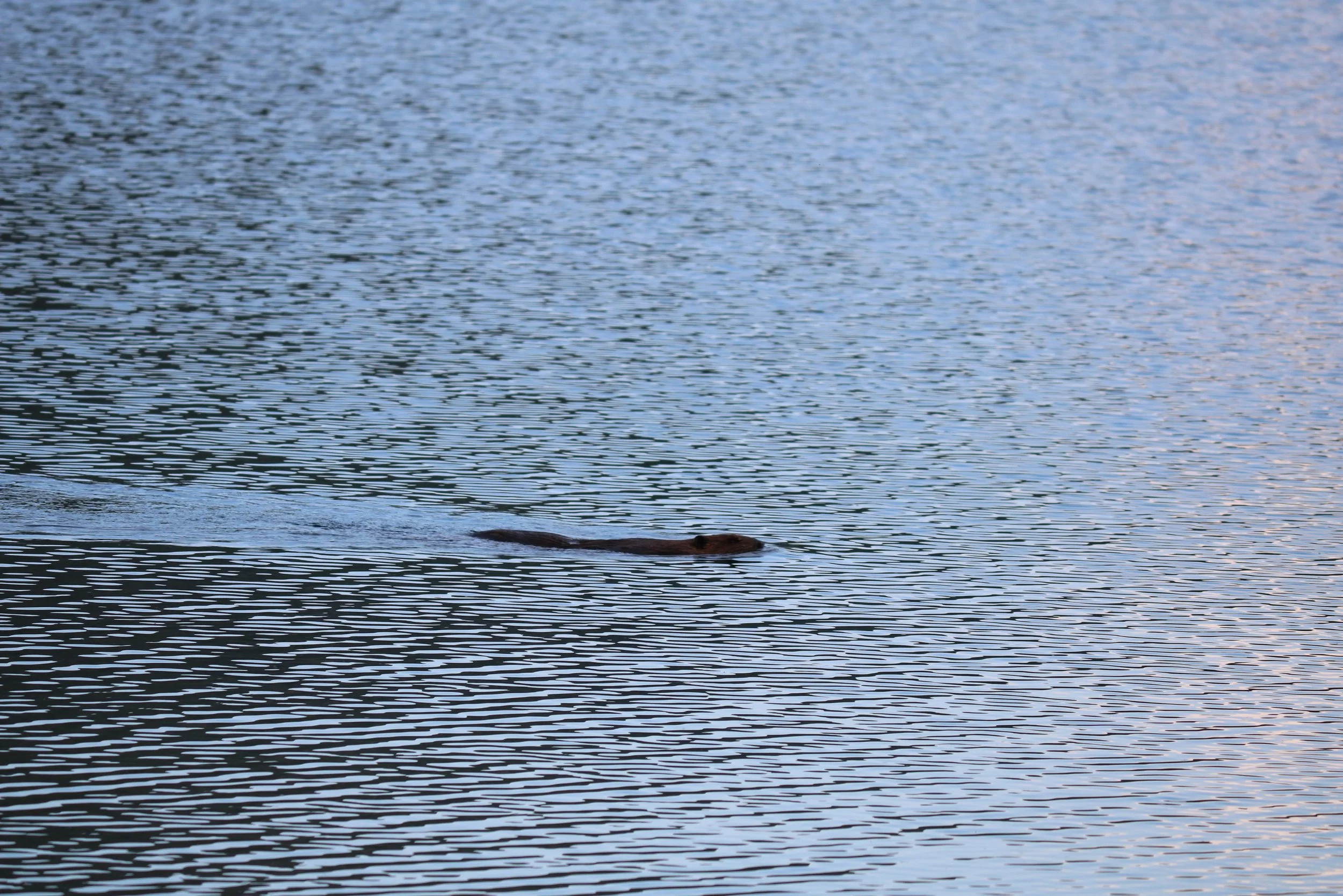
I woke the next morning feeling completely refreshed. We only had one disturbance during the night when the vigilant beaver once again went out on patrol and slapped its tail on the water at around 2 am. When there is utter silence, the crack of a beaver tail on glass-like water can really resonate! Due to the utter beauty of this place and the fact that this was the last day of our trip packing up was completed at a glacial pace, but I eventually did manage to tear myself away and get us back on the road.

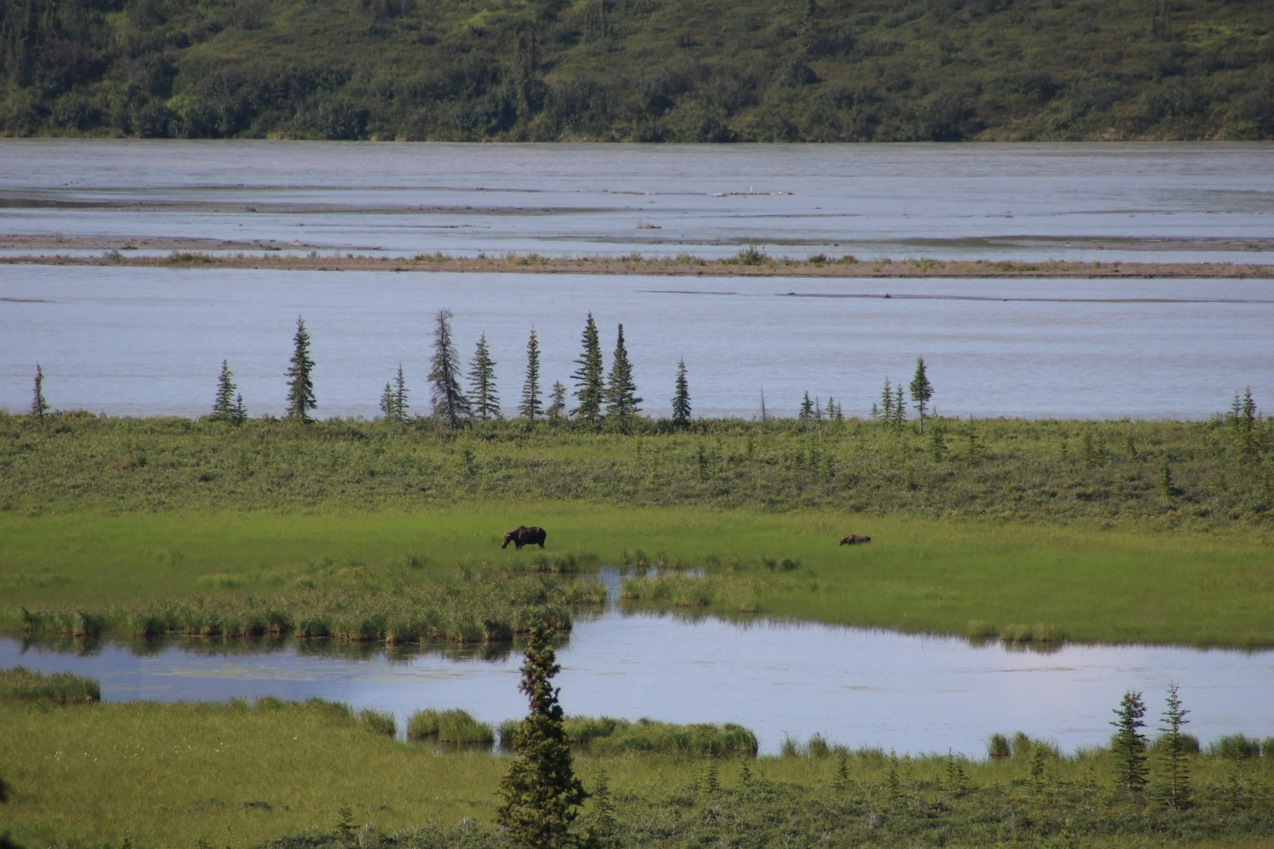
We made it back to the Denali Highway and continued east and as we climbed up toward the highest point on the highway, the MacLaren Summit, I spotted a large Moose with its calf way down in the grasslands beside the Susitna River. A great way to begin our homeward journey.
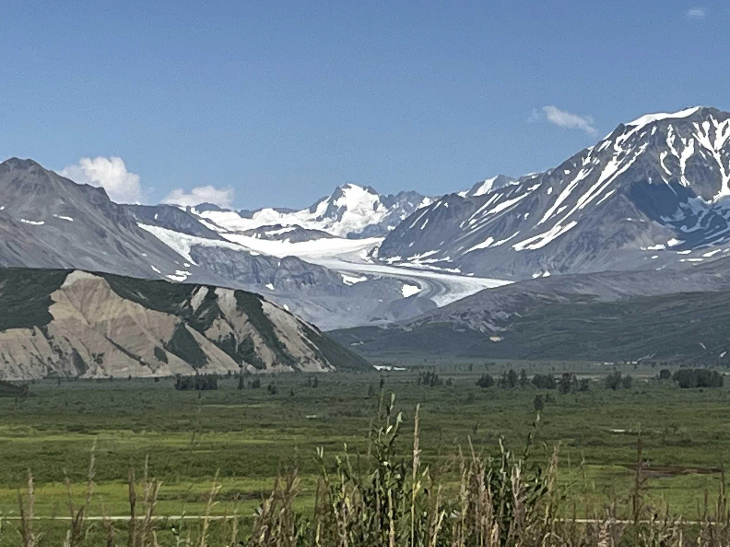
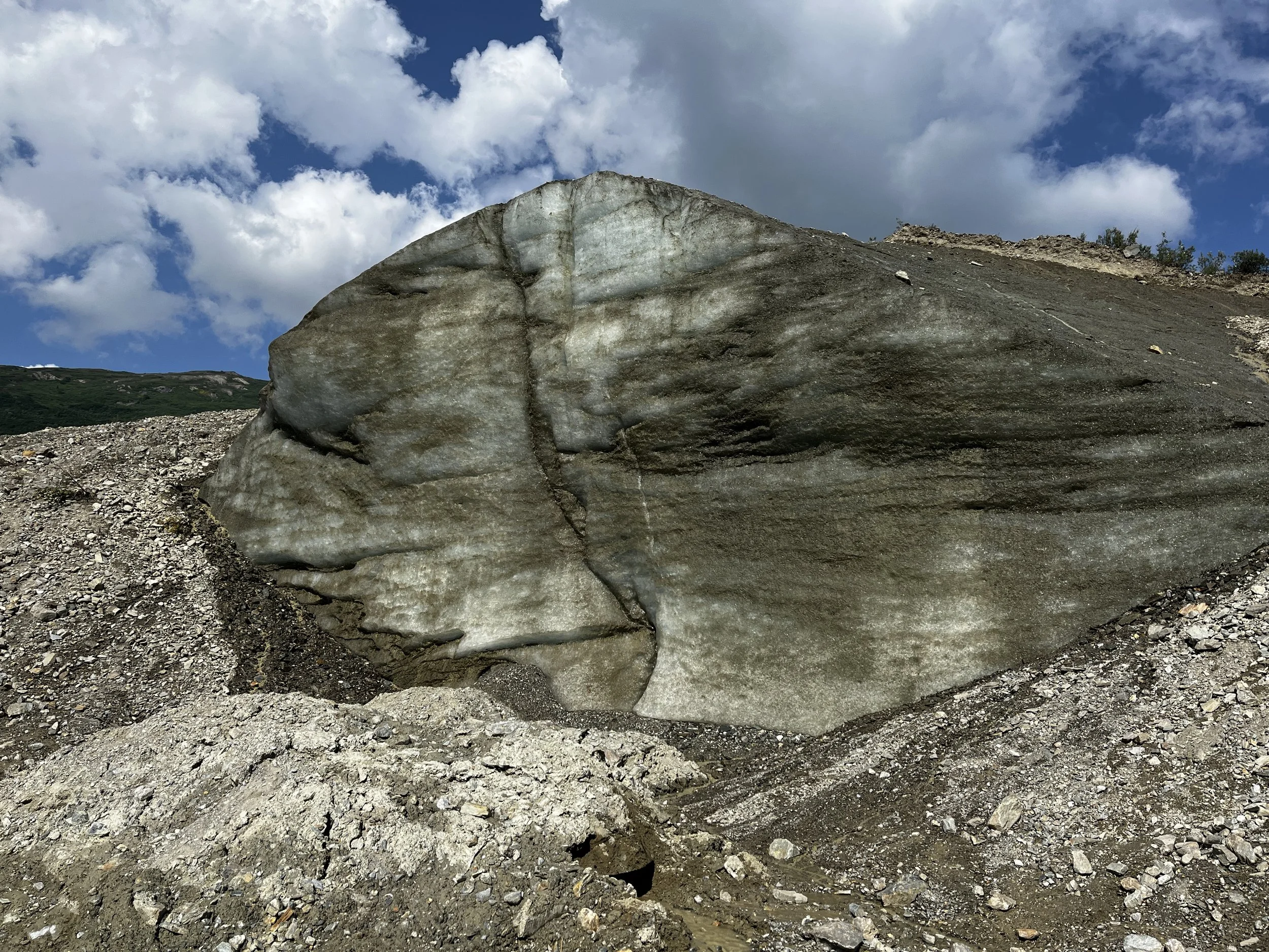
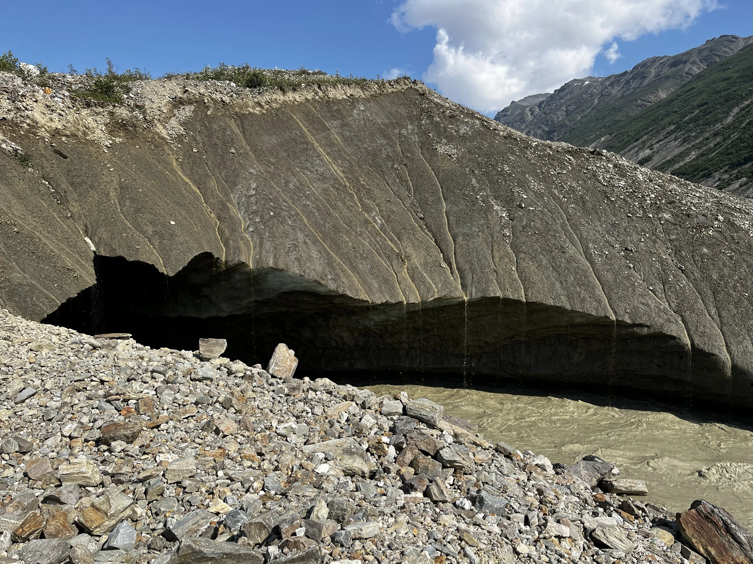
After reaching the summit at 1245m or just over 4000 feet, the road slowly descended toward the Tangle Lakes and the Amphitheater Mountains to the north before we joined the Richardson Highway at Paxson, AK. From there we ventured north until we reached the trail leading to the Castner Glacier Ice Cave where we went for a short hike.
During summer it was hard to tell what was ice and what was gravel as the ice looked the same as gravel but I can imagine what this would look like during winter covered in white. With the warm weather, we had to be careful during our approach as there were chunks of ice and rock cascading from above as the ice melted. After the short hike, we continued north to Delta Junction before heading back to Tok and the road back to Little Gold and the end of our trip.
Even though we didn’t have blue sky and sunshine throughout the trip, the mix of weather made for an epic all-around adventure while leaving some things for us to explore on a return trip someday soon. If you have the opportunity to visit Alaska, I highly recommend you see every spot mentioned in this blog. No matter what the weather may be, it will truly be a memorable trip.
As always Thank you for reading and I hope you enjoyed it and are looking forward to more, my incredible trip to Tuktoyaktuk is next! As always please feel free to leave a comment and follow us on Facebook and Instagram for more.